Old Maps of Boulder Point, Knox County for Genealogy
Trace your family roots with 12 historic maps of Boulder Point. These high-res maps reveal old neighborhoods, homesites, landmarks, and streets — helping you uncover where your ancestors lived and how the area evolved over time.
- Explore historic neighborhoods: Identify where your relatives may have lived in the 1800s or 1900s.
- Compare maps over time: Trace the changes in streets, buildings, and landmarks for multi-generational research.
- Perfect for genealogy & ancestry research: Used by family historians and researchers to map out lineage and migration.
These maps are an incredible resource for exploring your personal connection to Boulder Point's past.
Boulder Point, Knox County maps
(12)- 1893 Map of Briceville
 1893 Briceville1893 Print · USGSCovers Boulder Point, including Knoxville, Oak Ridge, and other nearby areas
 - 1895 Map of Briceville
 1895 Briceville1895 Print · USGSCovers Boulder Point, including Knoxville, Oak Ridge, and other nearby areas
 - 1896 Map of Briceville
 1896 Briceville1896 Print · USGSCovers Boulder Point, including Knoxville, Oak Ridge, and other nearby areas6 unique versions available
 - 1936 Map of Norris Dam
 1936 Norris Dam1936 Print · USGSCovers Boulder Point, including Knoxville, Oak Ridge, and other nearby areas
 - 1936 Map of Powell Station
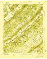
 1936 Powell Station1936 Print · USGSCovers Boulder Point, including Knoxville, Powell, and other nearby areas
 - 1941 Map of Powell Station
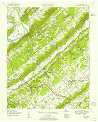
 1941 Powell Station1941 Print · USGSCovers Boulder Point, including Knoxville, Powell, and other nearby areas2 unique versions available
 - 1952 Map of Powell, 1955 Print
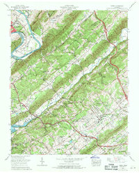
 1952 Powell1955 Print · USGSCovers Boulder Point, including Knoxville, Powell, and other nearby areas2 unique versions available
 - 1956 Map of Corbin, 1966 Print
 1956 Corbin1966 Print · USGSCovers Boulder Point, including Knoxville, Oak Ridge, and other nearby areas3 unique versions available
 - 1958 Map of Corbin
 1958 Corbin1958 Print · USGSCovers Boulder Point, including Knoxville, Oak Ridge, and other nearby areas
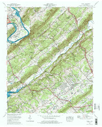
 - 1968 Map of Powell, 1971 Print
 1968 Powell1971 Print · USGSCovers Boulder Point, including Knoxville, Powell, and other nearby areas
 - 1976 Map of Powell, 1977 Print
 1976 Powell1977 Print · USGSCovers Boulder Point, including Knoxville, Powell, and other nearby areas2 unique versions available
 - 1979 Map of Oakridge, 1980 Print
 1979 Oakridge1980 Print · USGSCovers Boulder Point, including Knoxville, Oak Ridge, and other nearby areas
End of results
Showing maps 1-12 of 12
Frequently asked questions
- What are the different types of historical maps available for Boulder Point?
- What is the oldest map of Boulder Point?
- Where can I purchase historical maps of Boulder Point for my home or office?
- Where can I download high-res historical maps of Boulder Point?
- Are there historical topographic maps available for Boulder Point?
- Is there historical aerial imagery available for Boulder Point?
- Where are historical maps of Boulder Point sourced from?