Old Maps of Jonesborough, Tennessee
Explore 27 old maps of Jonesborough, spanning from 1891 to today. These high-resolution historic maps reveal how streets, neighborhoods, landmarks, and natural features evolved over time — perfect for genealogy, metal detecting, research, and local history exploration.
What you can do with these maps:
- See how Jonesborough changed over time: Compare historical maps to modern-day views to trace roads, homesites, rail lines & more.
- View detailed metadata: Each map includes creators, publishers, year, scale, and archive source.
- Overlay maps with satellite & LiDAR: Visualize the past alongside modern tools to explore terrain & human change.
- Trusted historical sources: Maps sourced from the USGS, Library of Congress, and other archives.
- Access maps your way: View online, download high-res files, or order prints for personal or research use.
Start exploring old maps of Jonesborough to uncover forgotten places, hidden landmarks, and the deep history beneath your feet.
Jonesborough, TN maps
(27)- 1891 Map of Roan Mountain
 1891 Roan Mountain1891 Print · USGSThe Tennessee-North Carolina border country comes alive in the 1890s, when narrow-gauge railroads and mountain ferries still moved the region's goods. Genealogists and historians can trace early crossings like Shipley's Ferry, industrial sites at Embreeville, and high-country settlements like Cloudland.
 - 1892 Map of Greeneville
 1892 Greeneville1892 Print · USGSEast Tennessee in the late nineteenth century was a landscape of river-crossing ferries and mountain gaps centered on Greeneville. Genealogists and historians can trace the early rail corridor of the East Tennessee Virginia and Georgia R. R. and locate family-named sites like Britton Ferry and Evans X Rds.
 - 1894 Map of Roan Mountain
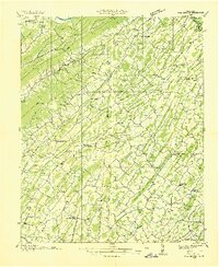
 1894 Roan Mountain1894 Print · USGSNortheast Tennessee and Western North Carolina are mapped here in the late nineteenth century as the rail network expands through the Unaka Range. Trace early industrial footprints and family lands near Elizabethton, Terry Furnace, and the high summit at Cloudland.3 unique versions available
 - 1896 Map of Greeneville
 1896 Greeneville1896 Print · USGSUpper East Tennessee thrives in the late nineteenth century as a hub of rail travel and river commerce centered around the county seat. Genealogists can trace family roots through numerous crossroads and post offices like Chissolms P. O., Hawes X Roads, and Britton Ferry.2 unique versions available
 - 1904 Map of Roan Mountain
 1904 Roan Mountain1904 Print · USGSUpper East Tennessee and Western North Carolina are documented here at a time when river fords and narrow-gauge railroads still connected mountain hollows. Trace the paths to Hodge Ore Bank, find old Poplar Ridge Church, or locate river crossings like Yoakley Ferry.4 unique versions available
 - 1904 Map of Greeneville
 1904 Greeneville1904 Print · USGSEast Tennessee at the turn of the century reveals a land of ridge-valley farms and early educational centers. Genealogists can trace family roots through historic settlements like Surgoinsville, early institutions like Washington College, and landmarks such as Bashors Mill.4 unique versions available
 - 1935 Map of Leesburg
 1935 Leesburg1935 Print · USGSWashington County in the mid-1930s shows a landscape of small farming communities and ridge-top settlements before modern development. Genealogists and researchers can trace family landmarks like the Keebler Institute, Hartmantown, and Dunkard Ch.
 - 1935 Map of Fall Branch
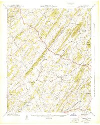
 1935 Fall Branch1935 Print · USGSNortheast Tennessee in the mid-thirties shows a rural landscape of ridges and crossroads at the junction of four counties. Trace family history through dozens of local landmarks like Kincheloe Mill, Evening Star Sch, and Cedar Chapel.
 - 1935 Map of Jonesboro
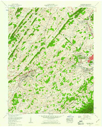
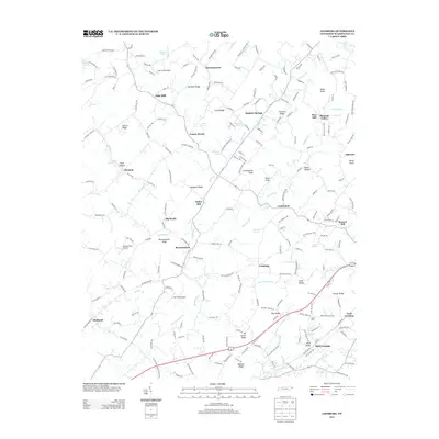
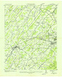 1935 Jonesboro1935 Print · USGSEastern Tennessee valley life comes into focus during the mid-thirties, centered on the settlement of Jonesboro. Genealogists can trace family footprints at Knob Creek Mill, Columbia Institute, and many small churches like Antioch Ch.
 - 1939 Map of Jonesboro
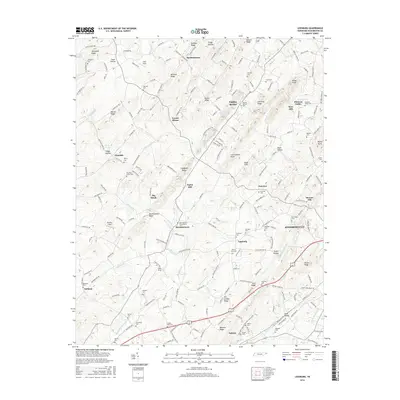
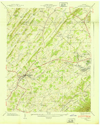 1939 Jonesboro1939 Print · USGSBefore the rapid post-war expansion, this area of Washington County centered on the rails and ridges around Jonesboro and Johnson City. Genealogists and historians can trace family landmarks like the Miller Cem, the Columbia Institute, and the Knob Creek Mill.2 unique versions available
 - 1939 Map of Leesburg
 1939 Leesburg1939 Print · USGSWashington County at the end of the 1930s shows a dense network of upland farms and community centers. Genealogists can locate family landmarks like the Keebler Institute, McCarty Chapel, and early mills including Taylor Mill and Keys Mill.5 unique versions available
 - 1955 Map of Johnson City
 1955 Johnson City1955 Print · USGSEast Tennessee and the bordering highlands of Virginia and Kentucky appear here during the post-war industrial boom. You can trace the complex network of mountain ridges and new TVA lakes, from Johnson City to the coalfields near Middlesboro and Lynch.
 - 1957 Map of Johnson City, 1966 Print
 1957 Johnson City1966 Print · USGSUpper East Tennessee and Southwest Virginia are shown here during the mid-sixties transition of the Appalachians. Researchers can trace the industrial rail hubs of Kingsport, the sprawling waters of Cherokee Lake, and the historic Cumberland Gap.
 - 1959 Map of Jonesboro, 1960 Print
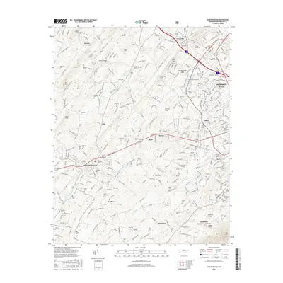
 1959 Jonesboro1960 Print · USGSWashington County at the close of the 1950s shows the historic town of Jonesboro alongside the industrial and institutional growth of JOHNSON CITY. Researchers can trace family history through local sites like Knob Creek Mill, the Veterans Administration Center, and numerous rural churches like Marvin Chapel.5 unique versions available
 - 1960 Map of Johnson City
 1960 Johnson City1960 Print · USGSUpper East Tennessee and the surrounding tri-state area are shown in the mid-fifties during the height of the TVA reservoir era. Trace the industrial rail lines of the Southern and Louisville and Nashville between Kingsport and Johnson City.
 - 1963 Map of Johnson City
 1963 Johnson City1963 Print · USGSThe Tri-Cities and the surrounding Appalachian ridges are shown in detail during the early sixties, highlighting the era's vital rail and river networks. Genealogists and historians can trace the routes of the Clinchfield RR and locate settlements from Rogersville to Elizabethton.
 - 1980 Map of Johnson City, 1981 Print
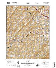
 1980 Johnson City1981 Print · USGSEast Tennessee in the early eighties shows a landscape of mountain ridges and growing valley towns. Trace local history through Washington College and the Andrew Johnson National Cemetery, or find sites like David Crockett Birthplace State Park.
 - 2010 Map of Leesburg, 2010 Print
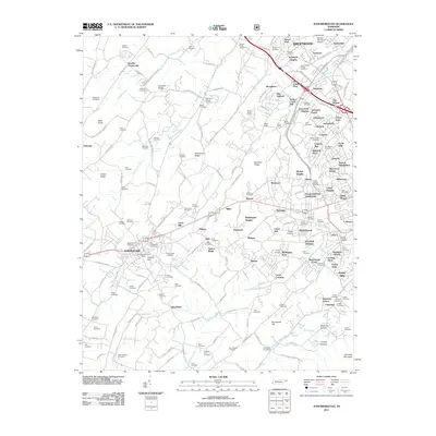
 2010 Leesburg2010 Print · USGSCovers Jonesborough, including Locust Mount, Fairview, and other nearby areas
 - 2011 Map of Jonesborough, 2011 Print
 2011 Jonesborough2011 Print · USGSCovers Jonesborough, including Johnson City, February, and other nearby areas
 - 2013 Map of Jonesborough, 2013 Print
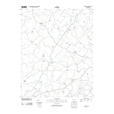
 2013 Jonesborough2013 Print · USGSCovers Jonesborough, including Johnson City, February, and other nearby areas
 - 2013 Map of Leesburg, 2013 Print
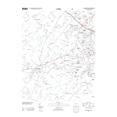
 2013 Leesburg2013 Print · USGSCovers Jonesborough, including Locust Mount, Fairview, and other nearby areas
 - 2016 Map of Leesburg, 2016 Print
 2016 Leesburg2016 Print · USGSCovers Jonesborough, including Locust Mount, Fairview, and other nearby areas
 - 2016 Map of Jonesborough, 2016 Print
 2016 Jonesborough2016 Print · USGSCovers Jonesborough, including Johnson City, February, and other nearby areas
 - 2019 Map of Jonesborough, 2019 Print
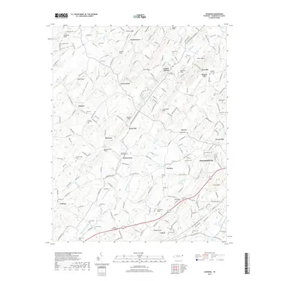
 2019 Jonesborough2019 Print · USGSCovers Jonesborough, including Johnson City, February, and other nearby areas
 - 2019 Map of Leesburg, 2019 Print
 2019 Leesburg2019 Print · USGSCovers Jonesborough, including Locust Mount, Fairview, and other nearby areas
Showing maps 1-25 of 27
Top cities near Jonesborough
- Johnson City historical maps
- Kingsport historical maps
- Bristol historical maps
- Elizabethton historical maps
- Church Hill historical maps
- Erwin historical maps
See more
Top neighborhoods of Jonesborough
Frequently asked questions
- What are the different types of historical maps available for Jonesborough?
- What is the oldest map of Jonesborough?
- Where can I purchase historical maps of Jonesborough for my home or office?
- Where can I download high-res historical maps of Jonesborough?
- Are there historical topographic maps available for Jonesborough?
- Is there historical aerial imagery available for Jonesborough?
- Where are historical maps of Jonesborough sourced from?