Old Maps of Mabelle, Texas
Explore 9 old maps of Mabelle, spanning from 1954 to today. These high-resolution historic maps reveal how streets, neighborhoods, landmarks, and natural features evolved over time — perfect for genealogy, metal detecting, research, and local history exploration.
What you can do with these maps:
- See how Mabelle changed over time: Compare historical maps to modern-day views to trace roads, homesites, rail lines & more.
- View detailed metadata: Each map includes creators, publishers, year, scale, and archive source.
- Overlay maps with satellite & LiDAR: Visualize the past alongside modern tools to explore terrain & human change.
- Trusted historical sources: Maps sourced from the USGS, Library of Congress, and other archives.
- Access maps your way: View online, download high-res files, or order prints for personal or research use.
Start exploring old maps of Mabelle to uncover forgotten places, hidden landmarks, and the deep history beneath your feet.
Mabelle, TX maps
(9)- 1954 Map of Wichita Falls, 1966 Print
 1954 Wichita Falls1966 Print · USGSNorth Texas in the mid-fifties is captured here as a landscape of expanding oil fields and vital rail corridors. Genealogists and historians can trace family roots through rural landmarks like Bacon Chapel and the rail-side growth of Seymour and Archer City.3 unique versions available
 - 1958 Map of Wichita Falls
 1958 Wichita Falls1958 Print · USGSNorth Texas during the late fifties reveals a landscape defined by the booming petroleum industry and established rail hubs. Researchers can trace the development of Wichita Falls and discover rural landmarks like Barton's Chapel or the Hull-Silk Oil Field.
 - 1966 Map of Southeast Lake Kemp, 1969 Print
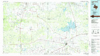
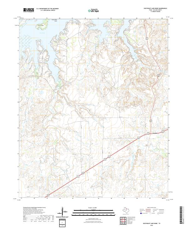
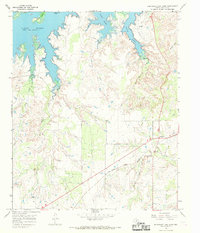 1966 Southeast Lake Kemp1969 Print · USGSBaylor County ranching and water management are captured here in the mid-1960s as the reservoir and railroad shape the local economy. Trace the course of the Fort Worth and Denver rail line near Mabelle or explore the inlets of Lake Kemp.
 - 1985 Map of Lake Kemp
 1985 Lake Kemp1985 Print · USGSThe North Texas plains come into sharp focus in the mid-eighties as a region defined by its vast reservoirs and deep-rooted agricultural hubs. Genealogists and local historians can trace the rural landscape surrounding Seymour, the rail lines of the Burlington Northern, and landmarks like The Narrows.2 unique versions available
 - 2010 Map of Southeast Lake Kemp, 2010 Print
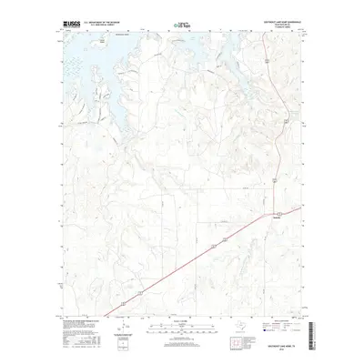
 2010 Southeast Lake Kemp2010 Print · USGSCovers Mabelle, including Baylor County, United States, and other nearby areas
 - 2013 Map of Southeast Lake Kemp, 2013 Print
 2013 Southeast Lake Kemp2013 Print · USGSCovers Mabelle, including Baylor County, United States, and other nearby areas
 - 2016 Map of Southeast Lake Kemp, 2016 Print
 2016 Southeast Lake Kemp2016 Print · USGSCovers Mabelle, including Baylor County, United States, and other nearby areas
 - 2019 Map of Southeast Lake Kemp, 2019 Print
 2019 Southeast Lake Kemp2019 Print · USGSCovers Mabelle, including Baylor County, United States, and other nearby areas
 - 2022 Map of Southeast Lake Kemp, 2022 Print
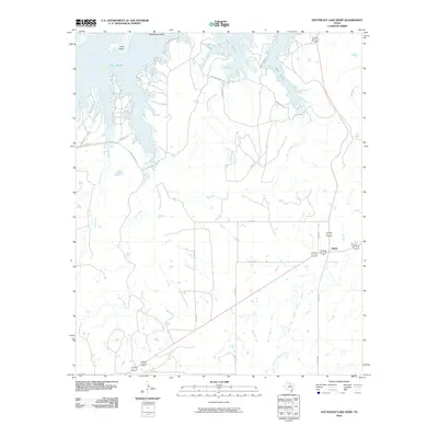
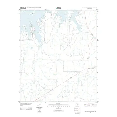
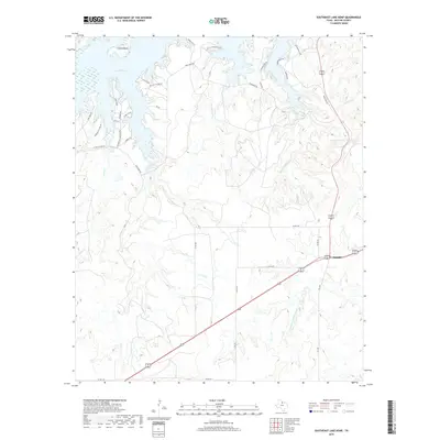
 2022 Southeast Lake Kemp2022 Print · USGSBaylor County ranchlands meet the southern shores of Lake Kemp in this 2020s survey of the Texas plains. Researchers can trace rural infrastructure and family landmarks near Mabelle, following names like Waggoner Rd and the waters of Big Moonshine Cr.
End of results
Showing maps 1-9 of 9
Top cities near Mabelle
Frequently asked questions
- What are the different types of historical maps available for Mabelle?
- What is the oldest map of Mabelle?
- Where can I purchase historical maps of Mabelle for my home or office?
- Where can I download high-res historical maps of Mabelle?
- Are there historical topographic maps available for Mabelle?
- Is there historical aerial imagery available for Mabelle?
- Where are historical maps of Mabelle sourced from?