Old Maps of Deer Park, Texas
Explore 27 old maps of Deer Park, spanning from 1915 to today. These high-resolution historic maps reveal how streets, neighborhoods, landmarks, and natural features evolved over time — perfect for genealogy, metal detecting, research, and local history exploration.
What you can do with these maps:
- See how Deer Park changed over time: Compare historical maps to modern-day views to trace roads, homesites, rail lines & more.
- View detailed metadata: Each map includes creators, publishers, year, scale, and archive source.
- Overlay maps with satellite & LiDAR: Visualize the past alongside modern tools to explore terrain & human change.
- Trusted historical sources: Maps sourced from the USGS, Library of Congress, and other archives.
- Access maps your way: View online, download high-res files, or order prints for personal or research use.
Start exploring old maps of Deer Park to uncover forgotten places, hidden landmarks, and the deep history beneath your feet.
Deer Park, TX maps
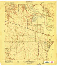
(27)- 1915 Map of Deepwater
 1915 Deepwater1915 Print · USGSSoutheast of Houston during the early twentieth-century boom, this area shows the vital transformation of the coastal prairie into an industrial hub. Trace the early footprints of Pasadena, South Houston, and Genoa alongside the Ship Channel and the Penn City School.
 - 1916 Map of La Porte
 1916 La Porte1916 Print · USGSCoastal Harris County is captured here during a period of rapid maritime and rail expansion just before the end of the Great War. Genealogists and historians can trace early property divisions and rail stops from Deer Park to the waters of Sylvan Beach and the San Jacinto Battlefield.2 unique versions available
 - 1919 Map of Deepwater
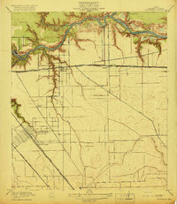 1919 Deepwater1919 Print · USGSHarris County at the height of the early shipping boom shows the transformation of the bayou into an industrial corridor. Trace family roots and early infrastructure in Pasadena and South Houston, or locate the Penn City Ferry and Dumont Sta.2 unique versions available
 - 1920 Map of La Porte
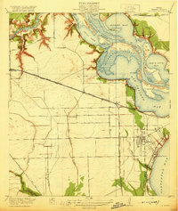 1920 La Porte1920 Print · USGSCoastal Harris County is documented here during a period of industrial growth along the Houston Ship Channel. Researchers can trace the early rail networks of the Galveston Harrisburg and San Antonio RR and locate community landmarks like Lomax School and Sylvan Beach.3 unique versions available
 - 1944 Map of La Porte
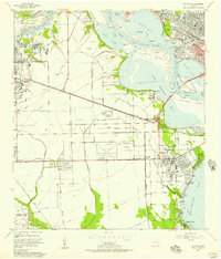
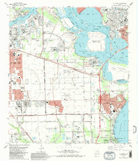
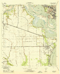 1944 La Porte1944 Print · USGSCoastal Harris County is captured during the mid-forties, showing the vital maritime and rail corridors near the San Jacinto River. Genealogists and researchers can trace local landmarks like the La Porte Cem, the whistle-stop at Strang, and the recreational grounds of Sylvan Beach.
 - 1950 Map of Houston, 1953 Print
 1950 Houston1953 Print · USGSCoastal Texas in the early fifties reveals a landscape of massive civil engineering and industrial transit. Genealogists and researchers can trace the growth of the Houston suburbs and the maritime infrastructure of Galveston Bay, including the Gulf Freeway and the Texas City Dike.
 - 1955 Map of La Porte, 1957 Print
 1955 La Porte1957 Print · USGSThe Harris County coastline was undergoing rapid industrial change in the mid-fifties as the Houston Ship Channel expanded. Trace early settlement patterns at Morgan Point, local schools like De Walt Sch, and the historic Sylvan Beach waterfront.
 - 1955 Map of Pasadena, 1957 Print
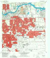
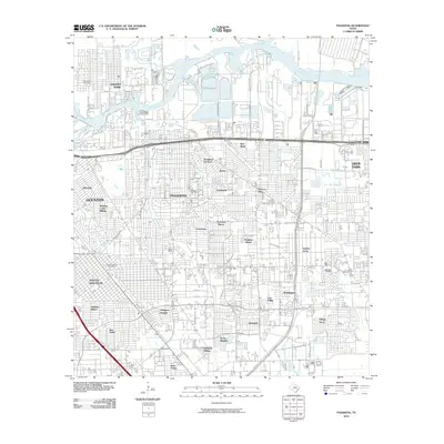
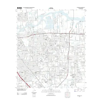
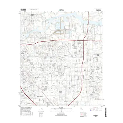
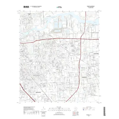
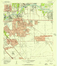 1955 Pasadena1957 Print · USGSSoutheast Texas industrial growth is on full display during the mid-fifties as the ship channel corridor rapidly expands. Genealogists and researchers can trace neighborhood development near Pasadena schools or find the footprint of the San Jacinto Ordnance Depot.
 - 1956 Map of Houston, 1963 Print
 1956 Houston1963 Print · USGSSoutheast Texas in the mid-fifties is captured here as a powerhouse of oil and maritime trade. Genealogists and historians can trace the foundations of Houston and its ports, alongside landmarks like the Rice Institute and the Spindletop Oil Field.2 unique versions available
 - 1967 Map of Pasadena, 1970 Print
 1967 Pasadena1970 Print · USGSSoutheast of Houston in the late sixties, this area shows a dense industrial and suburban landscape emerging along the Houston Ship Channel. Genealogists and local historians can locate established schools like Pearl Hall Sch and landmarks like the Texas Chiropractic College or the crossroads at Genoa.
 - 1967 Map of La Porte, 1970 Print
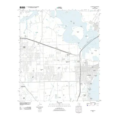
 1967 La Porte1970 Print · USGSCoastal Harris County in the late sixties shows a landscape where industrial shipping channels meet growing bayfront communities. Genealogists and local historians can trace residential patterns in Lomax, locate Betheny Cem, and see the early footprint of San Jacinto College.
 - 1975 Map of Houston, 1977 Print
 1975 Houston1977 Print · USGSThe Texas Gulf Coast in the mid-seventies shows a sprawling Houston metropolis linked to the sea by the massive Houston Ship Channel. Researchers can trace the mid-century industrial landscape from the Astrodome to the Lyndon B. Johnson Space Center.2 unique versions available
 - 1982 Map of La Porte, 1983 Print
 1982 La Porte1983 Print · USGSThe industrial and maritime heart of the Texas coast comes into focus in the early eighties as the ship channel drives the local economy. Trace family history and regional growth at La Porte, San Jacinto State Park, and the Wooster Cem.
 - 1982 Map of Pasadena, 1983 Print
 1982 Pasadena1983 Print · USGSGreater Houston experienced significant industrial and suburban maturation by the early eighties, centered on the vital shipping corridors. Researchers can trace family roots through neighborhood landmarks like Crown Hill Cem or locate former aviation sites such as Genoa Airport.
 - 1992 Map of Houston
 1992 Houston1992 Print · USGSThe Houston metropolitan area reached its modern sprawl in the early nineties, centered on the Buffalo Bayou and a massive regional rail network. Genealogists and historians can trace the development of satellite cities like Sugar Land and Pasadena, or locate legacy sites like the Humble Oil Field and the NASA Lyndon B Johnson Space Center.
 - 1995 Map of La Porte, 1999 Print
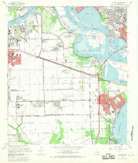
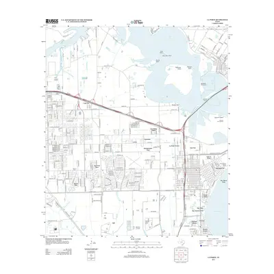
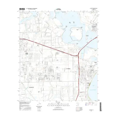
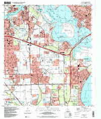 1995 La Porte1999 Print · USGSUpper Galveston Bay and the industrial heart of the Texas coast are detailed in this mid-1990s survey. Genealogists and local historians can trace the development of La Porte and Morgans Point alongside the San Jacinto Monument and Wooster Cem.
 - 1995 Map of Pasadena, 2000 Print
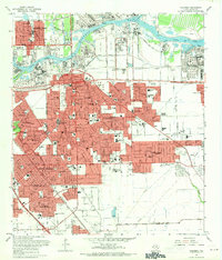
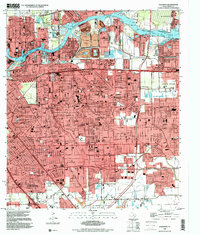 1995 Pasadena2000 Print · USGSThe industrial heart of the Gulf Coast is on full display in the mid-1990s as the suburbs of Houston expand around the shipping lanes. Genealogists and historians can locate specific neighborhood institutions like St Frances Cabrini Sch and Southmore Hosp or trace the path of the Port Terminal RR.
 - 2010 Map of Pasadena, 2010 Print
 2010 Pasadena2010 Print · USGSCovers Deer Park, including Houston, Pasadena, and other nearby areas
 - 2010 Map of La Porte, 2010 Print
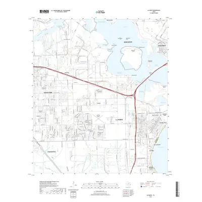
 2010 La Porte2010 Print · USGSCovers Deer Park, including Houston, Pasadena, and other nearby areas
 - 2013 Map of Pasadena, 2013 Print
 2013 Pasadena2013 Print · USGSCovers Deer Park, including Houston, Pasadena, and other nearby areas
 - 2013 Map of La Porte, 2013 Print
 2013 La Porte2013 Print · USGSCovers Deer Park, including Houston, Pasadena, and other nearby areas
 - 2016 Map of Pasadena, 2016 Print
 2016 Pasadena2016 Print · USGSCovers Deer Park, including Houston, Pasadena, and other nearby areas
 - 2016 Map of La Porte, 2016 Print
 2016 La Porte2016 Print · USGSCovers Deer Park, including Houston, Pasadena, and other nearby areas
 - 2019 Map of La Porte, 2019 Print
 2019 La Porte2019 Print · USGSCovers Deer Park, including Houston, Pasadena, and other nearby areas
 - 2019 Map of Pasadena, 2019 Print
 2019 Pasadena2019 Print · USGSCovers Deer Park, including Houston, Pasadena, and other nearby areas
Showing maps 1-25 of 27
Top cities near Deer Park
- Houston historical maps
- Pasadena historical maps
- Pearland historical maps
- League City historical maps
- Baytown historical maps
- Channelview historical maps
See more
Top neighborhoods of Deer Park
Frequently asked questions
- What are the different types of historical maps available for Deer Park?
- What is the oldest map of Deer Park?
- Where can I purchase historical maps of Deer Park for my home or office?
- Where can I download high-res historical maps of Deer Park?
- Are there historical topographic maps available for Deer Park?
- Is there historical aerial imagery available for Deer Park?
- Where are historical maps of Deer Park sourced from?