Old Maps of Lakewood Glen Trails, Harris County
Explore 25 old maps of Lakewood Glen Trails, spanning from 1915 to today. These high-resolution historic maps reveal how streets, neighborhoods, landmarks, and natural features evolved over time — perfect for genealogy, metal detecting, research, and local history exploration.
What you can do with these maps:
- See how Lakewood Glen Trails changed over time: Compare historical maps to modern-day views to trace roads, homesites, rail lines & more.
- View detailed metadata: Each map includes creators, publishers, year, scale, and archive source.
- Overlay maps with satellite & LiDAR: Visualize the past alongside modern tools to explore terrain & human change.
- Trusted historical sources: Maps sourced from the USGS, Library of Congress, and other archives.
- Access maps your way: View online, download high-res files, or order prints for personal or research use.
Start exploring old maps of Lakewood Glen Trails to uncover forgotten places, hidden landmarks, and the deep history beneath your feet.
Lakewood Glen Trails, Harris County maps
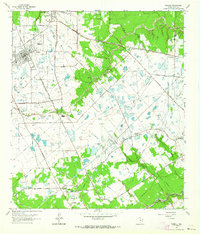
(25)- 1915 Map of Cypress
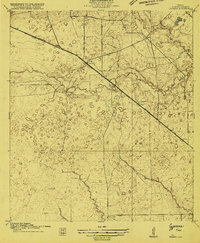 1915 Cypress1915 Print · USGSCovers Lakewood Glen Trails, including Houston, Cypress, and other nearby areas3 unique versions available
 - 1916 Map of Rose Hill
 1916 Rose Hill1916 Print · USGSCovers Lakewood Glen Trails, including Houston, Tomball, and other nearby areas
 - 1916 Map of Louetta
 1916 Louetta1916 Print · USGSCovers Lakewood Glen Trails, including Houston, Tomball, and other nearby areas
 - 1916 Map of Satsuma
 1916 Satsuma1916 Print · USGSCovers Lakewood Glen Trails, including Houston, Jersey Village, and other nearby areas3 unique versions available
 - 1918 Map of Cypress
 1918 Cypress1918 Print · USGSCovers Lakewood Glen Trails, including Houston, Cypress, and other nearby areas2 unique versions available
 - 1920 Map of Rose Hill
 1920 Rose Hill1920 Print · USGSCovers Lakewood Glen Trails, including Houston, Tomball, and other nearby areas
 - 1920 Map of Louetta
 1920 Louetta1920 Print · USGSCovers Lakewood Glen Trails, including Houston, Tomball, and other nearby areas2 unique versions available
 - 1920 Map of Satsuma
 1920 Satsuma1920 Print · USGSCovers Lakewood Glen Trails, including Houston, Jersey Village, and other nearby areas2 unique versions available
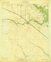
 - 1950 Map of Houston, 1953 Print
 1950 Houston1953 Print · USGSCovers Lakewood Glen Trails, including Houston, Pasadena, and other nearby areas
 - 1954 Map of Beaumont, 1964 Print
 1954 Beaumont1964 Print · USGSCovers Lakewood Glen Trails, including Houston, Beaumont, and other nearby areas3 unique versions available
 - 1955 Map of Addicks, 1957 Print
 1955 Addicks1957 Print · USGSCovers Lakewood Glen Trails, including Houston, Cypress, and other nearby areas
 - 1956 Map of Houston, 1963 Print
 1956 Houston1963 Print · USGSCovers Lakewood Glen Trails, including Houston, Pasadena, and other nearby areas2 unique versions available
 - 1957 Map of Beaumont
 1957 Beaumont1957 Print · USGSCovers Lakewood Glen Trails, including Houston, Beaumont, and other nearby areas
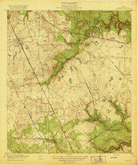
 - 1962 Map of Tomball, 1964 Print
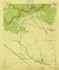
 1962 Tomball1964 Print · USGSCovers Lakewood Glen Trails, including Houston, Tomball, and other nearby areas4 unique versions available
 - 1962 Map of Rose Hill, 1964 Print
 1962 Rose Hill1964 Print · USGSCovers Lakewood Glen Trails, including Houston, Tomball, and other nearby areas3 unique versions available
 - 1970 Map of Cypress, 1972 Print
 1970 Cypress1972 Print · USGSCovers Lakewood Glen Trails, including Houston, Cypress, and other nearby areas3 unique versions available
 - 1970 Map of Satsuma, 1973 Print
 1970 Satsuma1973 Print · USGSCovers Lakewood Glen Trails, including Houston, Jersey Village, and other nearby areas
 - 1975 Map of Houston, 1977 Print
 1975 Houston1977 Print · USGSCovers Lakewood Glen Trails, including Houston, Pasadena, and other nearby areas2 unique versions available
 - 1982 Map of Satsuma
 1982 Satsuma1982 Print · USGSCovers Lakewood Glen Trails, including Houston, Jersey Village, and other nearby areas2 unique versions available
 - 1984 Map of Beaumont
 1984 Beaumont1984 Print · USGSCovers Lakewood Glen Trails, including Houston, Beaumont, and other nearby areas3 unique versions available
 - 1985 Map of Conroe
 1985 Conroe1985 Print · USGSCovers Lakewood Glen Trails, including Houston, The Woodlands, and other nearby areas2 unique versions available
 - 1992 Map of Houston
 1992 Houston1992 Print · USGSCovers Lakewood Glen Trails, including Houston, Pasadena, and other nearby areas
 - 1995 Map of Cypress, 1999 Print
 1995 Cypress1999 Print · USGSCovers Lakewood Glen Trails, including Houston, Cypress, and other nearby areas
 - 1995 Map of Tomball, 1999 Print
 1995 Tomball1999 Print · USGSCovers Lakewood Glen Trails, including Houston, Tomball, and other nearby areas
 - 1995 Map of Satsuma, 2000 Print
 1995 Satsuma2000 Print · USGSCovers Lakewood Glen Trails, including Houston, Jersey Village, and other nearby areas
End of results
Showing maps 1-25 of 25
Frequently asked questions
- What are the different types of historical maps available for Lakewood Glen Trails?
- What is the oldest map of Lakewood Glen Trails?
- Where can I purchase historical maps of Lakewood Glen Trails for my home or office?
- Where can I download high-res historical maps of Lakewood Glen Trails?
- Are there historical topographic maps available for Lakewood Glen Trails?
- Is there historical aerial imagery available for Lakewood Glen Trails?
- Where are historical maps of Lakewood Glen Trails sourced from?