Old Maps of Lone Peak View Estates, West Jordan for Hiking & Exploration
Hike through history with 16 historic maps of Lone Peak View Estates. Explore old trails, ghost towns, and forgotten backroads — perfect for outdoor adventurers and local explorers.
- Rediscover forgotten places: Map out old mining camps, roads, and footpaths that no longer exist on modern maps.
- Layer with modern tools: Combine with LiDAR or satellite views to plan hikes through historical terrain.
- Made for exploration: Popular among hikers, overlanders, and local history lovers.
Use these maps to find adventure and explore the hidden past of Lone Peak View Estates.
Lone Peak View Estates, West Jordan maps
(16)- 1885 Map of Salt Lake
 1885 Salt Lake1885 Print · USGSCovers Lone Peak View Estates, including Salt Lake City, West Valley City, and other nearby areas7 unique versions available
 - 1885 Map of Tooele Valley
 1885 Tooele Valley1885 Print · USGSCovers Lone Peak View Estates, including Salt Lake City, West Valley City, and other nearby areas6 unique versions available
 - 1925 Map of Ft. Douglas
 1925 Ft. Douglas1925 Print · USGSCovers Lone Peak View Estates, including Salt Lake City, West Valley City, and other nearby areas
 - 1928 Map of Ft. Douglas
 1928 Ft. Douglas1928 Print · USGSCovers Lone Peak View Estates, including Salt Lake City, West Valley City, and other nearby areas2 unique versions available
 - 1951 Map of Midvale, 1953 Print
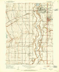 1951 Midvale1953 Print · USGSCovers Lone Peak View Estates, including West Jordan, Sandy, and other nearby areas
 - 1952 Map of Lark, 1954 Print
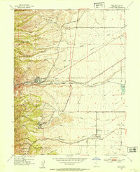 1952 Lark1954 Print · USGSCovers Lone Peak View Estates, including West Jordan, South Jordan, and other nearby areas5 unique versions available
 - 1953 Map of Tooele, 1968 Print
 1953 Tooele1968 Print · USGSCovers Lone Peak View Estates, including Salt Lake City, West Valley City, and other nearby areas3 unique versions available
 - 1954 Map of Salt Lake City, 1964 Print
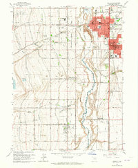
 1954 Salt Lake City1964 Print · USGSCovers Lone Peak View Estates, including Salt Lake City, West Valley City, and other nearby areas4 unique versions available
 - 1955 Map of Tooele, 1958 Print
 1955 Tooele1958 Print · USGSCovers Lone Peak View Estates, including Salt Lake City, West Valley City, and other nearby areas3 unique versions available
 - 1958 Map of Salt Lake City
 1958 Salt Lake City1958 Print · USGSCovers Lone Peak View Estates, including Salt Lake City, West Valley City, and other nearby areas
 - 1960 Map of Salt Lake City
 1960 Salt Lake City1960 Print · USGSCovers Lone Peak View Estates, including Salt Lake City, West Valley City, and other nearby areas
 - 1963 Map of Midvale, 1964 Print
 1963 Midvale1964 Print · USGSCovers Lone Peak View Estates, including West Jordan, Sandy, and other nearby areas3 unique versions available
 - 1979 Map of Tooele, 1980 Print
 1979 Tooele1980 Print · USGSCovers Lone Peak View Estates, including Salt Lake City, West Valley City, and other nearby areas
 - 1980 Map of Salt Lake City
 1980 Salt Lake City1980 Print · USGSCovers Lone Peak View Estates, including Salt Lake City, West Valley City, and other nearby areas3 unique versions available
 - 1999 Map of Copperton, 2001 Print
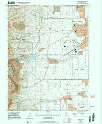 1999 Copperton2001 Print · USGSCovers Lone Peak View Estates, including West Jordan, South Jordan, and other nearby areas
 - 1999 Map of Midvale, 2001 Print
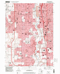 1999 Midvale2001 Print · USGSCovers Lone Peak View Estates, including West Jordan, Sandy, and other nearby areas
End of results
Showing maps 1-16 of 16
Frequently asked questions
- What are the different types of historical maps available for Lone Peak View Estates?
- What is the oldest map of Lone Peak View Estates?
- Where can I purchase historical maps of Lone Peak View Estates for my home or office?
- Where can I download high-res historical maps of Lone Peak View Estates?
- Are there historical topographic maps available for Lone Peak View Estates?
- Is there historical aerial imagery available for Lone Peak View Estates?
- Where are historical maps of Lone Peak View Estates sourced from?