Old Maps of Peterson Commons, West Jordan for Genealogy
Trace your family roots with 11 historic maps of Peterson Commons. These high-res maps reveal old neighborhoods, homesites, landmarks, and streets — helping you uncover where your ancestors lived and how the area evolved over time.
- Explore historic neighborhoods: Identify where your relatives may have lived in the 1800s or 1900s.
- Compare maps over time: Trace the changes in streets, buildings, and landmarks for multi-generational research.
- Perfect for genealogy & ancestry research: Used by family historians and researchers to map out lineage and migration.
These maps are an incredible resource for exploring your personal connection to Peterson Commons's past.
Peterson Commons, West Jordan maps
(11)- 1885 Map of Tooele Valley
 1885 Tooele Valley1885 Print · USGSThe valleys and ranges west of the Wasatch are captured here in the mid-1880s, showcasing the early mining and rail infrastructure of the region. Genealogists can trace early settlements like Grantsville, Ophir, and Stockton, or the route of the Utah and Nevada R. R.6 unique versions available
 - 1952 Map of Lark, 1954 Print
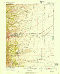 1952 Lark1954 Print · USGSThe mining and farming communities of the Oquirrh foothills are captured here in the early fifties, documenting the height of the regional copper era. Local researchers can trace family landmarks like Bingham High Sch, the Herriman Cem, and several named mine portals including the Butterfield Tunnel.5 unique versions available
 - 1953 Map of Tooele, 1968 Print
 1953 Tooele1968 Print · USGSTooele County is shown here in the 1950s, a vast landscape transitioning between the industrial growth of the Salt Lake Valley and isolated military testing grounds. Researchers can trace the routes of the Western Pacific railroad and locate historic outposts like Iosepa Ranch and St John Station.3 unique versions available
 - 1955 Map of Tooele, 1958 Print
 1955 Tooele1958 Print · USGSTooele County and the Great Salt Lake are captured here during the mid-fifties, an era of burgeoning military testing and industrial mining. Researchers can trace the rail sidings at Salduro Station, the grounds of the Deseret Chemical Corps Depot, and the International Smelting Co facilities.3 unique versions available
 - 1979 Map of Tooele, 1980 Print
 1979 Tooele1980 Print · USGSTooele and the eastern Oquirrh foothills appear here in the late seventies, showing a landscape defined by massive industrial works and military sites. Researchers can trace the rail corridors of the Western Pacific or locate the historic Monarch Mine and the vast Open Pit Mine near Bingham.
 - 1999 Map of Copperton, 2001 Print
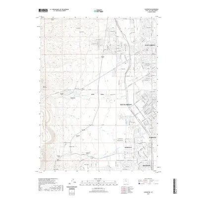
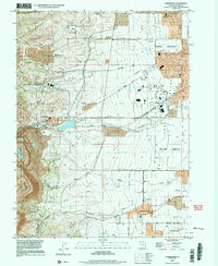 1999 Copperton2001 Print · USGSThe southwestern Salt Lake Valley was rapidly suburbanizing at the end of the century, even as the massive copper operations remained active. Genealogists and local historians can trace the early footprints of Herriman and Copperton, locating sites like the Bingham City Cem and Fort Herriman Historical Marker.
 - 2011 Map of Copperton, 2011 Print
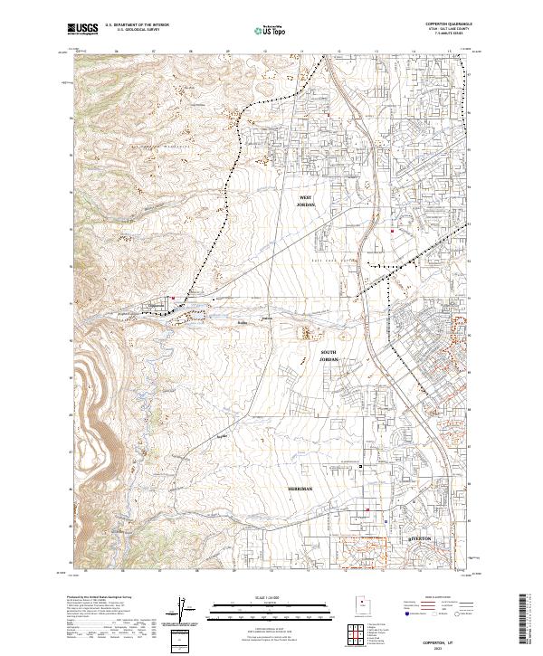
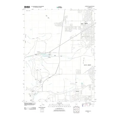 2011 Copperton2011 Print · USGSCovers Peterson Commons, including West Jordan, South Jordan, and other nearby areas
 - 2014 Map of Copperton, 2014 Print
 2014 Copperton2014 Print · USGSCovers Peterson Commons, including West Jordan, South Jordan, and other nearby areas
 - 2017 Map of Copperton, 2017 Print
 2017 Copperton2017 Print · USGSCovers Peterson Commons, including West Jordan, South Jordan, and other nearby areas
 - 2020 Map of Copperton, 2020 Print
 2020 Copperton2020 Print · USGSCovers Peterson Commons, including West Jordan, South Jordan, and other nearby areas
 - 2023 Map of Copperton, 2023 Print
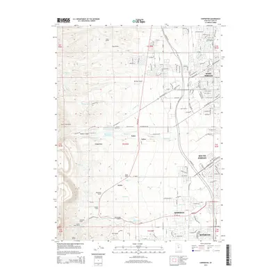
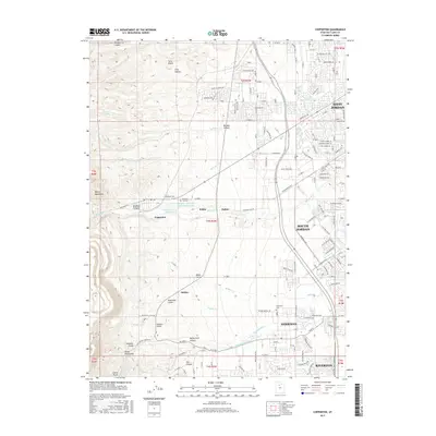
 2023 Copperton2023 Print · USGSThe foothills of the Oquirrh Mountains meet the suburban Salt Lake Valley in this recent survey. Researchers can trace the industrial footprint of Bingham Canyon alongside the Bingham City Cem and the small settlement of Dalton.
End of results
Showing maps 1-11 of 11
Frequently asked questions
- What are the different types of historical maps available for Peterson Commons?
- What is the oldest map of Peterson Commons?
- Where can I purchase historical maps of Peterson Commons for my home or office?
- Where can I download high-res historical maps of Peterson Commons?
- Are there historical topographic maps available for Peterson Commons?
- Is there historical aerial imagery available for Peterson Commons?
- Where are historical maps of Peterson Commons sourced from?