Old Maps of Riverbend Trailer Park, Utah for Hiking & Exploration
Hike through history with 15 historic maps of Riverbend Trailer Park. Explore old trails, ghost towns, and forgotten backroads — perfect for outdoor adventurers and local explorers.
- Rediscover forgotten places: Map out old mining camps, roads, and footpaths that no longer exist on modern maps.
- Layer with modern tools: Combine with LiDAR or satellite views to plan hikes through historical terrain.
- Made for exploration: Popular among hikers, overlanders, and local history lovers.
Use these maps to find adventure and explore the hidden past of Riverbend Trailer Park.
Riverbend Trailer Park, UT maps
(15)- 1885 Map of Salt Lake
 1885 Salt Lake1885 Print · USGSThe Wasatch Front and surrounding high valleys appear here in the mid-1880s during a period of rapid mining and rail expansion. Genealogists and historians can trace early town sites and mining camps including Alta, Silver City, and the military grounds of Fort Douglass.7 unique versions available
 - 1948 Map of Orem, 1959 Print
 1948 Orem1959 Print · USGSThe Utah Valley at the end of the 1940s showcases a unique blend of heavy industry and high-mountain wilderness. Local historians can trace the development of Orem and Pleasant Grove or locate the Steel Plant and Lincoln Jr HS near Utah Lake.2 unique versions available
 - 1948 Map of Aspen Grove, 1960 Print
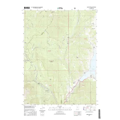
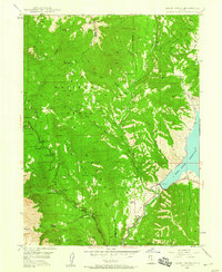 1948 Aspen Grove1960 Print · USGSThe Wasatch Range and Heber Valley appear here in the late 1940s, highlighting the area's role in education and recreation. You can trace the shoreline of the Deer Creek Reservoir and locate historic sites like the Alpine Summer School (B. Y. U.) and the Girls M. I. A. Camp.3 unique versions available
 - 1950 Map of Aspen Grove
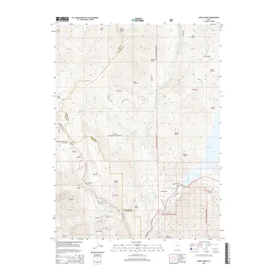
 1950 Aspen Grove1950 Print · USGSThe high Wasatch Range at the mid-point of the century shows a landscape defined by mountain recreation and education. Genealogists and historians can trace the foundations of Aspen Grove, the Alpine Summer School (B. Y. U.), and the early rail route of the Rio Grande and Western.
 - 1954 Map of Salt Lake City, 1964 Print
 1954 Salt Lake City1964 Print · USGSThe Wasatch Front and Uinta Mountains are captured here in the mid-fifties, showing the industrial heart of Utah and its high mountain wilderness. Researchers can locate vanished infrastructure and landmarks like the Geneva Steel Plant, Bingham Canyon Mine, and the Utah State Prison.4 unique versions available
 - 1958 Map of Salt Lake City
 1958 Salt Lake City1958 Print · USGSThe Wasatch Front and Uinta Basin are captured during a period of significant post-war growth and industrial development. Researchers can trace the mid-century rail lines of the Bamberger RR and locate sites like the Kiegley Limestone Quarry and Camp Williams Military Reservation.
 - 1960 Map of Salt Lake City
 1960 Salt Lake City1960 Print · USGSThe Wasatch Front and High Uintas are captured mid-century as the Salt Lake Valley underwent significant postwar expansion. Genealogists and historians can trace rail lines like the Union Pacific and locate established landmarks such as Fort Douglas, Camp Williams, and the Bingham Canyon Mine.
 - 1986 Map of Provo
 1986 Provo1986 Print · USGSThe Utah Valley during the mid-eighties shows a bustling corridor of growth between the mountains and Utah Lake. Genealogists and historians can trace the rail lines of the Union Pacific RR through settlements like Springville, Spanish Fork, and Payson.
 - 1993 Map of Aspen Grove, 1994 Print
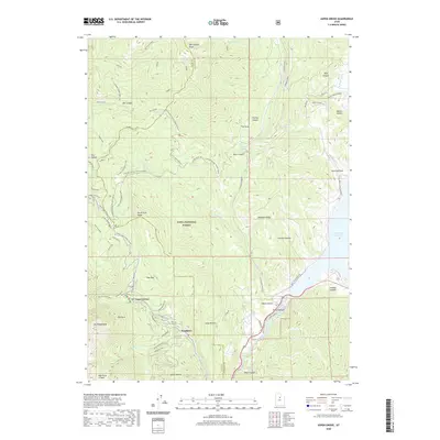
 1993 Aspen Grove1994 Print · USGSMount Timpanogos and the Provo Canyon corridor appear here in the early nineties, showcasing a landscape of high-altitude recreation and wilderness. Trace the development of the Sundance Ski Area, the Aspen Grove complex, and the Old Railroad Grade.2 unique versions available
 - 1998 Map of Aspen Grove, 2000 Print
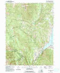
 1998 Aspen Grove2000 Print · USGSThe Wasatch Range in the late 1990s reveals a high-country landscape balanced between wild wilderness and developed recreation. Researchers can trace the trails and roads around Mount Timpanogos, finding historic sites like The Theater in the Pines and landmarks such as Cascade Springs.
 - 2011 Map of Aspen Grove, 2011 Print
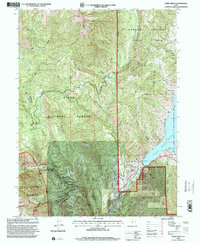
 2011 Aspen Grove2011 Print · USGSCovers Riverbend Trailer Park, including Aspen Grove, Utah County, and other nearby areas
 - 2014 Map of Aspen Grove, 2014 Print
 2014 Aspen Grove2014 Print · USGSCovers Riverbend Trailer Park, including Aspen Grove, Utah County, and other nearby areas
 - 2017 Map of Aspen Grove, 2017 Print
 2017 Aspen Grove2017 Print · USGSCovers Riverbend Trailer Park, including Aspen Grove, Utah County, and other nearby areas
 - 2020 Map of Aspen Grove, 2020 Print
 2020 Aspen Grove2020 Print · USGSCovers Riverbend Trailer Park, including Aspen Grove, Utah County, and other nearby areas
 - 2023 Map of Aspen Grove, 2023 Print
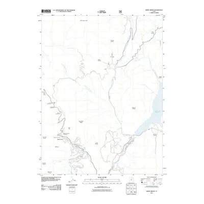
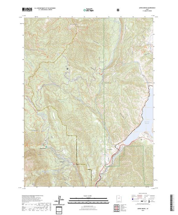 2023 Aspen Grove2023 Print · USGSThe high Wasatch Range at the dawn of the 2020s shows a landscape defined by alpine recreation and protected wilderness. Outdoorsmen and local historians can trace the trail networks around Aspen Grove, the resort layout of Sundance, and the glacial geology of Mt Timpanogos.
End of results
Showing maps 1-15 of 15
Top cities near Riverbend Trailer Park
- Provo historical maps
- Orem historical maps
- Sandy historical maps
- Spanish Fork historical maps
- Pleasant Grove historical maps
- Springville historical maps
See more
Frequently asked questions
- What are the different types of historical maps available for Riverbend Trailer Park?
- What is the oldest map of Riverbend Trailer Park?
- Where can I purchase historical maps of Riverbend Trailer Park for my home or office?
- Where can I download high-res historical maps of Riverbend Trailer Park?
- Are there historical topographic maps available for Riverbend Trailer Park?
- Is there historical aerial imagery available for Riverbend Trailer Park?
- Where are historical maps of Riverbend Trailer Park sourced from?