Old Maps of Soapstone Summer Homes, Wasatch County for Genealogy
Trace your family roots with 14 historic maps of Soapstone Summer Homes. These high-res maps reveal old neighborhoods, homesites, landmarks, and streets — helping you uncover where your ancestors lived and how the area evolved over time.
- Explore historic neighborhoods: Identify where your relatives may have lived in the 1800s or 1900s.
- Compare maps over time: Trace the changes in streets, buildings, and landmarks for multi-generational research.
- Perfect for genealogy & ancestry research: Used by family historians and researchers to map out lineage and migration.
These maps are an incredible resource for exploring your personal connection to Soapstone Summer Homes's past.
Soapstone Summer Homes, Wasatch County maps
(14)- 1885 Map of Salt Lake
 1885 Salt Lake1885 Print · USGSThe Wasatch Front and surrounding high valleys appear here in the mid-1880s during a period of rapid mining and rail expansion. Genealogists and historians can trace early town sites and mining camps including Alta, Silver City, and the military grounds of Fort Douglass.7 unique versions available
 - 1900 Map of Coalville, 1955 Print
 1900 Coalville1955 Print · USGSThe high valleys of Summit and Wasatch counties are captured at the turn of the century as the silver and coal industries flourished. Researchers can trace early settlements like Rockport and Hailstone or locate the industrial Ontario Drain Tunnel near Park City.2 unique versions available
 - 1903 Map of Coalville, 1921 Print
 1903 Coalville1921 Print · USGSUpper Utah at the turn of the century reveals a landscape defined by mining corridors and valley settlements. Genealogists and historians can trace the early path of the Union Pacific R. R. through Coalville or locate family-named sites like Rigby's Ranch and the Ontario Drain Tunnel.2 unique versions available
 - 1954 Map of Salt Lake City, 1964 Print
 1954 Salt Lake City1964 Print · USGSThe Wasatch Front and Uinta Mountains are captured here in the mid-fifties, showing the industrial heart of Utah and its high mountain wilderness. Researchers can locate vanished infrastructure and landmarks like the Geneva Steel Plant, Bingham Canyon Mine, and the Utah State Prison.4 unique versions available
 - 1958 Map of Salt Lake City
 1958 Salt Lake City1958 Print · USGSThe Wasatch Front and Uinta Basin are captured during a period of significant post-war growth and industrial development. Researchers can trace the mid-century rail lines of the Bamberger RR and locate sites like the Kiegley Limestone Quarry and Camp Williams Military Reservation.
 - 1960 Map of Salt Lake City
 1960 Salt Lake City1960 Print · USGSThe Wasatch Front and High Uintas are captured mid-century as the Salt Lake Valley underwent significant postwar expansion. Genealogists and historians can trace rail lines like the Union Pacific and locate established landmarks such as Fort Douglas, Camp Williams, and the Bingham Canyon Mine.
 - 1972 Map of Soapstone Basin, 1974 Print
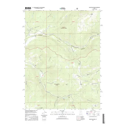
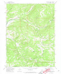 1972 Soapstone Basin1974 Print · USGSThe high Uinta backcountry in the early 1970s was a hub for forest management and mountain recreation. Trace the early layout of Camp Roger, the Soapstone Guard Sta, and remote camps like Piuta Camp along the river forks.2 unique versions available
 - 1980 Map of Salt Lake City
 1980 Salt Lake City1980 Print · USGSSalt Lake City and the surrounding Wasatch Range are shown in the early eighties during a period of rapid suburban growth. Genealogists and historians can trace old mining operations like the Ontario Mine and Wasatch Mine or follow the path of the Union Pacific through the canyons.3 unique versions available
 - 1998 Map of Soapstone Basin, 2001 Print
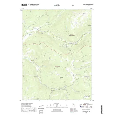
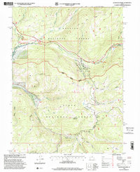 1998 Soapstone Basin2001 Print · USGSThe high Wasatch and Uinta national forests are mapped here as they appeared in the late nineties, centered on the upper Provo River. Researchers can trace forest management and recreation sites from the Soapstone Ranger Station to Camp Roger and the Historic Monument.
 - 2011 Map of Soapstone Basin, 2011 Print
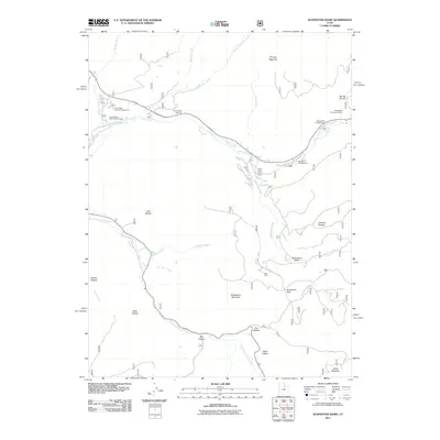 2011 Soapstone Basin2011 Print · USGSCovers Soapstone Summer Homes, including Summit County, Wasatch County, and other nearby areas
 - 2014 Map of Soapstone Basin, 2014 Print
 2014 Soapstone Basin2014 Print · USGSCovers Soapstone Summer Homes, including Summit County, Wasatch County, and other nearby areas
 - 2017 Map of Soapstone Basin, 2017 Print
 2017 Soapstone Basin2017 Print · USGSCovers Soapstone Summer Homes, including Summit County, Wasatch County, and other nearby areas
 - 2020 Map of Soapstone Basin, 2020 Print
 2020 Soapstone Basin2020 Print · USGSCovers Soapstone Summer Homes, including Summit County, Wasatch County, and other nearby areas
 - 2023 Map of Soapstone Basin, 2023 Print
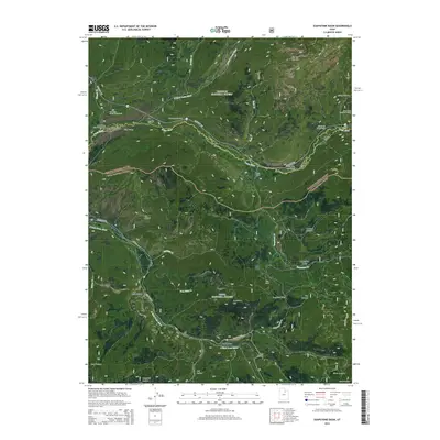
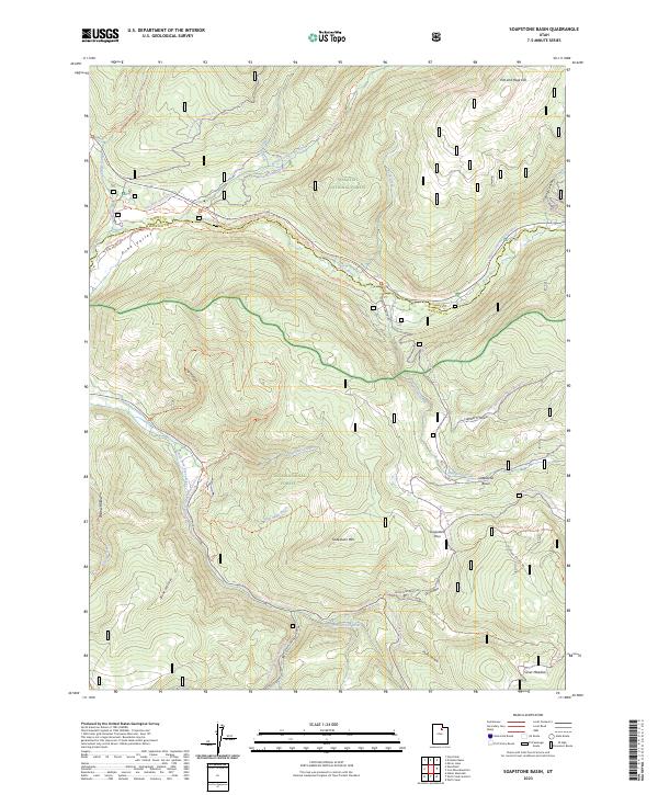 2023 Soapstone Basin2023 Print · USGSThe high Uinta and Wasatch forests come alive in this recent survey of the Utah backcountry. Researchers can trace the intersections of historic pack trails and modern recreation routes through Soapstone Basin, Silver Meadow, and Pine Valley.
End of results
Showing maps 1-14 of 14
Frequently asked questions
- What are the different types of historical maps available for Soapstone Summer Homes?
- What is the oldest map of Soapstone Summer Homes?
- Where can I purchase historical maps of Soapstone Summer Homes for my home or office?
- Where can I download high-res historical maps of Soapstone Summer Homes?
- Are there historical topographic maps available for Soapstone Summer Homes?
- Is there historical aerial imagery available for Soapstone Summer Homes?
- Where are historical maps of Soapstone Summer Homes sourced from?