Old Maps of St. George, Utah
Explore 62 old maps of St. George, spanning from 1885 to today. These high-resolution historic maps reveal how streets, neighborhoods, landmarks, and natural features evolved over time — perfect for genealogy, metal detecting, research, and local history exploration.
What you can do with these maps:
- See how St. George changed over time: Compare historical maps to modern-day views to trace roads, homesites, rail lines & more.
- View detailed metadata: Each map includes creators, publishers, year, scale, and archive source.
- Overlay maps with satellite & LiDAR: Visualize the past alongside modern tools to explore terrain & human change.
- Trusted historical sources: Maps sourced from the USGS, Library of Congress, and other archives.
- Access maps your way: View online, download high-res files, or order prints for personal or research use.
Start exploring old maps of St. George to uncover forgotten places, hidden landmarks, and the deep history beneath your feet.
St. George, UT maps
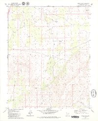
(62)- 1885 Map of St. George
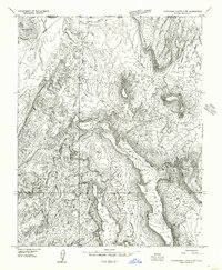
 1885 St. George1885 Print · USGSSouthern Utah’s high deserts and river valleys are captured here during the mid-1880s, an era of mining expansion and early settlement. Researchers can trace the layout of pioneer towns like Silver Reef, Virgin City, and the historic site of Mountain Meadows.
 - 1886 Map of Mt. Trumbull
 1886 Mt. Trumbull1886 Print · USGSMohave County in the late nineteenth century was a territory of extreme verticality and scarce water. Historians can trace early routes through the Arizona Strip via vital water stops like Pierce Ferry, Witches Pool, and Pakoon Spring.
 - 1891 Map of St. George
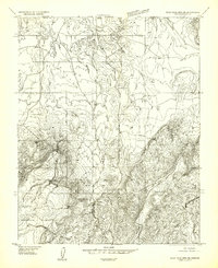
 1891 St. George1891 Print · USGSSouthwestern Utah in the early 1890s was a landscape of pioneer outposts and mining ventures at the edge of the Escalante Desert. Genealogists and historians can trace the early footprints of St George, the mining camp at Silver Reef, and the now-quiet site of Iron City.4 unique versions available
 - 1892 Map of Mt. Trumbull
 1892 Mt. Trumbull1892 Print · USGSNorthwestern Arizona in the late nineteenth century was a frontier of isolated springs and massive plateaus. You can trace early routes across the Colorado River at Pierce Ferry and locate vital water at Pakoon Spring or Witch Pool.6 unique versions available
 - 1953 Map of Cedar City, 1966 Print
 1953 Cedar City1966 Print · USGSSouthwestern Utah's high plateaus and desert basins are mapped here during the mid-fifties, showing the region before the modern interstate system. Researchers can trace historic mining at Silver Reef, follow the Union Pacific line, and locate early settlements like Kanarraville and Toquerville.3 unique versions available
 - 1953 Map of Grand Canyon, 1967 Print
 1953 Grand Canyon1967 Print · USGSArizona's northern frontier is captured here in the mid-twentieth century, from the high plateaus to the desert basins. Trace early routes like Arizona 67, explore the isolated Moccasin settlement, or locate early landmarks such as Mount Trumbull.3 unique versions available
 - 1954 Map of Hurricane Cliffs 2 NW, 1956 Print
 1954 Hurricane Cliffs 2 NW1956 Print · USGSThe Arizona Strip during the mid-fifties was a land of high mesas and vital water holes for cattle ranching along the Mohave county line. Researchers can trace the historic Sunshine Trail across West Mesa to find remote landmarks like Blake Pond and Joe Blake Hill.
 - 1954 Map of La Verkin 3 SW, 1956 Print
 1954 La Verkin 3 SW1956 Print · USGSThe Utah-Arizona borderlands south of the Virgin River are captured here in the mid-1950s, showing a landscape of pioneer history and early aviation. Researchers can locate the Fort Pearce (Ruins) and the CAA Intermediate Field alongside prominent landmarks like Shinob Kibe.
 - 1954 Map of Wolf Hole Mtn. NE, 1956 Print
 1954 Wolf Hole Mtn. NE1956 Print · USGSThe Arizona-Utah borderlands are captured in the mid-1950s, showing a remote landscape shaped by essential water sources and high desert terrain. Researchers can trace the drainage of Mokaac Wash and locate vital landmarks like Lizard Spring and Mokaac Spring.
 - 1954 Map of St. George, 1958 Print
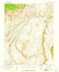
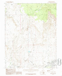
 1954 St. George1958 Print · USGSSouthern Utah in the mid-fifties reveals a network of emerging towns and established agriculture along the Virgin River. Researchers can locate the iconic Temple, the historic Toniquint site, and family heritage sites like the Santa Clara Cemetery.4 unique versions available
 - 1954 Map of Hurricane, 1959 Print
 1954 Hurricane1959 Print · USGSSouthern Utah's desert frontier comes alive in the mid-1950s, showing the early infrastructure of Hurricane and La Verkin. Genealogists and historians can trace the Fort Pierce (Ruins), find the Vanderbilt Mine, and locate family holdings like Bastion Ranch.2 unique versions available
 - 1956 Map of St. George SE
 1956 St. George SE1956 Print · USGSThe growing town of St. George and its surrounding valleys are captured here in the mid-fifties during a period of steady expansion. Researchers can locate specific institutions like Dixie Jr College, find the Toniquint (Site), or trace the critical irrigation routes of the St George and Washington Canal.
 - 1956 Map of St. George NW
 1956 St. George NW1956 Print · USGSSouthwestern Utah in the mid-1950s reveals a landscape of irrigation and indigenous lands west of St. George. You can trace the water systems of the Ivins Reservoir and Canal or locate the community Cemetery near Santa Clara.
 - 1956 Map of St. George NE
 1956 St. George NE1956 Print · USGSSouthwestern Utah in the mid-fifties reveals a landscape of high desert water sources and growing pioneer settlements. Trace the town grid of Washington, locate the Cem, and find the Cottonwood Guard Station within the Dixie National Forest.
 - 1956 Map of St. George SW
 1956 St. George SW1956 Print · USGSWashington County, Utah, was a landscape of remote ranching grounds and critical river irrigation in the mid-1950s. Genealogists and local historians can trace the settlement of Atkinsville and land features like Blakes Laming Ground or the Shivwits Indian Reservation.
 - 1957 Map of Grand Canyon
 1957 Grand Canyon1957 Print · USGSNorthern Arizona in the mid-fifties presents a sparsely settled expanse of high plateaus and ranching outposts surrounding the great canyon. Genealogists and historians can trace family land at Diamond Butte Ranch, locate the Moccasin settlement, or study the magnesium works at Black Diamond Mine.
 - 1958 Map of Grand Canyon
 1958 Grand Canyon1958 Print · USGSNorthern Arizona in the late fifties was a landscape of remote cattle ranches and timber operations spanning from the Virgin Mountains to the Kaibab Forest. Researchers can locate family outposts like Bundy Ranch, trace the Temple Trail, or find the Parashant Lumber Mill.
 - 1958 Map of Cedar City
 1958 Cedar City1958 Print · USGSSouthwestern Utah in the late fifties was a land of mineral extraction and monumental landscapes. Genealogists and historians can trace pioneer-era settlements like Grafton and Parowan alongside industrial sites such as the Silver Reef Mine.2 unique versions available
 - 1960 Map of Grand Canyon
 1960 Grand Canyon1960 Print · USGSThe Arizona strip and the Colorado River corridor appear in the 1950s as a vast network of isolated plateaus and remote outposts. Researchers can trace historic ranching and tribal lands including Supai, the Kaibab Indian Reservation, and the Mt Trumbull Post Office.
 - 1962 Map of Cedar City
 1962 Cedar City1962 Print · USGSSouthern Utah in the early sixties showcases a landscape of dramatic plateaus and historic mining outposts. Trace the early settlement patterns at the Silver Reef (ruins), locate the Iron Mine near the Hurricane Cliffs, or find the Fort Harmony Monument.
 - 1979 Map of Yellowhorse Flat
 1979 Yellowhorse Flat1979 Print · USGSThe high plateau of the Arizona-Utah border comes into focus in the late seventies, showing a landscape defined by mesa tops and desert washes. Local historians can trace the movement of early ranchers through remote landmarks like The Well, Blake Pond, and the Pack Trail near Joe Blake Hill.2 unique versions available
 - 1979 Map of Lizard Point
 1979 Lizard Point1979 Print · USGSBig Valley and the Arizona-Utah borderlands are captured here in the late seventies, showing a landscape defined by water scarcity and ranching life. Researchers can trace remote desert outposts and water sources like Gardner Well, Mokaac Spring, and the Corral.2 unique versions available
 - 1980 Map of St. George, 1981 Print
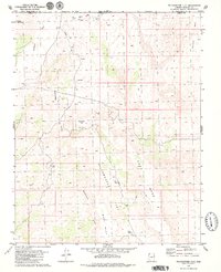
 1980 St. George1981 Print · USGSThe St. George region underwent significant expansion in the early eighties as ranching traditions met new modern development. Researchers can trace the heritage of the Virgin River valley through sites like Grafton, the Apex Mine, and Snow Canyon State Park.2 unique versions available
 - 1986 Map of White Hills, 1987 Print
 1986 White Hills1987 Print · USGSThe high desert along the Utah-Arizona border comes into focus in the mid-1980s as suburban boundaries meet traditional ranching lands. Genealogists and local historians can trace the paths between Santa Clara and Atkinville, or locate landmarks like Blakes Lambing Grounds and the Curly Hollow Reservoir.2 unique versions available
 - 1986 Map of Washington, 1987 Print
 1986 Washington1987 Print · USGSThe growing communities of southwestern Utah are captured here in the mid-eighties, showing the development around Washington and St George. Trace local geography from Black Knolls Reservoir to the heights of T Bone Hill and Cedar Bench.
Showing maps 1-25 of 62
Top cities near St. George
- Washington historical maps
- Hurricane historical maps
- Ivins historical maps
- Santa Clara historical maps
- Diamond Valley historical maps
- Leeds historical maps
See more
Top neighborhoods of St. George
- Sun River historical maps
- Bloomington Hills historical maps
- Middleton historical maps
- Bloomington historical maps
- Little Valley historical maps
- Desert Canyons historical maps
See more
Frequently asked questions
- What are the different types of historical maps available for St. George?
- What is the oldest map of St. George?
- Where can I purchase historical maps of St. George for my home or office?
- Where can I download high-res historical maps of St. George?
- Are there historical topographic maps available for St. George?
- Is there historical aerial imagery available for St. George?
- Where are historical maps of St. George sourced from?