Old Maps of Kent Neighborhood Historic District, Dorset for Hiking & Exploration
Hike through history with 13 historic maps of Kent Neighborhood Historic District. Explore old trails, ghost towns, and forgotten backroads — perfect for outdoor adventurers and local explorers.
- Rediscover forgotten places: Map out old mining camps, roads, and footpaths that no longer exist on modern maps.
- Layer with modern tools: Combine with LiDAR or satellite views to plan hikes through historical terrain.
- Made for exploration: Popular among hikers, overlanders, and local history lovers.
Use these maps to find adventure and explore the hidden past of Kent Neighborhood Historic District.
Kent Neighborhood Historic District, Dorset maps
(13)- 1894 Map of Equinox, 1964 Print
 1894 Equinox1964 Print · USGSCovers Kent Neighborhood Historic District, including Manchester, Shaftsbury, and other nearby areas2 unique versions available
 - 1896 Map of Equinox
 1896 Equinox1896 Print · USGSCovers Kent Neighborhood Historic District, including Manchester, Shaftsbury, and other nearby areas
 - 1900 Map of Equinox
 1900 Equinox1900 Print · USGSCovers Kent Neighborhood Historic District, including Manchester, Shaftsbury, and other nearby areas7 unique versions available
 - 1903 Map of Mettawee
 1903 Mettawee1903 Print · USGSCovers Kent Neighborhood Historic District, including Kingsbury, Granville, and other nearby areas2 unique versions available
 - 1950 Map of Glens Falls
 1950 Glens Falls1950 Print · USGSCovers Kent Neighborhood Historic District, including Queensbury, Saratoga Springs, and other nearby areas
 - 1956 Map of Glens Falls, 1968 Print
 1956 Glens Falls1968 Print · USGSCovers Kent Neighborhood Historic District, including Queensbury, Saratoga Springs, and other nearby areas3 unique versions available
 - 1959 Map of Glens Falls
 1959 Glens Falls1959 Print · USGSCovers Kent Neighborhood Historic District, including Queensbury, Saratoga Springs, and other nearby areas2 unique versions available
 - 1964 Map of Glens Falls
 1964 Glens Falls1964 Print · USGSCovers Kent Neighborhood Historic District, including Queensbury, Saratoga Springs, and other nearby areas
 - 1968 Map of Manchester, 1973 Print
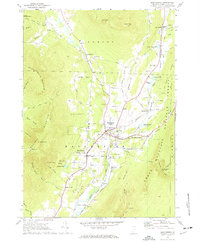 1968 Manchester1973 Print · USGSCovers Kent Neighborhood Historic District, including Manchester, Manchester, and other nearby areas4 unique versions available
 - 1986 Map of Glens Falls
 1986 Glens Falls1986 Print · USGSCovers Kent Neighborhood Historic District, including Queensbury, Saratoga Springs, and other nearby areas2 unique versions available
 - 1989 Map of Glens Falls
 1989 Glens Falls1989 Print · USGSCovers Kent Neighborhood Historic District, including Queensbury, Saratoga Springs, and other nearby areas
 - 1997 Map of Manchester, 2000 Print
 1997 Manchester2000 Print · USGSCovers Kent Neighborhood Historic District, including Manchester, Manchester, and other nearby areas
 - 2024 Map of Manchester, 2024 Print
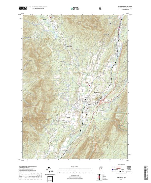 2024 Manchester2024 Print · USGSCovers Kent Neighborhood Historic District, including Manchester, Manchester, and other nearby areas
End of results
Showing maps 1-13 of 13
Frequently asked questions
- What are the different types of historical maps available for Kent Neighborhood Historic District?
- What is the oldest map of Kent Neighborhood Historic District?
- Where can I purchase historical maps of Kent Neighborhood Historic District for my home or office?
- Where can I download high-res historical maps of Kent Neighborhood Historic District?
- Are there historical topographic maps available for Kent Neighborhood Historic District?
- Is there historical aerial imagery available for Kent Neighborhood Historic District?
- Where are historical maps of Kent Neighborhood Historic District sourced from?