Old Maps of Fairlee, Vermont
Explore 27 old maps of Fairlee, spanning from 1931 to today. These high-resolution historic maps reveal how streets, neighborhoods, landmarks, and natural features evolved over time — perfect for genealogy, metal detecting, research, and local history exploration.
What you can do with these maps:
- See how Fairlee changed over time: Compare historical maps to modern-day views to trace roads, homesites, rail lines & more.
- View detailed metadata: Each map includes creators, publishers, year, scale, and archive source.
- Overlay maps with satellite & LiDAR: Visualize the past alongside modern tools to explore terrain & human change.
- Trusted historical sources: Maps sourced from the USGS, Library of Congress, and other archives.
- Access maps your way: View online, download high-res files, or order prints for personal or research use.
Start exploring old maps of Fairlee to uncover forgotten places, hidden landmarks, and the deep history beneath your feet.
Fairlee, VT maps
(27)- 1931 Map of Mt. Cube
 1931 Mt. Cube1931 Print · USGSThe Connecticut River valley and the foothills of the White Mountains are shown here as they appeared in the early 1930s. Genealogists and hikers can trace the Appalachian Trail, locate rural schools like Blood Brook Sch, or find family sites near Quinttown.3 unique versions available
 - 1933 Map of Mt. Cube
 1933 Mt. Cube1933 Print · USGSThe Upper Connecticut River valley is shown in the early thirties, where rail and river networks linked New Hampshire and Vermont. Genealogists and local historians can trace schoolhouses like Stetson Sch, the remote Quinttown settlement, and the historic Mt Cube House.6 unique versions available
 - 1950 Map of Glens Falls
 1950 Glens Falls1950 Print · USGSThe Adirondacks and the Green Mountains meet in this mid-century survey of the New York and Vermont borderlands. Researchers can trace the industrial rail corridors of the Rutland RR and Delaware & Hudson RR connecting Glens Falls, Rutland, and the shores of Lake George.
 - 1956 Map of Glens Falls, 1968 Print
 1956 Glens Falls1968 Print · USGSUpper New York and the Vermont mountains are captured here in the mid-fifties, showing the rugged rail-and-river network of the Northeast. Researchers can trace the paths of the Delaware and Hudson RR and Rutland RR as they wind through valley towns like Poultney and Whitehall.3 unique versions available
 - 1959 Map of Glens Falls
 1959 Glens Falls1959 Print · USGSUpper New York and Vermont are captured here during the late 1950s, a period of transition for these mountain communities. Researchers can trace the legacy of the region's river-and-rail economy through landmarks like Lake George, Saratoga Springs, and Killington Peak.2 unique versions available
 - 1964 Map of Glens Falls
 1964 Glens Falls1964 Print · USGSThe tri-state borderlands of New York, Vermont, and New Hampshire appear here in the mid-1960s. Researchers can trace the rail routes of the Rutland RR and find historic sites like Ticonderoga and Saratoga National Historical Park.
 - 1979 Map of Piermont, 1984 Print
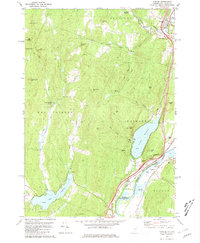
 1979 Piermont1984 Print · USGSThe Upper Connecticut River Valley comes into focus during the late seventies, showing the rural communities of Piermont and Orfordville. Genealogists can trace family sites at Cedar Grove Cem or Dame Hill Cem, while hikers can follow the Appalachian Trail past Mt Cube.2 unique versions available
 - 1981 Map of Lyme
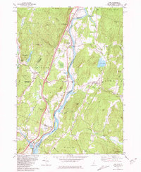 1981 Lyme1981 Print · USGSThe Upper Valley of the Connecticut River comes alive in the early eighties, showcasing the rural character of Vermont and New Hampshire. Genealogists and local historians can trace family ties through Lyme Cem, Highland Cem, and the historic Thetford Academy.3 unique versions available
 - 1981 Map of Fairlee
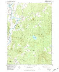
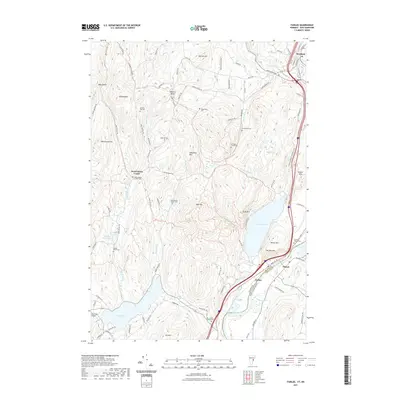
 1981 Fairlee1981 Print · USGSThe Connecticut River valley in the early eighties shows a landscape of lakeside leisure and transit corridors. Researchers can trace the Boston and Maine rail line, locate St Martins Chapel, and find local landmarks like the Drive-in Theater and Bear Ridge Raceway.3 unique versions available
 - 1985 Map of Rutland, 1988 Print
 1985 Rutland1988 Print · USGSThe Upper Valley of the mid-1980s comes to life along the winding Connecticut River as it divides the Green Mountain and Granite states. Historians can trace the industrial rail hubs of White River Junction and the paths of the Appalachian Trail and Long Trail.
 - 1996 Map of Piermont, 2001 Print
 1996 Piermont2001 Print · USGSThe Connecticut River valley and the western edge of the White Mountains are shown here in the mid-nineties. You can trace the Appalachian National Scenic Trail past Mount Cube or locate family plots at Cedar Grove Cemetery and Dame Hill Cemetery.
 - 1996 Map of Lyme, 2001 Print
 1996 Lyme2001 Print · USGSThe Upper Valley river towns of Lyme and Thetford are captured here in the mid-nineties, showing the rural character of the Vermont and New Hampshire border. Researchers can locate family landmarks like the Thetford Academy, the Covered Bridge, and the Wilmot Cem near High Peak.
 - 2012 Map of Piermont, 2012 Print
 2012 Piermont2012 Print · USGSCovers Fairlee, including Orford, Bradford, and other nearby areas
 - 2012 Map of Lyme, 2012 Print
 2012 Lyme2012 Print · USGSCovers Fairlee, including Hanover, Norwich, and other nearby areas
 - 2012 Map of Fairlee, 2012 Print
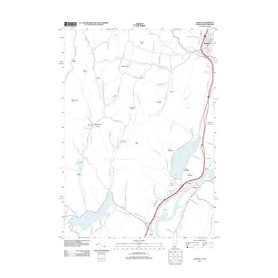 2012 Fairlee2012 Print · USGSCovers Fairlee, including Orford, Bradford, and other nearby areas
 - 2015 Map of Piermont, 2015 Print
 2015 Piermont2015 Print · USGSCovers Fairlee, including Orford, Bradford, and other nearby areas
 - 2015 Map of Lyme, 2015 Print
 2015 Lyme2015 Print · USGSCovers Fairlee, including Hanover, Norwich, and other nearby areas
 - 2015 Map of Fairlee, 2015 Print
 2015 Fairlee2015 Print · USGSCovers Fairlee, including Orford, Bradford, and other nearby areas
 - 2018 Map of Lyme, 2018 Print
 2018 Lyme2018 Print · USGSCovers Fairlee, including Hanover, Norwich, and other nearby areas
 - 2018 Map of Piermont, 2018 Print
 2018 Piermont2018 Print · USGSCovers Fairlee, including Orford, Bradford, and other nearby areas
 - 2018 Map of Fairlee, 2018 Print
 2018 Fairlee2018 Print · USGSCovers Fairlee, including Orford, Bradford, and other nearby areas
 - 2021 Map of Piermont, 2021 Print
 2021 Piermont2021 Print · USGSCovers Fairlee, including Orford, Bradford, and other nearby areas
 - 2021 Map of Lyme, 2021 Print
 2021 Lyme2021 Print · USGSCovers Fairlee, including Hanover, Norwich, and other nearby areas
 - 2021 Map of Fairlee, 2021 Print
 2021 Fairlee2021 Print · USGSCovers Fairlee, including Orford, Bradford, and other nearby areas
 - 2024 Map of Fairlee, 2024 Print
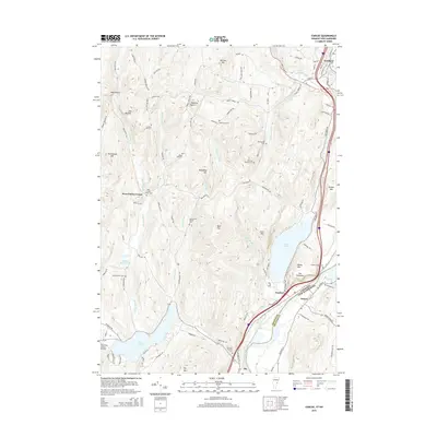
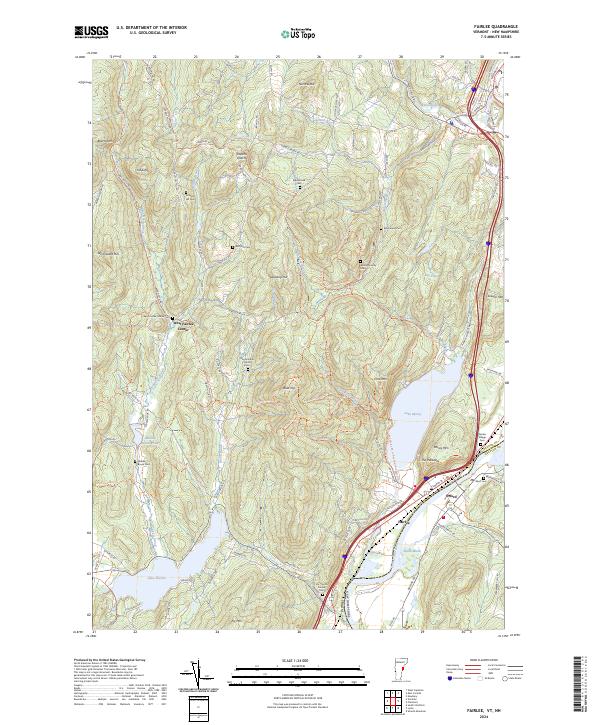 2024 Fairlee2024 Print · USGSThe river valley between Vermont and New Hampshire is documented here in the early twenty-first century. Genealogists can locate family burial grounds like Whiting Family Cem and Kidderhood Cem or trace the old paths of Old Stage Coach Rd.
Showing maps 1-25 of 27
Top cities near Fairlee
- Hanover historical maps
- Hartford historical maps
- Haverhill historical maps
- Norwich historical maps
- Newbury historical maps
- Newbury Village historical maps
See more
Frequently asked questions
- What are the different types of historical maps available for Fairlee?
- What is the oldest map of Fairlee?
- Where can I purchase historical maps of Fairlee for my home or office?
- Where can I download high-res historical maps of Fairlee?
- Are there historical topographic maps available for Fairlee?
- Is there historical aerial imagery available for Fairlee?
- Where are historical maps of Fairlee sourced from?