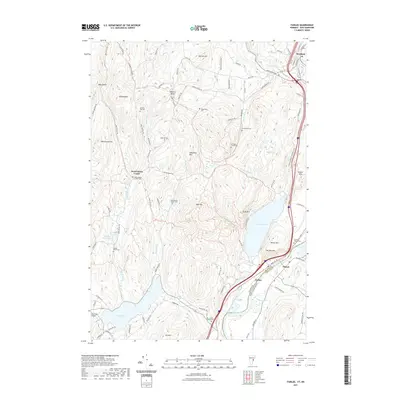
2021 Map of Fairlee
USGS Topo · Published 2021About this map
The Connecticut River serves as the eastern boundary of this Vermont landscape, separating Fairlee from the New Hampshire town of Orford. The terrain is defined by significant elevations such as Bald Top and Sawyer Mtn, while the basins below are filled by Lake Morey and Lake Fairlee. This 2021 survey illustrates a region with a deep commitment to its lineage, evidenced by a high density of small burial grounds, including the Whiting Family Cemetery and the Blood Brook School Cemetery.
Find a feature on this map
96 named features on this map. Tap any name to fly to it.
Don’t see what you’re looking for? This feature index may not catch every label — zoom into the map to look around manually.
Map Details
Editions of this 2021 Fairlee Map
This is the sole edition of this map. No revisions or reprints were ever made.
Other maps of this area

1896 · Strafford
USGS Topo · 1:62,500

1931 · Mt. Cube
USGS Topo · 1:62,500

1931 · Woodsville
USGS Topo · 1:48,000

1933 · Mt. Cube
USGS Topo · 1:62,500

1935 · Woodsville
USGS Topo · 1:62,500

1941 · Woodsville
USGS Topo · 1:62,500

1944 · Strafford
USGS Topo · 1:62,500

1947 · Corinth
USGS Topo · 1:62,500

1948 · East Barre
USGS Topo · 1:62,500

1950 · Glens Falls
USGS Topo · 1:250,000