Old Maps of Craftsbury, Vermont for Genealogy
Trace your family roots with 32 historic maps of Craftsbury. These high-res maps reveal old neighborhoods, homesites, landmarks, and streets — helping you uncover where your ancestors lived and how the area evolved over time.
- Explore historic neighborhoods: Identify where your relatives may have lived in the 1800s or 1900s.
- Compare maps over time: Trace the changes in streets, buildings, and landmarks for multi-generational research.
- Perfect for genealogy & ancestry research: Used by family historians and researchers to map out lineage and migration.
These maps are an incredible resource for exploring your personal connection to Craftsbury's past.
Craftsbury, VT maps
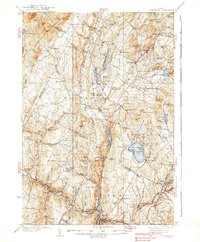
(32)- 1928 Map of Hardwick, 1938 Print
 1928 Hardwick1938 Print · USGSUpper Vermont at the end of the 1920s is seen here through its network of district schools and valley rail lines. Genealogists can trace family landmarks like Jackson Bridge or locate vanished schoolhouses such as Beeler Sch and Speir Sch.
 - 1934 Map of Hardwick
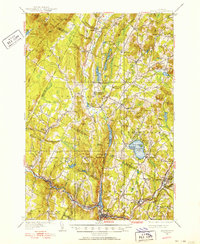
 1934 Hardwick1934 Print · USGSUpper Vermont's hill towns and river valleys are captured here in the mid-1930s, showing a landscape tied to the Lamoille River and small-town industry. Researchers can trace dozens of rural schoolhouses like Collinsville Sch and landmarks such as Jackson Bridge.
 - 1938 Map of Hardwick
 1938 Hardwick1938 Print · USGSVermont’s northern hills and the Lamoille River valley are shown in the late 1930s, documenting a time when rural schools and the railroad connected the highlands. Trace family roots through sites like Hazen Road Sch, Greensboro Bend, and the ST JOHNSBURY AND LAKE CHAMPLAIN RR.2 unique versions available
 - 1950 Map of Lake Champlain
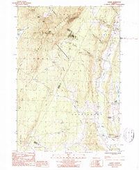
 1950 Lake Champlain1950 Print · USGSThe Lake Champlain valley and its surrounding peaks are captured in detail during the late 1940s, showing the vital rail and road connections between New York and Vermont. Researchers can trace the routes of the Central Vermont Railway or locate old industrial centers like Mineville and Witherbee.2 unique versions available
 - 1951 Map of Hardwick, 1952 Print
 1951 Hardwick1952 Print · USGSThe Northeast Kingdom's rugged highlands and river valleys are captured here in the early fifties, centering on the granite and rail hub of Hardwick. Researchers can trace old family schoolhouses like Wright Sch and Stan Sch or follow the route of the St Johnsbury and Lake Champlain Railroad.4 unique versions available
 - 1958 Map of Lake Champlain
 1958 Lake Champlain1958 Print · USGSThe Champlain Valley and surrounding high peaks are captured here in the late fifties, showcasing the cross-border region from the Adirondacks to the Green Mountains. Researchers can trace historic rail routes like the Rutland Railway or locate old valley settlements such as Keeseville and Vergennes.2 unique versions available
 - 1962 Map of Lake Champlain, 1975 Print
 1962 Lake Champlain1975 Print · USGSLake Champlain and the high peaks of the Adirondacks and Green Mountains are captured here during the mid-twentieth century. Researchers can trace the industrial legacy of the Lyon Mountain Mine and the rail corridors of the Central Vermont RR and Delaware & Hudson RR.3 unique versions available
 - 1986 Map of Wolcott, 1987 Print
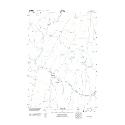
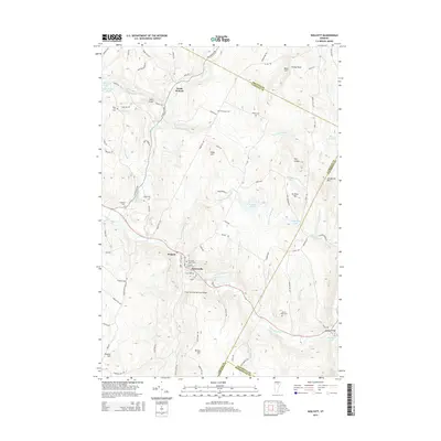
 1986 Wolcott1987 Print · USGSVermont's Lamoille River valley and the surrounding uplands are captured here in the mid-1980s as the region maintained its rural and recreational character. Trace the layout of riverside settlements like Wolcott and Pottersville or locate family landmarks near Scribner Hill and North Wolcott.2 unique versions available
 - 1986 Map of Albany, 1987 Print
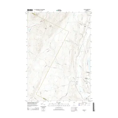
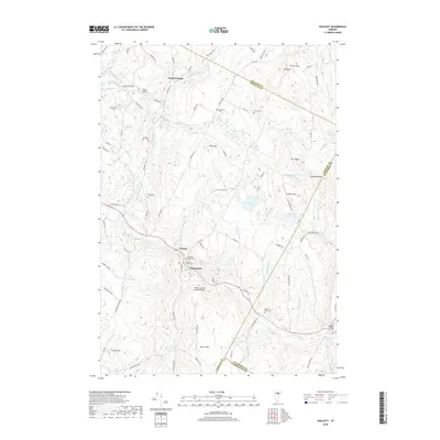
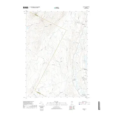
 1986 Albany1987 Print · USGSOrleans County in the mid-1980s reveals a classic Vermont mix of highland wilderness and river-valley villages. Researchers can trace the layout of Craftsbury Common, locate the old Mill Village, and follow the winding course of the Black River.2 unique versions available
 - 1986 Map of Caspian Lake, 1987 Print
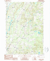
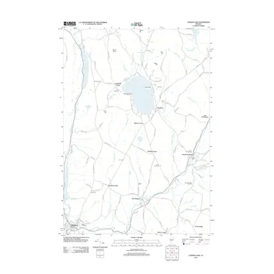
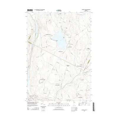
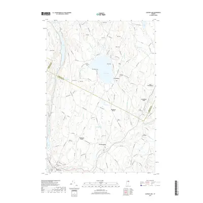
 1986 Caspian Lake1987 Print · USGSThe upland villages of Orleans and Caledonia counties are captured here in the mid-1980s, centered on the clear waters of Caspian Lake. Genealogists and historians can trace the local road networks connecting Hardwick Street, Greensboro Bend, and East Hardwick.2 unique versions available
 - 1986 Map of Craftsbury, 1987 Print
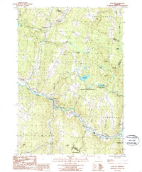
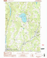
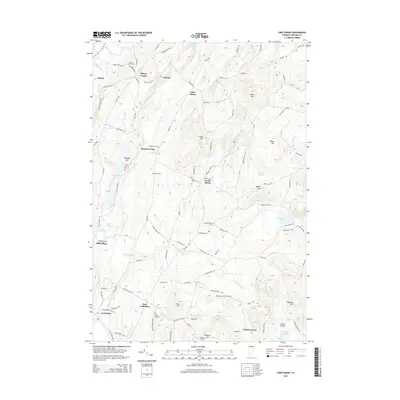
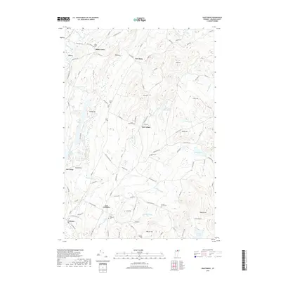
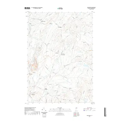
 1986 Craftsbury1987 Print · USGSOrleans County, Vermont, maintains its rural character in the mid-1980s as a landscape of small hamlets and glacial lakes. Genealogists and local historians can trace family-named sites like Merrill Corner and Gebbie Corner alongside the waters of Great Hosmer Pond.2 unique versions available
 - 1989 Map of Mount Mansfield
 1989 Mount Mansfield1989 Print · USGSNorthern Vermont in the late eighties remains a landscape of deep forests and isolated mountain villages. Genealogists and hikers can trace the old rail lines of the Canadian Pacific RR or locate family sites near Lake Willoughby and Brownington Village.
 - 2012 Map of Craftsbury, 2012 Print
 2012 Craftsbury2012 Print · USGSCovers Craftsbury, including Barton, Glover, and other nearby areas
 - 2012 Map of Albany, 2012 Print
 2012 Albany2012 Print · USGSCovers Craftsbury, including Hyde Park, Wolcott, and other nearby areas
 - 2012 Map of Wolcott, 2012 Print
 2012 Wolcott2012 Print · USGSCovers Craftsbury, including Hyde Park, Hardwick, and other nearby areas
 - 2012 Map of Caspian Lake, 2012 Print
 2012 Caspian Lake2012 Print · USGSCovers Craftsbury, including Hardwick, Wolcott, and other nearby areas
 - 2015 Map of Albany, 2015 Print
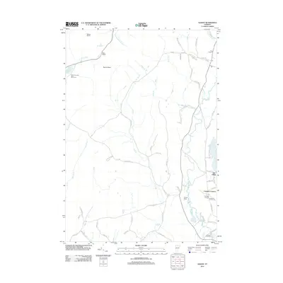
 2015 Albany2015 Print · USGSCovers Craftsbury, including Hyde Park, Wolcott, and other nearby areas
 - 2015 Map of Caspian Lake, 2015 Print
 2015 Caspian Lake2015 Print · USGSCovers Craftsbury, including Hardwick, Wolcott, and other nearby areas
 - 2015 Map of Craftsbury, 2015 Print
 2015 Craftsbury2015 Print · USGSCovers Craftsbury, including Barton, Glover, and other nearby areas
 - 2015 Map of Wolcott, 2015 Print
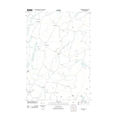
 2015 Wolcott2015 Print · USGSCovers Craftsbury, including Hyde Park, Hardwick, and other nearby areas
 - 2018 Map of Wolcott, 2018 Print
 2018 Wolcott2018 Print · USGSCovers Craftsbury, including Hyde Park, Hardwick, and other nearby areas
 - 2018 Map of Caspian Lake, 2018 Print
 2018 Caspian Lake2018 Print · USGSCovers Craftsbury, including Hardwick, Wolcott, and other nearby areas
 - 2018 Map of Albany, 2018 Print
 2018 Albany2018 Print · USGSCovers Craftsbury, including Hyde Park, Wolcott, and other nearby areas
 - 2018 Map of Craftsbury, 2018 Print
 2018 Craftsbury2018 Print · USGSCovers Craftsbury, including Barton, Glover, and other nearby areas
 - 2021 Map of Craftsbury, 2021 Print
 2021 Craftsbury2021 Print · USGSCovers Craftsbury, including Barton, Glover, and other nearby areas
Showing maps 1-25 of 32
Top cities near Craftsbury
- Stowe historical maps
- Johnson historical maps
- Hyde Park historical maps
- Hardwick historical maps
- Barton historical maps
- Danville historical maps
See more
Top neighborhoods of Craftsbury
Frequently asked questions
- What are the different types of historical maps available for Craftsbury?
- What is the oldest map of Craftsbury?
- Where can I purchase historical maps of Craftsbury for my home or office?
- Where can I download high-res historical maps of Craftsbury?
- Are there historical topographic maps available for Craftsbury?
- Is there historical aerial imagery available for Craftsbury?
- Where are historical maps of Craftsbury sourced from?