Old Maps of Cold River, Shrewsbury for Genealogy
Trace your family roots with 10 historic maps of Cold River. These high-res maps reveal old neighborhoods, homesites, landmarks, and streets — helping you uncover where your ancestors lived and how the area evolved over time.
- Explore historic neighborhoods: Identify where your relatives may have lived in the 1800s or 1900s.
- Compare maps over time: Trace the changes in streets, buildings, and landmarks for multi-generational research.
- Perfect for genealogy & ancestry research: Used by family historians and researchers to map out lineage and migration.
These maps are an incredible resource for exploring your personal connection to Cold River's past.
Cold River, Shrewsbury maps
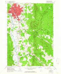
(10)- 1891 Map of Rutland, 1956 Print
 1891 Rutland1956 Print · USGSCovers Cold River, including Rutland City, Clarendon, and other nearby areas
 - 1893 Map of Rutland
 1893 Rutland1893 Print · USGSCovers Cold River, including Rutland City, Clarendon, and other nearby areas8 unique versions available
 - 1950 Map of Glens Falls
 1950 Glens Falls1950 Print · USGSCovers Cold River, including Queensbury, Saratoga Springs, and other nearby areas
 - 1956 Map of Glens Falls, 1968 Print
 1956 Glens Falls1968 Print · USGSCovers Cold River, including Queensbury, Saratoga Springs, and other nearby areas3 unique versions available
 - 1959 Map of Glens Falls
 1959 Glens Falls1959 Print · USGSCovers Cold River, including Queensbury, Saratoga Springs, and other nearby areas2 unique versions available
 - 1961 Map of Rutland, 1964 Print
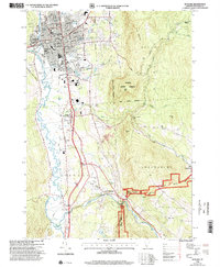
 1961 Rutland1964 Print · USGSCovers Cold River, including Rutland City, Clarendon, and other nearby areas5 unique versions available
 - 1964 Map of Glens Falls
 1964 Glens Falls1964 Print · USGSCovers Cold River, including Queensbury, Saratoga Springs, and other nearby areas
 - 1985 Map of Rutland, 1988 Print
 1985 Rutland1988 Print · USGSCovers Cold River, including Rutland City, Lebanon, and other nearby areas
 - 1996 Map of Rutland, 2000 Print
 1996 Rutland2000 Print · USGSCovers Cold River, including Rutland City, Clarendon, and other nearby areas
 - 2024 Map of Rutland, 2024 Print
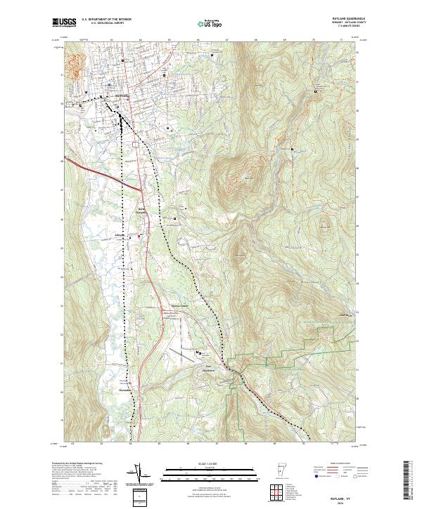 2024 Rutland2024 Print · USGSCovers Cold River, including Rutland City, Clarendon, and other nearby areas
End of results
Showing maps 1-10 of 10
Top cities near Cold River
- Rutland City historical maps
- Brandon historical maps
- Clarendon historical maps
- Ludlow historical maps
- Ludlow Village historical maps
- Wallingford historical maps
See more
Frequently asked questions
- What are the different types of historical maps available for Cold River?
- What is the oldest map of Cold River?
- Where can I purchase historical maps of Cold River for my home or office?
- Where can I download high-res historical maps of Cold River?
- Are there historical topographic maps available for Cold River?
- Is there historical aerial imagery available for Cold River?
- Where are historical maps of Cold River sourced from?