Old Maps of Kincaid, Virginia
Explore 16 old maps of Kincaid, spanning from 1894 to today. These high-resolution historic maps reveal how streets, neighborhoods, landmarks, and natural features evolved over time — perfect for genealogy, metal detecting, research, and local history exploration.
What you can do with these maps:
- See how Kincaid changed over time: Compare historical maps to modern-day views to trace roads, homesites, rail lines & more.
- View detailed metadata: Each map includes creators, publishers, year, scale, and archive source.
- Overlay maps with satellite & LiDAR: Visualize the past alongside modern tools to explore terrain & human change.
- Trusted historical sources: Maps sourced from the USGS, Library of Congress, and other archives.
- Access maps your way: View online, download high-res files, or order prints for personal or research use.
Start exploring old maps of Kincaid to uncover forgotten places, hidden landmarks, and the deep history beneath your feet.
Kincaid, VA maps
(16)- 1894 Map of Natural Bridge, 1898 Print
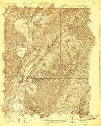
 1894 Natural Bridge1898 Print · USGSThe Virginia ridges thrived with iron furnaces and mineral springs during the 1890s. Genealogists and historians can trace the early industrial footprint of Long Dale Furnace and Victoria Mines, or locate local landmarks like Lick Run Ferry and Rapps Mill.7 unique versions available
 - 1929 Map of Falling Spring
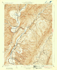
 1929 Falling Spring1929 Print · USGSThe Jackson River valley comes to life in this late 1920s survey of the Virginia highlands. Researchers can locate early schools and settlements like Tinkersville, Greavers Mill, and the Valley View Valley Sch.2 unique versions available
 - 1932 Map of Falling Spring
 1932 Falling Spring1932 Print · USGSThe Virginia and West Virginia borderlands in the early 1930s reveal a landscape of mountain ridges and riverside rail industry. Genealogists can trace family footprints at Greavers Mill, Jenkins Ford, and the old Cedar Creek Sch.3 unique versions available
 - 1945 Map of Clifton Forge, 1963 Print
 1945 Clifton Forge1963 Print · USGSThe rail and river corridors of Alleghany County are captured here at the end of the war, centered on the bustling junction of Clifton Forge. Genealogists and historians can trace old community landmarks like Union Chapel, the Rich Patch Mines, and the Deeds Sch among the ridgelines.2 unique versions available
 - 1947 Map of Roanoke, 1948 Print
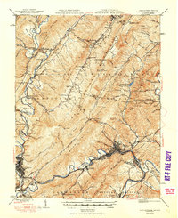
 1947 Roanoke1948 Print · USGSCentral Virginia in the late 1940s reveals a region defined by its great mountain ridges and the powerful river-and-rail economy connecting Roanoke to Lynchburg. Researchers can trace the path of the Virginian RR and locate historic county seats like Charlotte Court House.2 unique versions available
 - 1949 Map of Clifton Forge
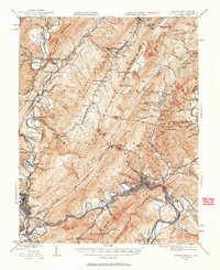
 1949 Clifton Forge1949 Print · USGSThe industrial corridor of the Alleghany Highlands thrives in the late 1940s as rail and river networks converge. Researchers can trace historic family-named landmarks and mountain settlements like Carloover, Rich Patch Mines, and Union Chapel.3 unique versions available
 - 1959 Map of Roanoke
 1959 Roanoke1959 Print · USGSCentral Virginia and the Blue Ridge appear in great detail during the late fifties, showcasing the transition from mountain industry to Piedmont farmland. Trace the path of the Norfolk and Western railroad or find old river towns like Appomattox and Amelia Court House.
 - 1963 Map of Roanoke
 1963 Roanoke1963 Print · USGSCentral Virginia and the Blue Ridge front appear here in the early sixties, caught between their deep railroad roots and new postwar developments. Genealogists and historians can trace the rail lines of the Norfolk and Western through towns like Bedford and Altavista, or locate family landmarks near Smith Mountain Lake.
 - 1966 Map of Falling Spring, 1967 Print
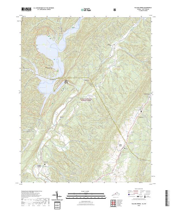
 1966 Falling Spring1967 Print · USGSThe Jackson River valley and the rugged ridges of the George Washington National Forest define this mid-century landscape. Genealogists and hikers can trace old mountain routes and family settlements near Falling Spring, Carloover, and the Emory Ch.3 unique versions available
 - 1971 Map of Roanoke, 1977 Print
 1971 Roanoke1977 Print · USGSThe Virginia Piedmont and Blue Ridge mountains meet in this early 1970s landscape of river valleys and rail hubs. Researchers can trace historic transportation routes and landmarks like the Appomattox Court House Nat Hist Pk, the Peaks of Otter, and Amelia Court House.2 unique versions available
 - 1986 Map of Buena Vista
 1986 Buena Vista1986 Print · USGSThe mid-eighties landscape around Rockbridge County comes alive in this survey of the Blue Ridge and Allegheny foothills. Researchers can trace the legacy of institutions like Washington and Lee University or follow the historic Chesapeake and Ohio Railway through Clifton Forge.2 unique versions available
 - 2011 Map of Falling Spring, 2011 Print
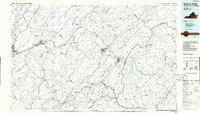
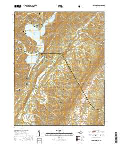
 2011 Falling Spring2011 Print · USGSCovers Kincaid, including Carloover, Valley View, and other nearby areas
 - 2013 Map of Falling Spring, 2013 Print
 2013 Falling Spring2013 Print · USGSCovers Kincaid, including Carloover, Valley View, and other nearby areas
 - 2016 Map of Falling Spring, 2016 Print
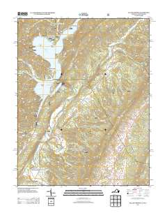
 2016 Falling Spring2016 Print · USGSCovers Kincaid, including Carloover, Valley View, and other nearby areas
 - 2019 Map of Falling Spring, 2019 Print
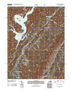
 2019 Falling Spring2019 Print · USGSCovers Kincaid, including Carloover, Valley View, and other nearby areas
 - 2022 Map of Falling Spring, 2022 Print
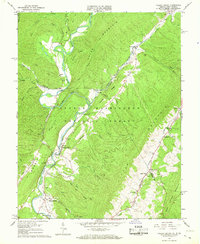
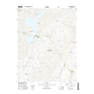
 2022 Falling Spring2022 Print · USGSFalling Spring and the Jackson River valley are captured here in the early twenty-first century as they wind through the Appalachian ridges. Genealogists can trace family roots at the Falling Spring Presbyterian Church Cem or find old homesites near Tinkertown and Valley View.
End of results
Showing maps 1-16 of 16
Top cities near Kincaid
- Covington historical maps
- Clifton Forge historical maps
- Mallow historical maps
- Hot Springs historical maps
- Low Moor historical maps
- Iron Gate historical maps
See more
Frequently asked questions
- What are the different types of historical maps available for Kincaid?
- What is the oldest map of Kincaid?
- Where can I purchase historical maps of Kincaid for my home or office?
- Where can I download high-res historical maps of Kincaid?
- Are there historical topographic maps available for Kincaid?
- Is there historical aerial imagery available for Kincaid?
- Where are historical maps of Kincaid sourced from?