Old Maps of McClintic Heights, Bath County for Genealogy
Trace your family roots with 17 historic maps of McClintic Heights. These high-res maps reveal old neighborhoods, homesites, landmarks, and streets — helping you uncover where your ancestors lived and how the area evolved over time.
- Explore historic neighborhoods: Identify where your relatives may have lived in the 1800s or 1900s.
- Compare maps over time: Trace the changes in streets, buildings, and landmarks for multi-generational research.
- Perfect for genealogy & ancestry research: Used by family historians and researchers to map out lineage and migration.
These maps are an incredible resource for exploring your personal connection to McClintic Heights's past.
McClintic Heights, Bath County maps
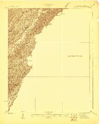
(17)- 1901 Map of Monterey, 1905 Print
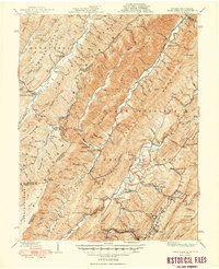
 1901 Monterey1905 Print · USGSThe high Allegheny ridges of Highland and Bath Counties are shown at the turn of the century when isolated valley settlements were linked by winding mountain gaps. Genealogists can trace early homesteads and commerce centers like Cleeks Mills, Mountaingrove, and New Hampden.8 unique versions available
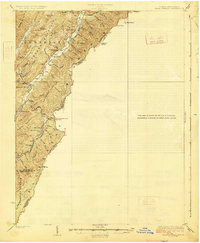
 - 1923 Map of Warm Springs
 1923 Warm Springs1923 Print · USGSThe mountain border between West Virginia and Virginia comes into focus in the early 1920s, revealing a landscape of remote mountain gaps and hollows. Researchers can locate numerous local landmarks like Minnehaha Springs, Mt Carmel Church, and the Circle Hill School.2 unique versions available
 - 1926 Map of Warm Springs
 1926 Warm Springs1926 Print · USGSThe West Virginia and Virginia borderlands come alive in this mid-1920s survey of the high Alleghenies. Researchers can trace rural life through landmarks like Minnehaha Springs, Westminster Church, and schools at Rimel and Sunset.5 unique versions available
 - 1930 Map of Warm Springs Run
 1930 Warm Springs Run1930 Print · USGSBath County's rugged ridge-and-valley landscape is captured here in the early 1930s as mountain communities remained deeply tied to their local terrain. Genealogists and historians can trace family locations near Thomastown, Mitchelltown, and schools like Thomastown Sch.2 unique versions available
 - 1933 Map of Warm Springs Run
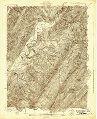
 1933 Warm Springs Run1933 Print · USGSBath County's central valley and surrounding ridges are captured here in the early 1930s, showing a landscape of tight-knit mountain communities. You can trace early school and church locations like The Gap Sch and Mt Hope Ch, or explore the historic layouts of Warm Springs and Bacova.3 unique versions available
 - 1946 Map of Warm Springs, 1962 Print
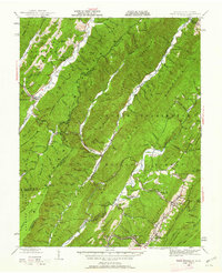 1946 Warm Springs1962 Print · USGSBath County and the Allegheny borderlands are captured here in the mid-1940s, showing the early infrastructure of this resort and timber region. Researchers can trace family sites at Mountain Grove, rural pulpits like Mt Hope Ch, and the crossing at Moclintic Bridge.2 unique versions available
 - 1949 Map of Charlottesville
 1949 Charlottesville1949 Print · USGSThe Shenandoah Valley and Blue Ridge appear in the late 1940s as a thriving corridor of rail and river commerce. Researchers can trace the mid-century footprints of Harrisonburg, Staunton, and Culpeper alongside the historic routes of the Southern Railway.2 unique versions available
 - 1949 Map of Warm Springs
 1949 Warm Springs1949 Print · USGSThe Virginia and West Virginia borderlands are documented here in the late 1940s, highlighting the famous resort springs and rugged Appalachian ridges. Genealogists can trace family locations near Warm Springs, Bacova, and the Chimney Run Ch or Zion Hill Ch.2 unique versions available
 - 1956 Map of Charlottesville, 1966 Print
 1956 Charlottesville1966 Print · USGSThe Shenandoah Valley and Blue Ridge are captured in detail during the mid-1960s as the modern interstate system began to emerge. Genealogists and historians can trace rail-connected hubs like Waynesboro or follow the river paths of the Rapidan River and Rivanna River.4 unique versions available
 - 1968 Map of Warm Springs, 1970 Print
 1968 Warm Springs1970 Print · USGSBath County's famous thermal spring corridor and the high ridges of the Allegheny Mountains appear here in the late sixties. Genealogists can locate family landmarks like Warm Springs Cem, and old church sites including Mt Pisgah Ch and Mt Hope Ch.2 unique versions available
 - 1986 Map of Staunton
 1986 Staunton1986 Print · USGSThe Shenandoah Valley and Allegheny Highlands meet in the mid-1980s, revealing a landscape of historic mountain towns and thermal resorts. Genealogists and historians can trace institutional landmarks like Mary Baldwin College or follow the legacy of the Chesapeake and Ohio Railroad through Craigsville and Swoope.2 unique versions available
 - 1999 Map of Warm Springs, 2000 Print
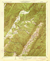
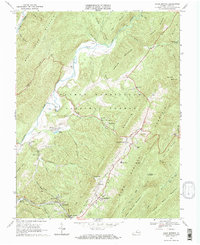
 1999 Warm Springs2000 Print · USGSBath County's renowned thermal spring valley is captured here in the late twentieth century as a landscape of established resort towns and mountain ridges. Researchers can pinpoint Warm Springs, Hot Springs, and Bacova, alongside local landmarks like John Wesley Ch and Valley High Sch.
 - 2011 Map of Warm Springs, 2011 Print
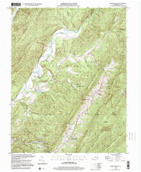
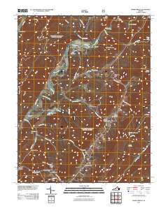 2011 Warm Springs2011 Print · USGSCovers McClintic Heights, including Warm Springs, Chimney Run, and other nearby areas
 - 2013 Map of Warm Springs, 2013 Print
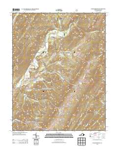 2013 Warm Springs2013 Print · USGSCovers McClintic Heights, including Warm Springs, Chimney Run, and other nearby areas
 - 2016 Map of Warm Springs, 2016 Print
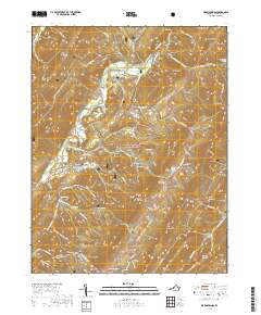
 2016 Warm Springs2016 Print · USGSCovers McClintic Heights, including Warm Springs, Chimney Run, and other nearby areas
 - 2019 Map of Warm Springs, 2019 Print
 2019 Warm Springs2019 Print · USGSCovers McClintic Heights, including Warm Springs, Chimney Run, and other nearby areas
 - 2022 Map of Warm Springs, 2022 Print
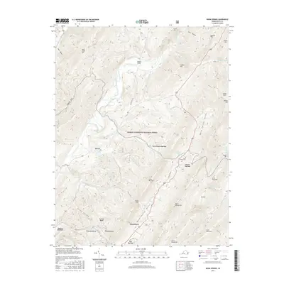
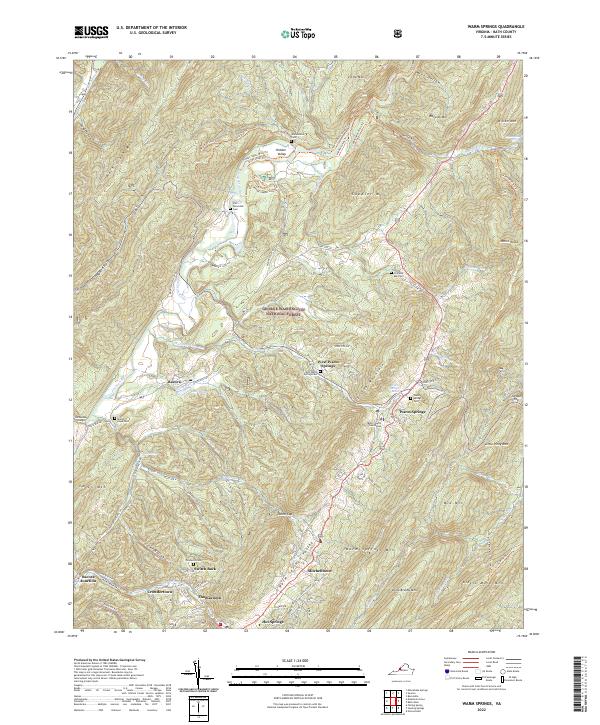 2022 Warm Springs2022 Print · USGSWarm Springs and the thermal valleys of Bath County are shown here in the early twenty-first century. Family historians can locate several burial grounds like Warwickton Cem and Mount Hope Cem alongside the historic Warm Springs Baths.
End of results
Showing maps 1-17 of 17
Frequently asked questions
- What are the different types of historical maps available for McClintic Heights?
- What is the oldest map of McClintic Heights?
- Where can I purchase historical maps of McClintic Heights for my home or office?
- Where can I download high-res historical maps of McClintic Heights?
- Are there historical topographic maps available for McClintic Heights?
- Is there historical aerial imagery available for McClintic Heights?
- Where are historical maps of McClintic Heights sourced from?