Old Maps of Woodland Park, Bath County for Genealogy
Trace your family roots with 12 historic maps of Woodland Park. These high-res maps reveal old neighborhoods, homesites, landmarks, and streets — helping you uncover where your ancestors lived and how the area evolved over time.
- Explore historic neighborhoods: Identify where your relatives may have lived in the 1800s or 1900s.
- Compare maps over time: Trace the changes in streets, buildings, and landmarks for multi-generational research.
- Perfect for genealogy & ancestry research: Used by family historians and researchers to map out lineage and migration.
These maps are an incredible resource for exploring your personal connection to Woodland Park's past.
Woodland Park, Bath County maps
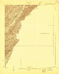
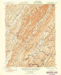
(12)- 1901 Map of Monterey, 1905 Print
 1901 Monterey1905 Print · USGSCovers Woodland Park, including Goshen, Monterey, and other nearby areas8 unique versions available
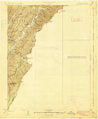
 - 1923 Map of Warm Springs
 1923 Warm Springs1923 Print · USGSCovers Woodland Park, including Warm Springs, Bacova Junction, and other nearby areas2 unique versions available
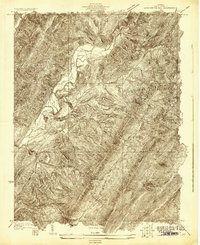
 - 1926 Map of Warm Springs
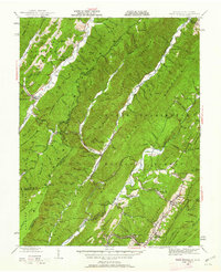
 1926 Warm Springs1926 Print · USGSCovers Woodland Park, including Warm Springs, Bacova Junction, and other nearby areas5 unique versions available
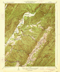
 - 1930 Map of Warm Springs Run
 1930 Warm Springs Run1930 Print · USGSCovers Woodland Park, including Warm Springs, Bacova Junction, and other nearby areas2 unique versions available
 - 1933 Map of Warm Springs Run
 1933 Warm Springs Run1933 Print · USGSCovers Woodland Park, including Warm Springs, Bacova Junction, and other nearby areas3 unique versions available
 - 1946 Map of Warm Springs, 1962 Print
 1946 Warm Springs1962 Print · USGSCovers Woodland Park, including Warm Springs, Bacova Junction, and other nearby areas2 unique versions available
 - 1949 Map of Charlottesville
 1949 Charlottesville1949 Print · USGSCovers Woodland Park, including Harrisonburg, Charlottesville, and other nearby areas2 unique versions available
 - 1949 Map of Warm Springs
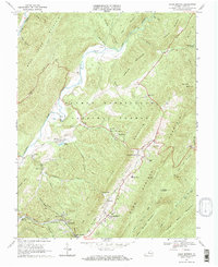
 1949 Warm Springs1949 Print · USGSCovers Woodland Park, including Warm Springs, Bacova Junction, and other nearby areas2 unique versions available
 - 1956 Map of Charlottesville, 1966 Print
 1956 Charlottesville1966 Print · USGSCovers Woodland Park, including Harrisonburg, Charlottesville, and other nearby areas4 unique versions available
 - 1968 Map of Warm Springs, 1970 Print
 1968 Warm Springs1970 Print · USGSCovers Woodland Park, including Warm Springs, Bacova Junction, and other nearby areas2 unique versions available
 - 1986 Map of Staunton
 1986 Staunton1986 Print · USGSCovers Woodland Park, including Staunton, Stuarts Draft, and other nearby areas2 unique versions available
 - 1999 Map of Warm Springs, 2000 Print
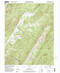 1999 Warm Springs2000 Print · USGSCovers Woodland Park, including Warm Springs, Bacova Junction, and other nearby areas
End of results
Showing maps 1-12 of 12
Frequently asked questions
- What are the different types of historical maps available for Woodland Park?
- What is the oldest map of Woodland Park?
- Where can I purchase historical maps of Woodland Park for my home or office?
- Where can I download high-res historical maps of Woodland Park?
- Are there historical topographic maps available for Woodland Park?
- Is there historical aerial imagery available for Woodland Park?
- Where are historical maps of Woodland Park sourced from?