Old Maps of Cleveland Heights, Charlottesville for Genealogy
Trace your family roots with 32 historic maps of Cleveland Heights. These high-res maps reveal old neighborhoods, homesites, landmarks, and streets — helping you uncover where your ancestors lived and how the area evolved over time.
- Explore historic neighborhoods: Identify where your relatives may have lived in the 1800s or 1900s.
- Compare maps over time: Trace the changes in streets, buildings, and landmarks for multi-generational research.
- Perfect for genealogy & ancestry research: Used by family historians and researchers to map out lineage and migration.
These maps are an incredible resource for exploring your personal connection to Cleveland Heights's past.
Cleveland Heights, Charlottesville maps
(32)- 1892 Map of Gordonsville, 1899 Print
 1892 Gordonsville1899 Print · USGSCentral Virginia’s railway hubs and mountain gaps come alive in this late nineteenth-century survey. Genealogists and historians can trace the foundations of Charlottesville and the bustling rail junctions at Gordonsville and Orange.6 unique versions available
 - 1892 Map of Harrisonburg, 1901 Print
 1892 Harrisonburg1901 Print · USGSThe Shenandoah Valley during the 1890s reveals a landscape of thriving springs, mills, and emerging industry across Rockingham and Albemarle counties. Genealogists can trace family locations through sites like Meyerhoffer's Store, the Crimora Mine, and the University of Virginia Observatory.6 unique versions available
 - 1931 Map of University
 1931 University1931 Print · USGSAlbemarle County is shown here during the late Prohibition era, when the university and the railroad defined the local economy. Genealogists can trace family names through landmarks like the Miller School, Whitehall, and Mt Plains Ch.2 unique versions available
 - 1935 Map of Charlottesville
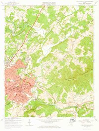
 1935 Charlottesville1935 Print · USGSAlbemarle County's landscape is meticulously detailed in the mid-1930s, centered on the historic crossroads and river forks surrounding the city. Genealogists and local historians can trace family-named landmarks and essential community sites like Monticello, the Rosenwald Sch, and the rail junction at Barboursville.2 unique versions available
 - 1935 Map of Charlottesville And Vicinity
 1935 Charlottesville And Vicinity1935 Print · USGSCharlottesville and the Albemarle countryside are captured in detail in the mid-thirties, from the expanding university campus to the historic estates of the south. Researchers can trace the grounds of Monticello, locate local landmarks like Riverview Cemetery, and follow the old routes of the Southern Railway.
 - 1935 Map of University, 1962 Print
 1935 University1962 Print · USGSAlbemarle County is captured here in the mid-thirties as the new national park and Skyline Drive begin to reshape the Blue Ridge peaks. Genealogists can trace family names across dozens of rural institutions, from the Miller School to Meriwether Lewis Sch and Hillsboro.
 - 1939 Map of Charlottesville
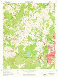
 1939 Charlottesville1939 Print · USGSAlbemarle and Orange Counties come alive in the late 1930s, showing a Piedmont landscape defined by the Southwest Mountains and historic river valleys. Genealogists can locate family landmarks from Monticello to the Rosenwald Sch, alongside dozens of rural churches like Bethany Ch.3 unique versions available
 - 1949 Map of Charlottesville
 1949 Charlottesville1949 Print · USGSThe Shenandoah Valley and Blue Ridge appear in the late 1940s as a thriving corridor of rail and river commerce. Researchers can trace the mid-century footprints of Harrisonburg, Staunton, and Culpeper alongside the historic routes of the Southern Railway.2 unique versions available
 - 1949 Map of Charlottesville, 1962 Print
 1949 Charlottesville1962 Print · USGSMid-century Albemarle County is captured here during a period of steady growth, anchored by the expansion of the Charlottesville area and its surrounding ridges. Researchers can locate rural landmarks like Advance Mills, the Albemarle Training Sch, and the historic Spotswood Trail.
 - 1956 Map of Charlottesville, 1966 Print
 1956 Charlottesville1966 Print · USGSThe Shenandoah Valley and Blue Ridge are captured in detail during the mid-1960s as the modern interstate system began to emerge. Genealogists and historians can trace rail-connected hubs like Waynesboro or follow the river paths of the Rapidan River and Rivanna River.4 unique versions available
 - 1960 Map of Charlottesville And Vicinity
 1960 Charlottesville And Vicinity1960 Print · USGSCharlottesville and the rolling Albemarle County hills are captured here in the mid-twentieth century, centered on the University of Virginia. Genealogists and historians can trace the estates of Monticello and Ash Lawn alongside local landmarks like Riverview Cemetery and Hickory Hill Ch.
 - 1964 Map of Charlottesville East, 1965 Print
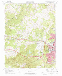
 1964 Charlottesville East1965 Print · USGSCharlottesville and the surrounding Albemarle hills are captured here in the mid-sixties, just as the local landscape was being reshaped by new infrastructure. Genealogists and historians can locate Monticello, trace the vanished streets of Vinegar Hill, or find family names at Michie Tavern Cem and Griffin Cem.2 unique versions available
 - 1964 Map of Charlottesville West, 1966 Print
 1964 Charlottesville West1966 Print · USGSAlbemarle County and the western fringe of Charlottesville are captured here in the mid-sixties during a period of significant suburban growth. Genealogists and local historians can trace legacy landmarks like Meriwether Lewis Sch, Mt Calvary Cem, and the historic Farmington estate.2 unique versions available
 - 1972 Map of Charlottesville West, 1974 Print
 1972 Charlottesville West1974 Print · USGSAlbemarle County comes into sharp focus in the early seventies through this detailed aerial orthophotomap of the Piedmont. Researchers can trace the mid-century expansion of local infrastructure along Route 250 and examine the wooded slopes of the Ragge Mountains.
 - 1972 Map of Charlottesville East, 1974 Print
 1972 Charlottesville East1974 Print · USGSAlbemarle County comes into sharp focus during the early 1970s as the suburbs and road networks expand toward the Piedmont slopes. Researchers can trace the watercourses of the Rivanna River and the elevations of Southwestern Mountain.
 - 1973 Map of Charlottesville West, 1974 Print
 1973 Charlottesville West1974 Print · USGSAlbemarle County and the western reaches of Charlottesville appear here during a period of rapid institutional growth in the early seventies. Genealogists and historians can trace family-named summits like Turners Mtn and Clark Mtn or locate local landmarks including Olivet Ch and Sherwood Farms.3 unique versions available
 - 1973 Map of Charlottesville East, 1974 Print
 1973 Charlottesville East1974 Print · USGSThe Charlottesville area in the early seventies shows a balance of historical preservation and suburban growth. Trace the grounds of Monticello and the Jefferson Tomb, or locate family sites like Moon Cem and Chapman Grove Ch.3 unique versions available
 - 1977 Map of Charlottesville West, 1982 Print
 1977 Charlottesville West1982 Print · USGSWestern Albemarle County at the end of the seventies is seen here through detailed aerial imagery of the developing countryside. Researchers can trace the layout of Farmington or locate the rural outskirts of Owensville and Millington.
 - 1977 Map of Charlottesville East, 1982 Print
 1977 Charlottesville East1982 Print · USGSAlbemarle County in the late seventies is captured here just as the suburban footprint of the city was expanding into the surrounding hills. Genealogists and local historians can trace the rural tracts around Shadwell or follow the riverbanks at Eastham.
 - 1986 Map of Charlottesville
 1986 Charlottesville1986 Print · USGSCentral Virginia in the mid-eighties shows a landscape balanced between the growing city centers of the Piedmont and the protected ridges of the Blue Ridge. Trace the historic rail lines of the Chesapeake and Ohio Railway or locate local landmarks like Monticello Mountain and Bridgewater College.3 unique versions available
 - 1997 Map of Charlottesville West, 1999 Print
 1997 Charlottesville West1999 Print · USGSCharlottesville and its western suburbs appear in high detail during the late nineties as the university and residential corridors expanded toward the mountains. Researchers can trace the grounds of the Univ Of Virginia or locate landmarks like the McCormick Observatory and Farmington Country Club.
 - 1997 Map of Charlottesville East, 1999 Print
 1997 Charlottesville East1999 Print · USGSCharlottesville and Albemarle County are captured here in the late twentieth century as suburban growth reached toward the Southwest Mountains. Genealogists and historians can locate the Jefferson Tomb, find historic congregations like Chapman Grove Ch, or trace the old Three Chopt Road.
 - 2011 Map of Charlottesville East, 2011 Print
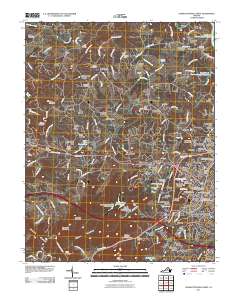
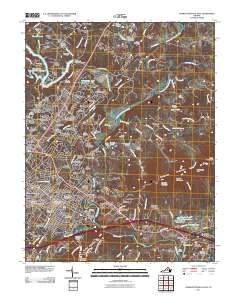 2011 Charlottesville East2011 Print · USGSCovers Cleveland Heights, including Charlottesville, Hollymead, and other nearby areas
 - 2011 Map of Charlottesville West, 2011 Print
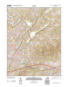
 2011 Charlottesville West2011 Print · USGSCovers Cleveland Heights, including University of Virginia, Ivy, and other nearby areas
 - 2013 Map of Charlottesville East, 2013 Print
 2013 Charlottesville East2013 Print · USGSCovers Cleveland Heights, including Charlottesville, Hollymead, and other nearby areas
Showing maps 1-25 of 32
Frequently asked questions
- What are the different types of historical maps available for Cleveland Heights?
- What is the oldest map of Cleveland Heights?
- Where can I purchase historical maps of Cleveland Heights for my home or office?
- Where can I download high-res historical maps of Cleveland Heights?
- Are there historical topographic maps available for Cleveland Heights?
- Is there historical aerial imagery available for Cleveland Heights?
- Where are historical maps of Cleveland Heights sourced from?