Old Maps of New Castle, Virginia
Explore 15 old maps of New Castle, spanning from 1887 to today. These high-resolution historic maps reveal how streets, neighborhoods, landmarks, and natural features evolved over time — perfect for genealogy, metal detecting, research, and local history exploration.
What you can do with these maps:
- See how New Castle changed over time: Compare historical maps to modern-day views to trace roads, homesites, rail lines & more.
- View detailed metadata: Each map includes creators, publishers, year, scale, and archive source.
- Overlay maps with satellite & LiDAR: Visualize the past alongside modern tools to explore terrain & human change.
- Trusted historical sources: Maps sourced from the USGS, Library of Congress, and other archives.
- Access maps your way: View online, download high-res files, or order prints for personal or research use.
Start exploring old maps of New Castle to uncover forgotten places, hidden landmarks, and the deep history beneath your feet.
New Castle, VA maps
(15)- 1887 Map of Lewisburg
 1887 Lewisburg1887 Print · USGSCovers New Castle, including Lewisburg, White Sulphur Springs, and other nearby areas
 - 1890 Map of Christiansburg
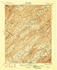
 1890 Christiansburg1890 Print · USGSCovers New Castle, including Blacksburg, Salem, and other nearby areas10 unique versions available
 - 1891 Map of Lewisburg
 1891 Lewisburg1891 Print · USGSCovers New Castle, including Lewisburg, White Sulphur Springs, and other nearby areas8 unique versions available
 - 1929 Map of Salem
 1929 Salem1929 Print · USGSCovers New Castle, including Salem, Skyview, and other nearby areas2 unique versions available
 - 1932 Map of Salem
 1932 Salem1932 Print · USGSCovers New Castle, including Salem, Skyview, and other nearby areas3 unique versions available
 - 1945 Map of New Castle, 1964 Print
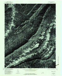
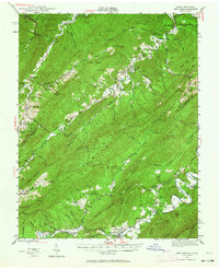 1945 New Castle1964 Print · USGSCovers New Castle, including Crows, Iron Hill Springs, and other nearby areas
 - 1947 Map of New Castle
 1947 New Castle1947 Print · USGSCovers New Castle, including Crows, Iron Hill Springs, and other nearby areas2 unique versions available
 - 1955 Map of Bluefield
 1955 Bluefield1955 Print · USGSCovers New Castle, including Blacksburg, Salem, and other nearby areas
 - 1957 Map of Bluefield, 1967 Print
 1957 Bluefield1967 Print · USGSCovers New Castle, including Blacksburg, Salem, and other nearby areas2 unique versions available
 - 1961 Map of Bluefield
 1961 Bluefield1961 Print · USGSCovers New Castle, including Blacksburg, Salem, and other nearby areas
 - 1963 Map of Catawba, 1965 Print
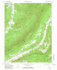 1963 Catawba1965 Print · USGSCovers New Castle, including Catawba, Roanoke Red Sulphur Springs, and other nearby areas4 unique versions available
 - 1966 Map of New Castle, 1967 Print
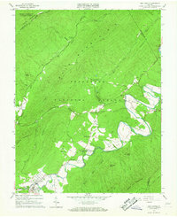 1966 New Castle1967 Print · USGSCovers New Castle, including Virginia Mineral Springs, Marshalltown, and other nearby areas3 unique versions available
 - 1977 Map of Catawba, 1983 Print
 1977 Catawba1983 Print · USGSCovers New Castle, including Catawba, Roanoke Red Sulphur Springs, and other nearby areas
 - 1982 Map of Radford, 1983 Print
 1982 Radford1983 Print · USGSCovers New Castle, including Blacksburg, Salem, and other nearby areas2 unique versions available
 - 1984 Map of Lewisburg, 1985 Print
 1984 Lewisburg1985 Print · USGSCovers New Castle, including Lewisburg, Hinton, and other nearby areas2 unique versions available
End of results
Showing maps 1-15 of 15
Top cities near New Castle
- Salem historical maps
- Hollins historical maps
- Vinton historical maps
- Cloverdale historical maps
- Daleville historical maps
- Fincastle historical maps
See more
Frequently asked questions
- What are the different types of historical maps available for New Castle?
- What is the oldest map of New Castle?
- Where can I purchase historical maps of New Castle for my home or office?
- Where can I download high-res historical maps of New Castle?
- Are there historical topographic maps available for New Castle?
- Is there historical aerial imagery available for New Castle?
- Where are historical maps of New Castle sourced from?