1900s (20th Century) Maps of Village of Culpeper, Culpeper
Explore 6 historic maps of Village of Culpeper from the 1900s (20th Century). These maps offer a rare glimpse into what life looked like during the 1900s — showing old roads, neighborhoods, homes, and landmarks that have changed or disappeared over time.
Whether you're researching your family's past, planning a metal detecting trip, or studying how Village of Culpeper's landscape evolved across the 1900s, these high-resolution maps are a powerful tool for exploring the history of this region.
- Focus on a specific era: All maps on this page are from the 1900s, giving you a focused view of this time period.
- See what’s changed: Compare century-old streets, trails, and buildings to today's modern landscape using overlays and satellite layers.
- Research with precision: Use these maps for genealogy, historical research, land use analysis, or educational projects.
- View, download, or print: Maps are fully viewable online in high resolution, and can be downloaded or printed for your own records.
Start exploring Village of Culpeper's history through authentic maps from the 1900s. This is your window into the past.
Village of Culpeper, Culpeper maps
(6)- 1949 Map of Charlottesville
 1949 Charlottesville1949 Print · USGSThe Shenandoah Valley and Blue Ridge appear in the late 1940s as a thriving corridor of rail and river commerce. Researchers can trace the mid-century footprints of Harrisonburg, Staunton, and Culpeper alongside the historic routes of the Southern Railway.2 unique versions available
 - 1956 Map of Charlottesville, 1966 Print
 1956 Charlottesville1966 Print · USGSThe Shenandoah Valley and Blue Ridge are captured in detail during the mid-1960s as the modern interstate system began to emerge. Genealogists and historians can trace rail-connected hubs like Waynesboro or follow the river paths of the Rapidan River and Rivanna River.4 unique versions available
 - 1961 Map of Rapidan, 1963 Print
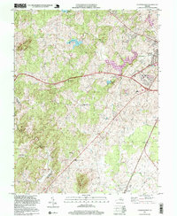
 1961 Rapidan1963 Print · USGSMadison and Culpeper Counties during the early sixties show a transition from a traditional mill-based economy to a modern rural landscape. Genealogists can trace family names at Waylands Mill, Achsah, and Thorofare Mtn Chapel along the Piedmont rivers.2 unique versions available
 - 1971 Map of Culpeper West, 1972 Print
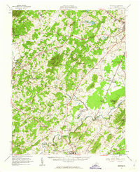
 1971 Culpeper West1972 Print · USGSCulpeper and its western mountain fringes are captured here in the early seventies, showing a landscape defined by traditional rail corridors and rural churches. Genealogists can trace family names at Fairview Cem and find local landmarks like Waylands Mill and the Piedmont Vocational Sch.2 unique versions available
 - 1986 Map of Charlottesville
 1986 Charlottesville1986 Print · USGSCentral Virginia in the mid-eighties shows a landscape balanced between the growing city centers of the Piedmont and the protected ridges of the Blue Ridge. Trace the historic rail lines of the Chesapeake and Ohio Railway or locate local landmarks like Monticello Mountain and Bridgewater College.3 unique versions available
 - 1997 Map of Culpeper West, 1999 Print
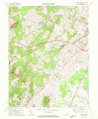
 1997 Culpeper West1999 Print · USGSCulpeper and its western rural surroundings are captured in the late 1990s as the town expanded toward the Piedmont hills. Researchers can trace historic settlements and local landmarks like Waylands Mill, Rising Zion Ch, and the tracks of the Southern railroad.
End of results
Showing maps 1-6 of 6
Frequently asked questions
- What are the different types of historical maps available for Village of Culpeper?
- What is the oldest map of Village of Culpeper?
- Where can I purchase historical maps of Village of Culpeper for my home or office?
- Where can I download high-res historical maps of Village of Culpeper?
- Are there historical topographic maps available for Village of Culpeper?
- Is there historical aerial imagery available for Village of Culpeper?
- Where are historical maps of Village of Culpeper sourced from?