Old Maps of Dumbarton, Virginia for Genealogy
Trace your family roots with 18 historic maps of Dumbarton. These high-res maps reveal old neighborhoods, homesites, landmarks, and streets — helping you uncover where your ancestors lived and how the area evolved over time.
- Explore historic neighborhoods: Identify where your relatives may have lived in the 1800s or 1900s.
- Compare maps over time: Trace the changes in streets, buildings, and landmarks for multi-generational research.
- Perfect for genealogy & ancestry research: Used by family historians and researchers to map out lineage and migration.
These maps are an incredible resource for exploring your personal connection to Dumbarton's past.
Dumbarton, VA maps
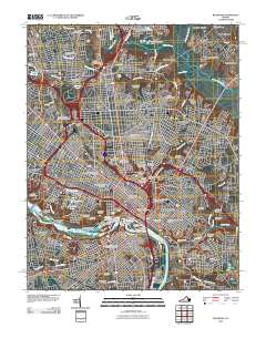
(18)- 1894 Map of Richmond
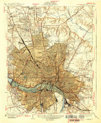
 1894 Richmond1894 Print · USGSThe Richmond area at the close of the nineteenth century reveals a city expanding into its rural surroundings via a complex network of turnpikes and railroads. Genealogists and historians can trace family-named sites like Hawes Shop, Hazelgrove's Store, and Gilman's Mill alongside civil war landmarks at Seven Pines and Old Cold Harbor.
 - 1895 Map of Richmond
 1895 Richmond1895 Print · USGSRichmond and Manchester thrive as bustling riverfront hubs in the 1890s, where rail lines and historic turnpikes converge on the James River. Genealogists and historians can trace family locations near Merry Oaks Church or follow the road to Old Cold Harbor and Seven Pines.5 unique versions available
 - 1934 Map of Richmond
 1934 Richmond1934 Print · USGSRichmond's urban landscape is captured in the mid-1930s, showing a capital city shaped by its riverfront industry and rail network. Researchers can trace the grounds of the State Capitol, find the Broad Street Sta, and locate the Confederate Soldiers Home.2 unique versions available
 - 1939 Map of Richmond
 1939 Richmond1939 Print · USGSRichmond before the war shows a sophisticated urban landscape defined by river power and a complex rail network. Genealogists and historians can locate numerous burial grounds like Hollywood Cemetery or trace the early streetcar path of the Richmond Ashland Electric Ry.2 unique versions available
 - 1943 Map of Richmond, 1972 Print
 1943 Richmond1972 Print · USGSCoastal Virginia and the state capital are shown in detail during the mid-century era of infrastructure expansion. Genealogists and historians can trace the grounds of Richmond Nat Battlefield Park, locate the Yorktown Nat Cem, or follow the many rural routes through Amelia Court House and Tappahannock.
 - 1949 Map of Richmond, 1951 Print
 1949 Richmond1951 Print · USGSCoastal Virginia in the years following World War II remained a landscape of historic river towns and expanding military bases. Genealogists and historians can trace the rail lines of the Southern Ry and locate established landmarks from Camp Lee to the remote reaches of Dragon Swamp.
 - 1956 Map of Richmond, 1959 Print
 1956 Richmond1959 Print · USGSMid-century Richmond is shown just as the new turnpike began to reshape the urban landscape and the historic James River riverfront. Researchers can trace the footprints of Union Theological Seminary, the historic Hollywood Cemetery, and the old Seaboard Air Line Railroad yards.
 - 1959 Map of Richmond
 1959 Richmond1959 Print · USGSMid-century Virginia is captured here at its most vital rail and river junctions, from the capital city to the Chesapeake Bay. Genealogists and historians can trace the development of colonial settlements like Williamsburg and military landmarks including Fort Monroe and Camp Lee.
 - 1964 Map of Richmond
 1964 Richmond1964 Print · USGSCoastal and central Virginia are mapped during the mid-twentieth century, showing the critical intersection of rail, river, and military life. Genealogists can trace family roots through rural county seats like Amelia or find vanished coastal neighborhoods near Phoebus and Hilton Village.
 - 1964 Map of Richmond, 1966 Print
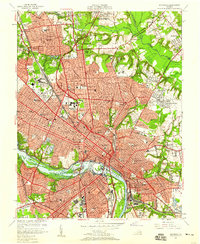
 1964 Richmond1966 Print · USGSRichmond and its riverfront suburbs come alive in the mid-1960s, showing the intersection of historic urban density and new interstate-era development. Genealogists and historians can trace extensive burial grounds like Hollywood Cemetery or visit the campus of Virginia Union University.8 unique versions available
 - 1973 Map of Richmond, 1974 Print
 1973 Richmond1974 Print · USGSThe Virginia Tidewater and Piedmont come alive in the early seventies, showcasing a region defined by its great rivers and massive military installations. Researchers can trace the mid-century growth of Richmond or locate family sites near Amelia Court House and Highland Springs.2 unique versions available
 - 1974 Map of Richmond, 1977 Print
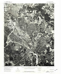 1974 Richmond1977 Print · USGSVirginia's capital city is shown in the mid-seventies through detailed orthophotographic imagery that captures the urban core and expanding suburbs. Local historians and urban researchers can trace the 1974 footprint of Richmond and its dense residential and industrial districts.
 - 1984 Map of Richmond, 1986 Print
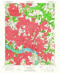
 1984 Richmond1986 Print · USGSCentral Virginia during the mid-eighties shows a landscape of rapid suburban expansion centered on the state capital and its historic riverfront. Genealogists and historians can trace institutional sites like Randolph-Macon College, the grounds of Fort Lee, and small community landmarks like Hebron Ch.3 unique versions available
 - 2010 Map of Richmond, 2010 Print
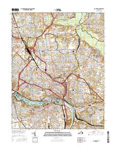
 2010 Richmond2010 Print · USGSCovers Dumbarton, including Richmond, Lakeside, and other nearby areas
 - 2013 Map of Richmond, 2013 Print
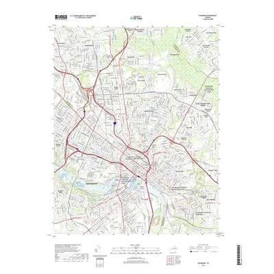
 2013 Richmond2013 Print · USGSCovers Dumbarton, including Richmond, Lakeside, and other nearby areas
 - 2016 Map of Richmond, 2016 Print
 2016 Richmond2016 Print · USGSCovers Dumbarton, including Richmond, Lakeside, and other nearby areas
 - 2019 Map of Richmond, 2019 Print
 2019 Richmond2019 Print · USGSCovers Dumbarton, including Richmond, Lakeside, and other nearby areas
 - 2022 Map of Richmond, 2022 Print
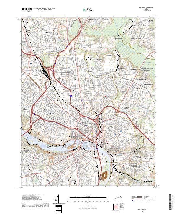 2022 Richmond2022 Print · USGSRichmond at the dawn of the 2020s shows a landscape where high-volume rail infrastructure and modern universities meet historic burial grounds and riverfront islands. Researchers can trace the layout of Hollywood Cem, the vast Acca Yard, and the grounds of Virginia Union University.
End of results
Showing maps 1-18 of 18
Top cities near Dumbarton
- Richmond historical maps
- Tuckahoe historical maps
- Mechanicsville historical maps
- Short Pump historical maps
- Meadowbrook historical maps
- Bon Air historical maps
See more
Frequently asked questions
- What are the different types of historical maps available for Dumbarton?
- What is the oldest map of Dumbarton?
- Where can I purchase historical maps of Dumbarton for my home or office?
- Where can I download high-res historical maps of Dumbarton?
- Are there historical topographic maps available for Dumbarton?
- Is there historical aerial imagery available for Dumbarton?
- Where are historical maps of Dumbarton sourced from?