Old Maps of Yahley Mills Estates, Henrico County for Genealogy
Trace your family roots with 17 historic maps of Yahley Mills Estates. These high-res maps reveal old neighborhoods, homesites, landmarks, and streets — helping you uncover where your ancestors lived and how the area evolved over time.
- Explore historic neighborhoods: Identify where your relatives may have lived in the 1800s or 1900s.
- Compare maps over time: Trace the changes in streets, buildings, and landmarks for multi-generational research.
- Perfect for genealogy & ancestry research: Used by family historians and researchers to map out lineage and migration.
These maps are an incredible resource for exploring your personal connection to Yahley Mills Estates's past.
Yahley Mills Estates, Henrico County maps
(17)- 1894 Map of Bermuda Hundred
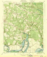
 1894 Bermuda Hundred1894 Print · USGSBermuda Hundred and the James River winding toward the Chesapeake are captured here in the late nineteenth century. Researchers can trace the legacy of the Civil War through Drewry Bluff, Malvern Hill, and the engineering of the Dutch Gap Canal.5 unique versions available
 - 1938 Map of Dutch Gap
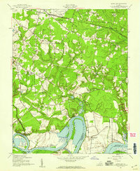
 1938 Dutch Gap1938 Print · USGSHenrico County and the James River loops are seen here in the late thirties, when military breastworks still crisscrossed the rural landscape. Researchers can locate Richmond National Battlefield Park and ancestral sites like Montague Cem and the Union Grove Chapel.
 - 1943 Map of Dutch Gap
 1943 Dutch Gap1943 Print · USGSHenrico County during the early years of the Second World War shows a landscape of historic river plantations and Civil War fortifications. Researchers can locate family landmarks like Aiken House and rural community hubs including Gravel Hill Sch and Fourmile Creek Ch.2 unique versions available
 - 1943 Map of Richmond, 1972 Print
 1943 Richmond1972 Print · USGSCoastal Virginia and the state capital are shown in detail during the mid-century era of infrastructure expansion. Genealogists and historians can trace the grounds of Richmond Nat Battlefield Park, locate the Yorktown Nat Cem, or follow the many rural routes through Amelia Court House and Tappahannock.
 - 1946 Map of Bermuda Hundred
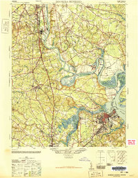 1946 Bermuda Hundred1946 Print · USGSThe James River corridor south of Richmond is shown here just after the war, where industrial hubs like Hopewell meet colonial-era landscapes. Genealogists and historians can trace the foundations of Bermuda Hundred, the grounds of Camp Lee, and landmarks like Shirley or Drewrys Bluff.2 unique versions available
 - 1949 Map of Richmond, 1951 Print
 1949 Richmond1951 Print · USGSCoastal Virginia in the years following World War II remained a landscape of historic river towns and expanding military bases. Genealogists and historians can trace the rail lines of the Southern Ry and locate established landmarks from Camp Lee to the remote reaches of Dragon Swamp.
 - 1952 Map of Dutch Gap, 1959 Print
 1952 Dutch Gap1959 Print · USGSHenrico County in the early fifties remains a landscape of river plantations and Civil War battlements along the James River. Genealogists and historians can trace family sites at Varina Plantation, find Second Bethel Ch, or locate markers within the National Cem and Richmond National Battlefield Park.
 - 1959 Map of Richmond
 1959 Richmond1959 Print · USGSMid-century Virginia is captured here at its most vital rail and river junctions, from the capital city to the Chesapeake Bay. Genealogists and historians can trace the development of colonial settlements like Williamsburg and military landmarks including Fort Monroe and Camp Lee.
 - 1964 Map of Richmond
 1964 Richmond1964 Print · USGSCoastal and central Virginia are mapped during the mid-twentieth century, showing the critical intersection of rail, river, and military life. Genealogists can trace family roots through rural county seats like Amelia or find vanished coastal neighborhoods near Phoebus and Hilton Village.
 - 1969 Map of Dutch Gap, 1971 Print
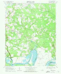 1969 Dutch Gap1971 Print · USGSHenrico County in the late sixties shows a landscape where Civil War earthworks meet the jet age at Byrd Field. Genealogists and historians can locate Curles Neck Plantation, the Washington Memorial Cem, and Fort Harrison.4 unique versions available
 - 1973 Map of Richmond, 1974 Print
 1973 Richmond1974 Print · USGSThe Virginia Tidewater and Piedmont come alive in the early seventies, showcasing a region defined by its great rivers and massive military installations. Researchers can trace the mid-century growth of Richmond or locate family sites near Amelia Court House and Highland Springs.2 unique versions available
 - 1984 Map of Petersburg, 1985 Print
 1984 Petersburg1985 Print · USGSCentral Virginia in the mid-eighties shows a complex landscape of growing suburban centers and significant military installations. Researchers can trace historic boundaries and civic sites from Amelia Court House to the Glendale Nat Cem and Virginia State College.2 unique versions available
 - 2010 Map of Dutch Gap, 2010 Print
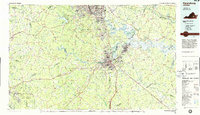
 2010 Dutch Gap2010 Print · USGSCovers Yahley Mills Estates, including Varina, Chesterfield County, and other nearby areas
 - 2013 Map of Dutch Gap, 2013 Print
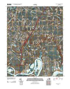
 2013 Dutch Gap2013 Print · USGSCovers Yahley Mills Estates, including Varina, Chesterfield County, and other nearby areas
 - 2016 Map of Dutch Gap, 2016 Print
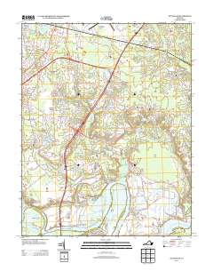
 2016 Dutch Gap2016 Print · USGSCovers Yahley Mills Estates, including Varina, Chesterfield County, and other nearby areas
 - 2019 Map of Dutch Gap, 2019 Print
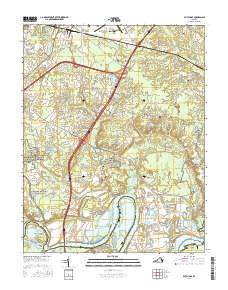
 2019 Dutch Gap2019 Print · USGSCovers Yahley Mills Estates, including Varina, Chesterfield County, and other nearby areas
 - 2022 Map of Dutch Gap, 2022 Print
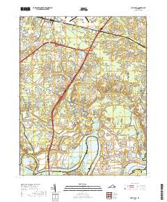
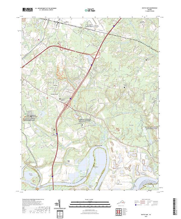 2022 Dutch Gap2022 Print · USGSThe James River peninsula near Richmond is shown here in the early 2020s, dominated by river meanders and major battlefield sites. Genealogists can trace several old burying grounds, including Saint James Cem, James Cem, and the Poplar Springs Cem.
End of results
Showing maps 1-17 of 17
Frequently asked questions
- What are the different types of historical maps available for Yahley Mills Estates?
- What is the oldest map of Yahley Mills Estates?
- Where can I purchase historical maps of Yahley Mills Estates for my home or office?
- Where can I download high-res historical maps of Yahley Mills Estates?
- Are there historical topographic maps available for Yahley Mills Estates?
- Is there historical aerial imagery available for Yahley Mills Estates?
- Where are historical maps of Yahley Mills Estates sourced from?