Old Maps of Patna, Virginia for Genealogy
Trace your family roots with 13 historic maps of Patna. These high-res maps reveal old neighborhoods, homesites, landmarks, and streets — helping you uncover where your ancestors lived and how the area evolved over time.
- Explore historic neighborhoods: Identify where your relatives may have lived in the 1800s or 1900s.
- Compare maps over time: Trace the changes in streets, buildings, and landmarks for multi-generational research.
- Perfect for genealogy & ancestry research: Used by family historians and researchers to map out lineage and migration.
These maps are an incredible resource for exploring your personal connection to Patna's past.
Patna, VA maps
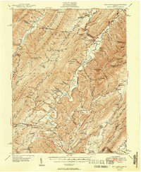
(13)- 1901 Map of Monterey, 1905 Print
 1901 Monterey1905 Print · USGSThe high Allegheny ridges of Highland and Bath Counties are shown at the turn of the century when isolated valley settlements were linked by winding mountain gaps. Genealogists can trace early homesteads and commerce centers like Cleeks Mills, Mountaingrove, and New Hampden.8 unique versions available
 - 1946 Map of Williamsville, 1964 Print
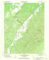
 1946 Williamsville1964 Print · USGSThe mountain valleys of Bath and Highland counties are captured here in the mid-1940s, showing a landscape of forest ridges and river settlements. Genealogists and hikers can locate old landmarks like Lockridge Memorial Ch, the Flood Sch, and the Duncan Knob Lookout Tower.
 - 1949 Map of Charlottesville
 1949 Charlottesville1949 Print · USGSThe Shenandoah Valley and Blue Ridge appear in the late 1940s as a thriving corridor of rail and river commerce. Researchers can trace the mid-century footprints of Harrisonburg, Staunton, and Culpeper alongside the historic routes of the Southern Railway.2 unique versions available
 - 1949 Map of Williamsville
 1949 Williamsville1949 Print · USGSThe ridges and valleys of Bath and Highland Counties come alive in this mid-century survey, documenting a time of remote mountain settlements and forest lookouts. Trace the locations of Starr Chapel, Flood Sch, and the high-elevation Duncan Knob Lookout Tower.2 unique versions available
 - 1956 Map of Charlottesville, 1966 Print
 1956 Charlottesville1966 Print · USGSThe Shenandoah Valley and Blue Ridge are captured in detail during the mid-1960s as the modern interstate system began to emerge. Genealogists and historians can trace rail-connected hubs like Waynesboro or follow the river paths of the Rapidan River and Rivanna River.4 unique versions available
 - 1969 Map of Williamsville, 1971 Print
 1969 Williamsville1971 Print · USGSThe river valleys of Highland and Bath counties appear in the late 1960s as a quiet landscape of mountain gap settlements and forest ridges. Researchers can locate family landmarks and historic congregations like Mt Zion Ch near Flood or the Coursey Springs Fish Hatchery on the river.3 unique versions available
 - 1986 Map of Staunton
 1986 Staunton1986 Print · USGSThe Shenandoah Valley and Allegheny Highlands meet in the mid-1980s, revealing a landscape of historic mountain towns and thermal resorts. Genealogists and historians can trace institutional landmarks like Mary Baldwin College or follow the legacy of the Chesapeake and Ohio Railroad through Craigsville and Swoope.2 unique versions available
 - 1999 Map of Williamsville, 2000 Print
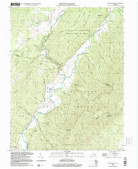 1999 Williamsville2000 Print · USGSThe river valleys of Bath and Highland Counties appear at the close of the twentieth century, centered on the convergence of the Bullpasture River and Cowpasture River. Local history researchers can trace family roots through settlements like Williamsville and Flood, or locate old landmarks including Mt Zion Ch and the Coursey Springs State Fish Hatchery.
 - 2011 Map of Williamsville, 2011 Print
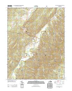
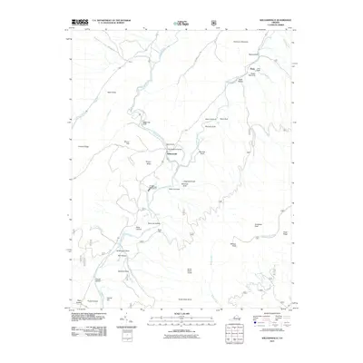 2011 Williamsville2011 Print · USGSCovers Patna, including Fort Lewis, Williamsville, and other nearby areas
 - 2013 Map of Williamsville, 2013 Print
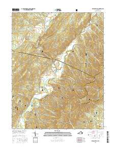
 2013 Williamsville2013 Print · USGSCovers Patna, including Fort Lewis, Williamsville, and other nearby areas
 - 2016 Map of Williamsville, 2016 Print
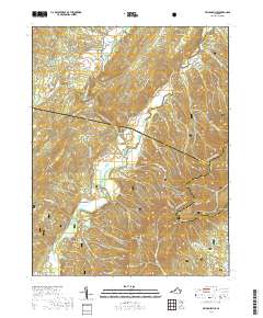
 2016 Williamsville2016 Print · USGSCovers Patna, including Fort Lewis, Williamsville, and other nearby areas
 - 2019 Map of Williamsville, 2019 Print
 2019 Williamsville2019 Print · USGSCovers Patna, including Fort Lewis, Williamsville, and other nearby areas
 - 2022 Map of Williamsville, 2022 Print
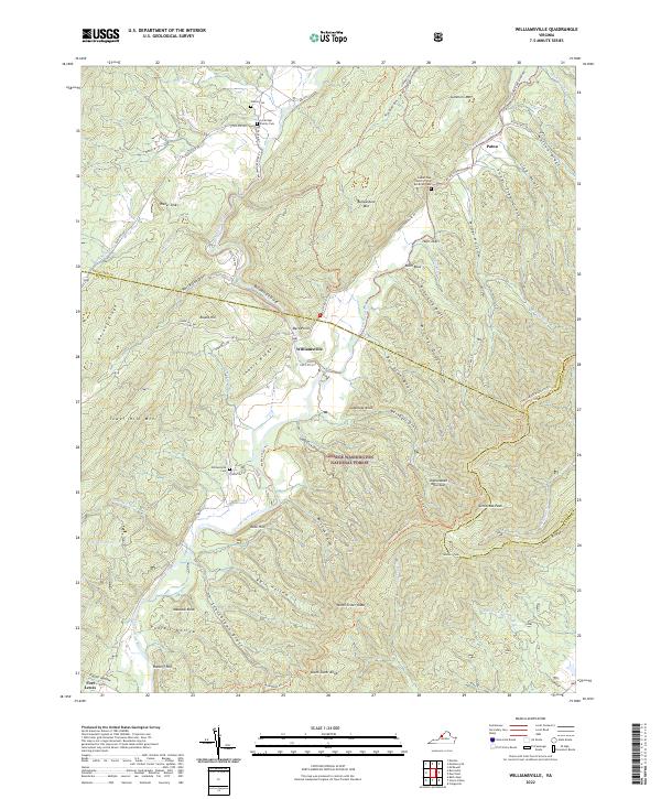 2022 Williamsville2022 Print · USGSBath and Highland Counties at the confluence of the Bullpasture and Cowpasture Rivers are captured here in the early 2020s. Genealogists and hikers can trace family sites at Lockridge Family Cemetery or follow the Shenandoah Mountain Trail through the George Washington National Forest.
End of results
Showing maps 1-13 of 13
Top cities near Patna
Frequently asked questions
- What are the different types of historical maps available for Patna?
- What is the oldest map of Patna?
- Where can I purchase historical maps of Patna for my home or office?
- Where can I download high-res historical maps of Patna?
- Are there historical topographic maps available for Patna?
- Is there historical aerial imagery available for Patna?
- Where are historical maps of Patna sourced from?