Old Maps of Lansdowne on the Potomac, Loudoun County for Hiking & Exploration
Hike through history with 21 historic maps of Lansdowne on the Potomac. Explore old trails, ghost towns, and forgotten backroads — perfect for outdoor adventurers and local explorers.
- Rediscover forgotten places: Map out old mining camps, roads, and footpaths that no longer exist on modern maps.
- Layer with modern tools: Combine with LiDAR or satellite views to plan hikes through historical terrain.
- Made for exploration: Popular among hikers, overlanders, and local history lovers.
Use these maps to find adventure and explore the hidden past of Lansdowne on the Potomac.
Lansdowne on the Potomac, Loudoun County maps
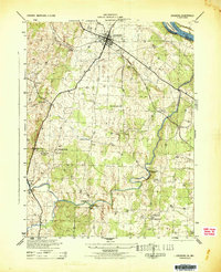
(21)- 1884 Map of Harpers Ferry
 1884 Harpers Ferry1884 Print · USGSCovers Lansdowne on the Potomac, including Leesburg, Martinsburg, and other nearby areas
 - 1891 Map of Harpers Ferry
 1891 Harpers Ferry1891 Print · USGSCovers Lansdowne on the Potomac, including Leesburg, Martinsburg, and other nearby areas
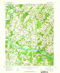
 - 1893 Map of Frederick
 1893 Frederick1893 Print · USGSCovers Lansdowne on the Potomac, including Germantown, Frederick, and other nearby areas
 - 1893 Map of Harpers Ferry, 1898 Print
 1893 Harpers Ferry1898 Print · USGSCovers Lansdowne on the Potomac, including Leesburg, Martinsburg, and other nearby areas7 unique versions available
 - 1894 Map of Frederick
 1894 Frederick1894 Print · USGSCovers Lansdowne on the Potomac, including Germantown, Frederick, and other nearby areas5 unique versions available
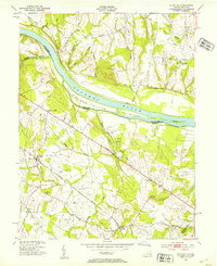
 - 1908 Map of Seneca
 1908 Seneca1908 Print · USGSCovers Lansdowne on the Potomac, including Germantown, Gaithersburg, and other nearby areas7 unique versions available
 - 1944 Map of Leesburg
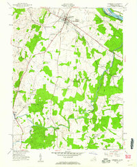
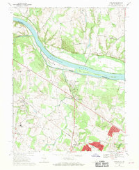
 1944 Leesburg1944 Print · USGSCovers Lansdowne on the Potomac, including Leesburg, Broadlands, and other nearby areas
 - 1944 Map of Seneca, 1963 Print
 1944 Seneca1963 Print · USGSCovers Lansdowne on the Potomac, including Germantown, Gaithersburg, and other nearby areas
 - 1948 Map of Baltimore
 1948 Baltimore1948 Print · USGSCovers Lansdowne on the Potomac, including Baltimore, Columbia, and other nearby areas2 unique versions available
 - 1952 Map of Sterling, 1954 Print
 1952 Sterling1954 Print · USGSCovers Lansdowne on the Potomac, including Ashburn, Sterling, and other nearby areas3 unique versions available
 - 1952 Map of Leesburg, 1960 Print
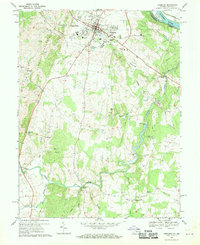
 1952 Leesburg1960 Print · USGSCovers Lansdowne on the Potomac, including Leesburg, Broadlands, and other nearby areas
 - 1954 Map of Baltimore
 1954 Baltimore1954 Print · USGSCovers Lansdowne on the Potomac, including Baltimore, Columbia, and other nearby areas
 - 1956 Map of Baltimore
 1956 Baltimore1956 Print · USGSCovers Lansdowne on the Potomac, including Baltimore, Columbia, and other nearby areas
 - 1957 Map of Baltimore, 1964 Print
 1957 Baltimore1964 Print · USGSCovers Lansdowne on the Potomac, including Baltimore, Columbia, and other nearby areas5 unique versions available
 - 1961 Map of Baltimore
 1961 Baltimore1961 Print · USGSCovers Lansdowne on the Potomac, including Baltimore, Columbia, and other nearby areas
 - 1968 Map of Sterling, 1970 Print
 1968 Sterling1970 Print · USGSCovers Lansdowne on the Potomac, including Ashburn, Sterling, and other nearby areas4 unique versions available
 - 1968 Map of Leesburg, 1970 Print
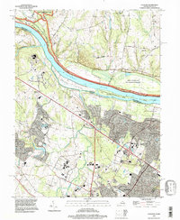
 1968 Leesburg1970 Print · USGSCovers Lansdowne on the Potomac, including Leesburg, Broadlands, and other nearby areas5 unique versions available
 - 1984 Map of Frederick, 1985 Print
 1984 Frederick1985 Print · USGSCovers Lansdowne on the Potomac, including Germantown, Frederick, and other nearby areas
 - 1989 Map of Baltimore
 1989 Baltimore1989 Print · USGSCovers Lansdowne on the Potomac, including Baltimore, Columbia, and other nearby areas
 - 1994 Map of Sterling, 1998 Print
 1994 Sterling1998 Print · USGSCovers Lansdowne on the Potomac, including Ashburn, Sterling, and other nearby areas
 - 1994 Map of Leesburg, 1998 Print
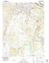 1994 Leesburg1998 Print · USGSCovers Lansdowne on the Potomac, including Leesburg, Broadlands, and other nearby areas
End of results
Showing maps 1-21 of 21
Frequently asked questions
- What are the different types of historical maps available for Lansdowne on the Potomac?
- What is the oldest map of Lansdowne on the Potomac?
- Where can I purchase historical maps of Lansdowne on the Potomac for my home or office?
- Where can I download high-res historical maps of Lansdowne on the Potomac?
- Are there historical topographic maps available for Lansdowne on the Potomac?
- Is there historical aerial imagery available for Lansdowne on the Potomac?
- Where are historical maps of Lansdowne on the Potomac sourced from?