Old Maps of Montgomery County, Virginia
Explore 117 old maps of Montgomery County, spanning from 1889 to today. These high-resolution historic maps reveal how streets, neighborhoods, landmarks, and natural features evolved over time — perfect for genealogy, metal detecting, research, and local history exploration.
What you can do with these maps:
- See how Montgomery County changed over time: Compare historical maps to modern-day views to trace roads, homesites, rail lines & more.
- View detailed metadata: Each map includes creators, publishers, year, scale, and archive source.
- Overlay maps with satellite & LiDAR: Visualize the past alongside modern tools to explore terrain & human change.
- Trusted historical sources: Maps sourced from the USGS, Library of Congress, and other archives.
- Access maps your way: View online, download high-res files, or order prints for personal or research use.
Start exploring old maps of Montgomery County to uncover forgotten places, hidden landmarks, and the deep history beneath your feet.
Montgomery County, VA maps
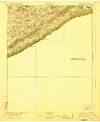
(117)- 1889 Map of Hillsville
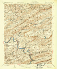
 1889 Hillsville1889 Print · USGSThe Blue Ridge Highlands and the upper New River valley are captured in the late 1880s, showcasing a landscape of iron furnaces and mountain gaps. Trace early industrial sites like Boom Furnace and Lead Mines, or locate ancestral homesteads near Hillsville and Old Town.
 - 1890 Map of Dublin
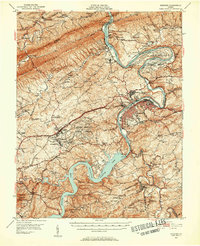
 1890 Dublin1890 Print · USGSThe mountainous borderlands of Virginia and West Virginia are captured here in the late nineteenth century as industry and rail expanded along the New River. Genealogists and historians can trace the foundations of local commerce through sites like Pearisburg, the Belle Hampton Mine, and river crossings at Peppers Ferry.
 - 1890 Map of Christiansburg
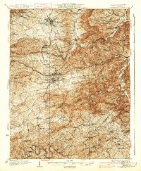
 1890 Christiansburg1890 Print · USGSSouthwestern Virginia in the late nineteenth century centers on the emerging rail and resort economy. Trace the Norfolk and Western Railroad through Christiansburg and find historic resorts like Alleghany Springs.10 unique versions available
 - 1891 Map of Dublin
 1891 Dublin1891 Print · USGSAcross Southwest Virginia and West Virginia in the late nineteenth century, the river and rail lines dictated the pace of mountain life. Genealogists can trace family footprints through numerous river crossings like Ingles Ferry and historic industry sites like Altoona Mines and Mercers Salt Works.9 unique versions available
 - 1892 Map of Hillsville
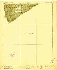
 1892 Hillsville1892 Print · USGSSouthwest Virginia in the late nineteenth century is captured here as a landscape of iron furnaces and river crossings. Genealogists and historians can trace old family mills and ferries like Pedegos Mill, Howards Ferry, and the early settlement at Old Town.
 - 1896 Map of Hillsville
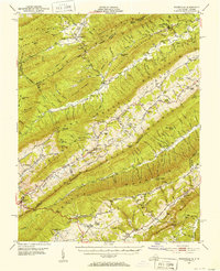
 1896 Hillsville1896 Print · USGSThe Blue Ridge Highlands and New River corridor appear here in the 1890s, when iron furnaces and river ferries dictated the pace of local life. Researchers can trace ancestral locations near Hillsville, the Lead Mines, and historic river crossings like Jackson Ferry.7 unique versions available
 - 1923 Map of Pearisburg
 1923 Pearisburg1923 Print · USGSThe West Virginia and Virginia state line follows the high crest of Peters Mountain in the early 1920s. Genealogists can trace a remarkable concentration of rural education and faith at sites like Oak Hill School and Green Valley Church.3 unique versions available
 - 1923 Map of Waiteville
 1923 Waiteville1923 Print · USGSThe mountain border between West Virginia and Virginia comes to life in the early 1920s, centered on the settlement of Waiteville. Local historians can trace the Norfolk and Western Ry line as it snakes along Potts Cr beneath Peters Mountain.2 unique versions available
 - 1929 Map of Salem
 1929 Salem1929 Print · USGSThe Roanoke River valley and surrounding mountain ridges are captured here in the late 1920s as the railroad and highway networks expanded. Genealogists and researchers can trace local landmarks like Catawba Sanatorium, Webb Mill, and old schoolhouses including Rubles Sch.2 unique versions available
 - 1931 Map of Waiteville
 1931 Waiteville1931 Print · USGSThe Virginia and West Virginia borderlands in the early 1930s reveal a landscape of high ridges and isolated valley settlements. Genealogists can trace family footprints around Newport, Clover Hollow Ch, and the waters of Striking Creek.
 - 1932 Map of Salem
 1932 Salem1932 Print · USGSThe Roanoke Valley and the high ridges of the Blue Ridge meet in this early 1930s survey of the Salem area. Genealogists can locate family landmarks like Webbs Mill, the Catawba Sanatorium, and numerous rural churches including New Hope Church.3 unique versions available
 - 1932 Map of Pearisburg
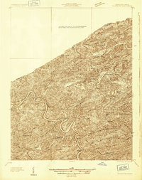 1932 Pearisburg1932 Print · USGSGiles County in the early 1930s is defined by the winding New River and its mountain-bound communities. Genealogists can trace early homesteads and local institutions through Goodwins Ferry, Hoges Store, and several named schools like McGrady Sch.3 unique versions available
 - 1932 Map of Blacksburg
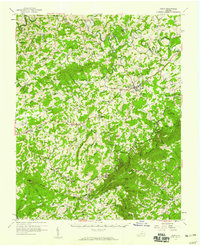
 1932 Blacksburg1932 Print · USGSMontgomery and Floyd Counties are documented here in the early thirties as the regional rail and coal economy thrived. Genealogists can trace family homesteads near landmarks like the Virginia Polytechnic Institute, Merrimac Mines, and Christiansburg Industrial Sch.2 unique versions available
 - 1937 Map of Pearisburg
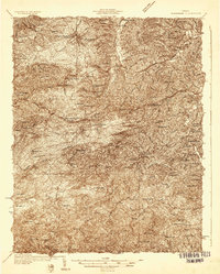
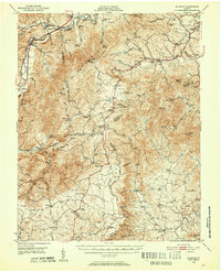
 1937 Pearisburg1937 Print · USGSGiles County at the onset of the late 1930s reveals a rugged mountain landscape where the New River dictates the path of commerce and travel. Genealogists can trace family roots through numerous rural landmarks like Hoges Store, Goodwins Ferry, and the remote McClardy School.3 unique versions available
 - 1937 Map of Blacksburg
 1937 Blacksburg1937 Print · USGSMontgomery County was a hub of higher education, coal mining, and rail transport in the 1930s. Researchers can trace the early grounds of the Virginia Polytechnic Institute and locate numerous rural landmarks like Merrimac Mines, Kanodee Mill, and Yellow Sulphur Springs.3 unique versions available
 - 1944 Map of Waiteville
 1944 Waiteville1944 Print · USGSThe borderlands of Giles and Craig counties are captured here in the early twentieth century, showing a transition from rail-dependent industry to rural isolation. Genealogists and historians can trace family locations near Mt Olivet Ch, the settlement at Waiteville, and the now-silent tracks of the Norfolk and Western Ry.
 - 1950 Map of Elliston, 1952 Print
 1950 Elliston1952 Print · USGSThe Roanoke River headwaters and Blue Ridge highlands are captured here in the early postwar era. Genealogists and historians can trace community roots through numerous country landmarks like Check High Sch, Dillons Mill, and Bend Union Ch.4 unique versions available
 - 1950 Map of Radford, 1952 Print
 1950 Radford1952 Print · USGSThe New River valley and the newly formed Claytor Lake are captured here at the start of the 1950s. Genealogists and historians can locate family-named sites like Goodwins Ferry, Hickman Cem, and schools such as Walton Sch No 1.3 unique versions available
 - 1951 Map of Waiteville, 1953 Print
 1951 Waiteville1953 Print · USGSThe Virginia and West Virginia borderlands are captured here in the early fifties, showing a landscape of high ridges and narrow valley settlements. Researchers can find old community hubs like Blue Healing Springs, Simmonsville, and Slussers Chapel among the mountain hollows.3 unique versions available
 - 1953 Map of Winston-Salem, 1974 Print
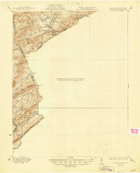
 1953 Winston-Salem1974 Print · USGSThe North Carolina Piedmont and Virginia highlands meet in the mid-1950s, a landscape defined by the tobacco and textile hubs of the Blue Ridge foothills. Researchers can trace the rail-and-river geography connecting Winston-Salem to mountain towns like Mount Airy and Galax.2 unique versions available
 - 1955 Map of Bluefield
 1955 Bluefield1955 Print · USGSThe Central Appalachian borderlands come alive in the mid-fifties, showing the coal and rail networks connecting Bluefield to Beckley. Researchers can trace the industrial landscape of the New River Ordnance Plant and the terrain of Burkes Garden.
 - 1955 Map of Winston-Salem
 1955 Winston-Salem1955 Print · USGSThe Central Blue Ridge and Piedmont transition are captured here in the mid-fifties, from the industrial hub of Winston-Salem to the high peaks of Southwest Virginia. Genealogists can trace family landmarks like Richmond Hill Ch, Siloam Ch, and the old rail stops along the Southern Railway.
 - 1956 Map of Macks Mountain, 1969 Print
 1956 Macks Mountain1969 Print · USGSCarroll and Floyd counties are shown here in the mid-fifties, just as the regional landscape was being reshaped by the waters of Claytor Lake. Genealogists can trace family roots through numerous mountain landmarks like Mabry Crossroads, Indian Valley, and the Dugspur School.
 - 1957 Map of Floyd, 1959 Print
 1957 Floyd1959 Print · USGSFloyd and the surrounding Blue Ridge highlands are captured here in the late fifties as the Blue Ridge Parkway integrated with local backroads. Researchers can locate family landmarks like Mabry Mill, Shelors Mill, and numerous country churches including Dillons Chapel.
 - 1957 Map of Bluefield, 1967 Print
 1957 Bluefield1967 Print · USGSThe heart of Central Appalachia in the mid-fifties is defined by the winding rail lines and river valleys of the coalfields. Researchers can trace the industrial footprints of towns like Welch and Princeton or locate landmarks such as the Bluestone Reservoir and Claytor Lake.2 unique versions available
Showing maps 1-25 of 117
Top cities of Montgomery County
- Blacksburg historical maps
- Christiansburg historical maps
- Merrimac historical maps
- Plum Creek historical maps
- Prices Fork historical maps
- Belview historical maps
See more
Frequently asked questions
- What are the different types of historical maps available for Montgomery County?
- What is the oldest map of Montgomery County?
- Where can I purchase historical maps of Montgomery County for my home or office?
- Where can I download high-res historical maps of Montgomery County?
- Are there historical topographic maps available for Montgomery County?
- Is there historical aerial imagery available for Montgomery County?
- Where are historical maps of Montgomery County sourced from?