Old Maps of Lodebar, Virginia
Explore 15 old maps of Lodebar, spanning from 1892 to today. These high-resolution historic maps reveal how streets, neighborhoods, landmarks, and natural features evolved over time — perfect for genealogy, metal detecting, research, and local history exploration.
What you can do with these maps:
- See how Lodebar changed over time: Compare historical maps to modern-day views to trace roads, homesites, rail lines & more.
- View detailed metadata: Each map includes creators, publishers, year, scale, and archive source.
- Overlay maps with satellite & LiDAR: Visualize the past alongside modern tools to explore terrain & human change.
- Trusted historical sources: Maps sourced from the USGS, Library of Congress, and other archives.
- Access maps your way: View online, download high-res files, or order prints for personal or research use.
Start exploring old maps of Lodebar to uncover forgotten places, hidden landmarks, and the deep history beneath your feet.
Lodebar, VA maps
(15)- 1892 Map of Buckingham
 1892 Buckingham1892 Print · USGSCentral Virginia in the late nineteenth century was defined by its river-and-rail economy along the James River. Genealogists and historians can trace the foundations of local life through the Kleinburg School, the Soap Stone Quarry, and the Virginia Midland Railroad.7 unique versions available
 - 1943 Map of Lovingston, 1961 Print
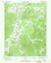
 1943 Lovingston1961 Print · USGSThe Nelson County foothills and Blue Ridge summits are captured in the early 1940s, during a transitional period for Virginia's upland communities. Genealogists and historians can trace family locations near Lovingston or find rural landmarks like Locust Grove Ch, Woods Mill, and the Stage Bridge.2 unique versions available
 - 1946 Map of Lovingston
 1946 Lovingston1946 Print · USGSNelson County and the eastern slopes of the Blue Ridge are captured here in the mid-1940s, just as the regional road network was maturing. Genealogists can locate family landmarks and community hubs like Lovingston, Massies Mill, and the Dutch Creek Sch.2 unique versions available
 - 1947 Map of Roanoke, 1948 Print
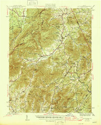
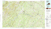
 1947 Roanoke1948 Print · USGSCentral Virginia in the late 1940s reveals a region defined by its great mountain ridges and the powerful river-and-rail economy connecting Roanoke to Lynchburg. Researchers can trace the path of the Virginian RR and locate historic county seats like Charlotte Court House.2 unique versions available
 - 1959 Map of Roanoke
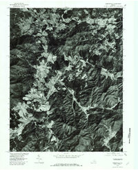
 1959 Roanoke1959 Print · USGSCentral Virginia and the Blue Ridge appear in great detail during the late fifties, showcasing the transition from mountain industry to Piedmont farmland. Trace the path of the Norfolk and Western railroad or find old river towns like Appomattox and Amelia Court House.
 - 1963 Map of Roanoke
 1963 Roanoke1963 Print · USGSCentral Virginia and the Blue Ridge front appear here in the early sixties, caught between their deep railroad roots and new postwar developments. Genealogists and historians can trace the rail lines of the Norfolk and Western through towns like Bedford and Altavista, or locate family landmarks near Smith Mountain Lake.
 - 1967 Map of Greenfield, 1970 Print
 1967 Greenfield1970 Print · USGSThe Rockfish River valley in Nelson and Albemarle counties was a network of small family settlements and country parishes in the late sixties. Genealogists and historians can trace local roots at Hebron Ch, Nellysford, and Durrett Town, or locate old landmarks like Stockton Mill Creek and Tool Gap.3 unique versions available
 - 1971 Map of Roanoke, 1977 Print
 1971 Roanoke1977 Print · USGSThe Virginia Piedmont and Blue Ridge mountains meet in this early 1970s landscape of river valleys and rail hubs. Researchers can trace historic transportation routes and landmarks like the Appomattox Court House Nat Hist Pk, the Peaks of Otter, and Amelia Court House.2 unique versions available
 - 1979 Map of Greenfield, 1982 Print
 1979 Greenfield1982 Print · USGSNelson County's agrarian landscape near Greenfield is captured in the late seventies through detailed aerial imagery. Genealogists and historians can trace property lines and family homesteads near Nelly s Ford, Avon, and the slopes of Pilot Mountain.
 - 1979 Map of Dillwyn, 1982 Print
 1979 Dillwyn1982 Print · USGSCentral Virginia in the late seventies is defined by the winding James River and the rural communities of the Piedmont. Trace old transportation corridors and family-named ridges from Dillwyn and Buckingham to the Blue Ridge foothills.
 - 2011 Map of Greenfield, 2011 Print
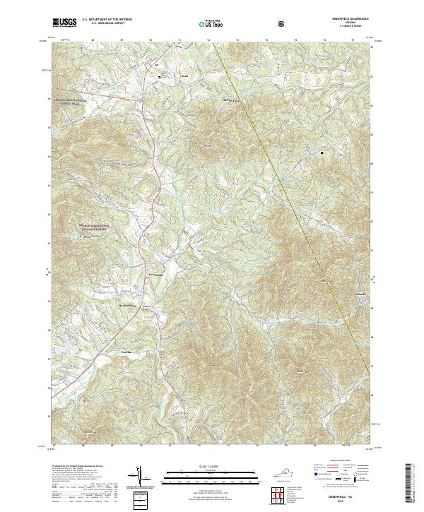
 2011 Greenfield2011 Print · USGSCovers Lodebar, including Nellysford, Avon, and other nearby areas
 - 2013 Map of Greenfield, 2013 Print
 2013 Greenfield2013 Print · USGSCovers Lodebar, including Nellysford, Avon, and other nearby areas
 - 2016 Map of Greenfield, 2016 Print
 2016 Greenfield2016 Print · USGSCovers Lodebar, including Nellysford, Avon, and other nearby areas
 - 2019 Map of Greenfield, 2019 Print
 2019 Greenfield2019 Print · USGSCovers Lodebar, including Nellysford, Avon, and other nearby areas
 - 2022 Map of Greenfield, 2022 Print
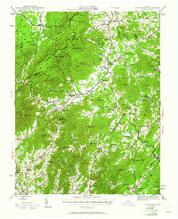
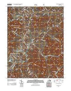
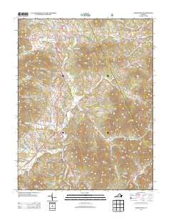
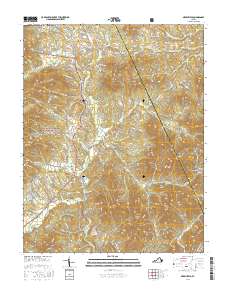
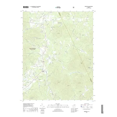
 2022 Greenfield2022 Print · USGSThe foothills of the Blue Ridge are captured here in the early twenty-first century as they span the Nelson and Albemarle county line. Researchers can trace the paths of the Appalachian National Scenic Trail and locate family sites near Hebron Baptist Church Cem, Lodebar, and Martins Store.
End of results
Showing maps 1-15 of 15
Top cities near Lodebar
- Waynesboro historical maps
- Stuarts Draft historical maps
- Crozet historical maps
- Lyndhurst historical maps
- Dooms historical maps
- Nellysford historical maps
See more
Frequently asked questions
- What are the different types of historical maps available for Lodebar?
- What is the oldest map of Lodebar?
- Where can I purchase historical maps of Lodebar for my home or office?
- Where can I download high-res historical maps of Lodebar?
- Are there historical topographic maps available for Lodebar?
- Is there historical aerial imagery available for Lodebar?
- Where are historical maps of Lodebar sourced from?