1900s (20th Century) Maps of Oakland Park, Northampton County
Explore 9 historic maps of Oakland Park from the 1900s (20th Century). These maps offer a rare glimpse into what life looked like during the 1900s — showing old roads, neighborhoods, homes, and landmarks that have changed or disappeared over time.
Whether you're researching your family's past, planning a metal detecting trip, or studying how Oakland Park's landscape evolved across the 1900s, these high-resolution maps are a powerful tool for exploring the history of this region.
- Focus on a specific era: All maps on this page are from the 1900s, giving you a focused view of this time period.
- See what’s changed: Compare century-old streets, trails, and buildings to today's modern landscape using overlays and satellite layers.
- Research with precision: Use these maps for genealogy, historical research, land use analysis, or educational projects.
- View, download, or print: Maps are fully viewable online in high resolution, and can be downloaded or printed for your own records.
Start exploring Oakland Park's history through authentic maps from the 1900s. This is your window into the past.
Oakland Park, Northampton County maps
(9)- 1943 Map of Exmore, 1962 Print
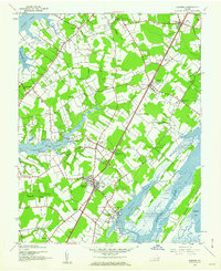 1943 Exmore1962 Print · USGSThe Virginia Eastern Shore is captured here during the 1940s, showing a landscape defined by the PENNSYLVANIA railroad and tidal creeks. Researchers can locate family landmarks like Willis Wharf, Savage Town, and numerous schools including Painter H S.
 - 1944 Map of Exmore
 1944 Exmore1944 Print · USGSCoastal Virginia during the Second World War reveals a landscape of tidal creeks and rail-side hamlets. Researchers can trace the maritime economy through Cedar View Wharf and the Pennsylvania railroad line connecting Exmore and Painter.
 - 1946 Map of Eastville, 1971 Print
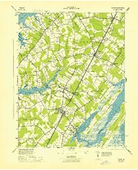
 1946 Eastville1971 Print · USGSCoastal Virginia and the Outer Banks are captured here during a period of expanding naval and aerospace presence. Researchers can trace the path of the Penn Central railroad through Chincoteague and Modest Town, or locate landmarks like the Wright Brothers National Memorial.
 - 1961 Map of Eastville
 1961 Eastville1961 Print · USGSThe Eastern Shore and Outer Banks are captured here in the mid-twentieth century, showing a maritime landscape of lighthouses, rail-linked towns, and naval outposts. Researchers can trace the Pennsylvania Railroad through Parksley or locate historical sites like Chincoteague Field Naval Auxiliary Air Station and Tangier Island.
 - 1966 Map of Eastville
 1966 Eastville1966 Print · USGSThe Delmarva Peninsula and Outer Banks appear in the mid-sixties, showing a landscape of maritime trade, military outposts, and fishing villages. Researchers can trace the lines of the Norfolk & Southern through Exmore and Parksley or locate historical sites like Fort John Custis and the Janes Island Lighthouse.
 - 1968 Map of Exmore, 1972 Print
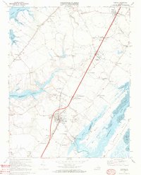 1968 Exmore1972 Print · USGSExmore and the surrounding Eastern Shore communities are caught in a moment of rural transition during the late sixties. Genealogists can locate family landmarks like Belle Haven Cemetery, Willis Wharf, and numerous local pulpits such as Shiloh Ch and St Josephs Ch.4 unique versions available
 - 1977 Map of Exmore, 1982 Print
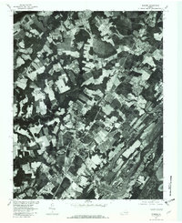 1977 Exmore1982 Print · USGSVirginia's Eastern Shore in the late seventies is revealed through this aerial orthophoto, showcasing the agricultural heart of the peninsula. Researchers can trace the waterfront layouts of Willis Wharf and the inland grid of Exmore alongside Belle Haven.
 - 1981 Map of Chincoteague, 1982 Print
 1981 Chincoteague1982 Print · USGSThe Delmarva Eastern Shore at the start of the eighties shows a unique blend of traditional coastal life and modern aerospace technology. Researchers can trace the Penn Central rail line through rural towns like Modest Town and Bloxom or explore the marshlands of the Saxis Marsh Waterfowl Management Area and Refuge.
 - 1984 Map of Chincoteague
 1984 Chincoteague1984 Print · USGSThe Virginia Eastern Shore and Delmarva Peninsula are captured here in the mid-1980s, showcasing a landscape of barrier islands and tidewater towns. Researchers can trace the Penn Central rail line through Accomac or locate the Wallops Flight Facility (NASA) and Chincoteague Nat Wildlife Refuge.2 unique versions available
End of results
Showing maps 1-9 of 9
Frequently asked questions
- What are the different types of historical maps available for Oakland Park?
- What is the oldest map of Oakland Park?
- Where can I purchase historical maps of Oakland Park for my home or office?
- Where can I download high-res historical maps of Oakland Park?
- Are there historical topographic maps available for Oakland Park?
- Is there historical aerial imagery available for Oakland Park?
- Where are historical maps of Oakland Park sourced from?