Old Maps of Pulaski County, Virginia
Explore 86 old maps of Pulaski County, spanning from 1889 to today. These high-resolution historic maps reveal how streets, neighborhoods, landmarks, and natural features evolved over time — perfect for genealogy, metal detecting, research, and local history exploration.
What you can do with these maps:
- See how Pulaski County changed over time: Compare historical maps to modern-day views to trace roads, homesites, rail lines & more.
- View detailed metadata: Each map includes creators, publishers, year, scale, and archive source.
- Overlay maps with satellite & LiDAR: Visualize the past alongside modern tools to explore terrain & human change.
- Trusted historical sources: Maps sourced from the USGS, Library of Congress, and other archives.
- Access maps your way: View online, download high-res files, or order prints for personal or research use.
Start exploring old maps of Pulaski County to uncover forgotten places, hidden landmarks, and the deep history beneath your feet.
Pulaski County, VA maps
(86)- 1889 Map of Hillsville
 1889 Hillsville1889 Print · USGSThe Blue Ridge Highlands and the upper New River valley are captured in the late 1880s, showcasing a landscape of iron furnaces and mountain gaps. Trace early industrial sites like Boom Furnace and Lead Mines, or locate ancestral homesteads near Hillsville and Old Town.
 - 1890 Map of Dublin
 1890 Dublin1890 Print · USGSThe mountainous borderlands of Virginia and West Virginia are captured here in the late nineteenth century as industry and rail expanded along the New River. Genealogists and historians can trace the foundations of local commerce through sites like Pearisburg, the Belle Hampton Mine, and river crossings at Peppers Ferry.
 - 1891 Map of Dublin
 1891 Dublin1891 Print · USGSAcross Southwest Virginia and West Virginia in the late nineteenth century, the river and rail lines dictated the pace of mountain life. Genealogists can trace family footprints through numerous river crossings like Ingles Ferry and historic industry sites like Altoona Mines and Mercers Salt Works.9 unique versions available
 - 1892 Map of Hillsville
 1892 Hillsville1892 Print · USGSSouthwest Virginia in the late nineteenth century is captured here as a landscape of iron furnaces and river crossings. Genealogists and historians can trace old family mills and ferries like Pedegos Mill, Howards Ferry, and the early settlement at Old Town.
 - 1896 Map of Hillsville
 1896 Hillsville1896 Print · USGSThe Blue Ridge Highlands and New River corridor appear here in the 1890s, when iron furnaces and river ferries dictated the pace of local life. Researchers can trace ancestral locations near Hillsville, the Lead Mines, and historic river crossings like Jackson Ferry.7 unique versions available
 - 1930 Map of Max Meadows
 1930 Max Meadows1930 Print · USGSThe industrial and riverine corridor of Wythe and Carroll counties comes alive in the late 1920s, showcasing a network of mining towns and rail lines. Trace family roots and local history through landmarks like Fort Chiswell, the Boom Furnace, and the ferry crossing at Carter Ferry.3 unique versions available
 - 1934 Map of Pulaski
 1934 Pulaski1934 Print · USGSPulaski and the surrounding Appalachian ridges are captured here during the mid-1930s, showing the intersection of mountain geography and local industry. Researchers can trace rural life through sites like the Stanse Mines, the Brick Church, and several valley schoolhouses including Long Spur Sch.
 - 1940 Map of Pulaski
 1940 Pulaski1940 Print · USGSPulaski and the surrounding Blue Ridge foothills are captured in the mid-1930s as the railroad and timber industries shaped the local economy. Researchers can trace family sites near Shiloh Ch, locate the Stange Mines, or find old schoolhouses like Mill Iron Sch.3 unique versions available
 - 1950 Map of Radford, 1952 Print
 1950 Radford1952 Print · USGSThe New River valley and the newly formed Claytor Lake are captured here at the start of the 1950s. Genealogists and historians can locate family-named sites like Goodwins Ferry, Hickman Cem, and schools such as Walton Sch No 1.3 unique versions available
 - 1953 Map of Winston-Salem, 1974 Print
 1953 Winston-Salem1974 Print · USGSThe North Carolina Piedmont and Virginia highlands meet in the mid-1950s, a landscape defined by the tobacco and textile hubs of the Blue Ridge foothills. Researchers can trace the rail-and-river geography connecting Winston-Salem to mountain towns like Mount Airy and Galax.2 unique versions available
 - 1955 Map of Bluefield
 1955 Bluefield1955 Print · USGSThe Central Appalachian borderlands come alive in the mid-fifties, showing the coal and rail networks connecting Bluefield to Beckley. Researchers can trace the industrial landscape of the New River Ordnance Plant and the terrain of Burkes Garden.
 - 1955 Map of Winston-Salem
 1955 Winston-Salem1955 Print · USGSThe Central Blue Ridge and Piedmont transition are captured here in the mid-fifties, from the industrial hub of Winston-Salem to the high peaks of Southwest Virginia. Genealogists can trace family landmarks like Richmond Hill Ch, Siloam Ch, and the old rail stops along the Southern Railway.
 - 1956 Map of Macks Mountain, 1969 Print
 1956 Macks Mountain1969 Print · USGSCarroll and Floyd counties are shown here in the mid-fifties, just as the regional landscape was being reshaped by the waters of Claytor Lake. Genealogists can trace family roots through numerous mountain landmarks like Mabry Crossroads, Indian Valley, and the Dugspur School.
 - 1957 Map of Bluefield, 1967 Print
 1957 Bluefield1967 Print · USGSThe heart of Central Appalachia in the mid-fifties is defined by the winding rail lines and river valleys of the coalfields. Researchers can trace the industrial footprints of towns like Welch and Princeton or locate landmarks such as the Bluestone Reservoir and Claytor Lake.2 unique versions available
 - 1961 Map of Bluefield
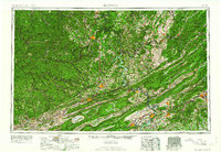 1961 Bluefield1961 Print · USGSThe coalfields and mountain ridges of southern West Virginia and southwest Virginia are captured in the early sixties. Genealogists can trace family ties through rail-linked towns like Princeton and Richlands or along the shores of Bluestone Reservoir.
 - 1962 Map of Winston-Salem
 1962 Winston-Salem1962 Print · USGSThe North Carolina Piedmont meets the Virginia highlands in the early sixties, showing the rail corridors and mountain gaps of the southern Appalachians. Researchers can trace the Blue Ridge Parkway or locate family sites near Winston-Salem, Mount Airy, and Hanging Rock Mountain.
 - 1965 Map of Staffordsville, 1966 Print
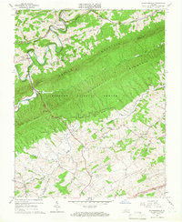 1965 Staffordsville1966 Print · USGSThe border of Giles and Pulaski counties comes into focus in the mid-1960s as the ridges of Walker Mountain meet the valley floor. Genealogists can locate family-named sites like Anderson-Vickers Cem, the Shannon-King Sch, and the riverside settlement of Staffordsville.3 unique versions available
 - 1965 Map of Radford North, 1966 Print
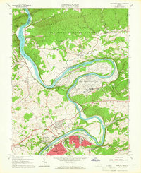 1965 Radford North1966 Print · USGSRadford and the surrounding New River valley are seen here in the mid-sixties, dominated by a mix of military industry and university life. Genealogists and historians can trace local landmarks like Morgans Chapel, the Radford Army Ammunition Plant, and several old mining sites on Brush Mountain.4 unique versions available
 - 1965 Map of Radford South, 1966 Print
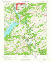 1965 Radford South1966 Print · USGSPulaski and Montgomery counties are captured in the mid-1960s as the New River valley balances industrial growth with rural tradition. Genealogists can trace family names through landmarks like Snowville, Simpkinstown, and schools like Bethel Sch.5 unique versions available
 - 1965 Map of Dublin, 1966 Print
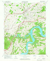 1965 Dublin1966 Print · USGSPulaski County's landscape in the mid-sixties centers on the growing hub of Dublin and the sprawling waters of the New River. Researchers can trace old family sites and rural landmarks like New Dublin Ch, Shiloh, and Highland Memory Gardens.5 unique versions available
 - 1965 Map of Long Spur, 1967 Print
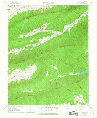 1965 Long Spur1967 Print · USGSThe mountain valleys of Wythe and Pulaski counties are captured here in the mid-1960s as rural life persisted along the ridges. Genealogists and hikers can trace the Appalachian Trail across Walker Mountain or locate the old Spur Branch Sch and Davis Ch near Long Spur.3 unique versions available
 - 1965 Map of White Gate, 1967 Print
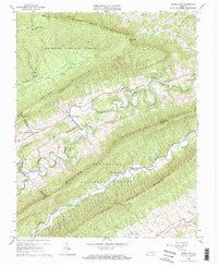 1965 White Gate1967 Print · USGSGiles and Bland counties are captured in the mid-sixties, showing a landscape of deep ridges and the winding Walker Creek. Genealogists and hikers can trace the Appalachian Trail, locate the Bland State Correctional Farm, or find rural churches like Walkers Creek Ch.2 unique versions available
 - 1965 Map of Pulaski, 1967 Print
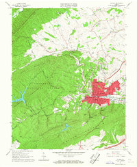 1965 Pulaski1967 Print · USGSPulaski was a thriving rail and mountain hub during the mid-sixties, situated at the edge of the Jefferson National Forest. Researchers can trace the town's growth through landmarks like Calfee Park, the Empire Mine, and the Norfolk and Western rail network.4 unique versions available
 - 1965 Map of Fosters Falls, 1967 Print
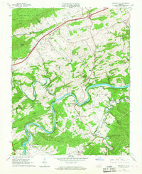 1965 Fosters Falls1967 Print · USGSThe New River valley at the mid-century mark reveals a landscape defined by the Norfolk and Western railroad and the iron-industry legacy of Fosters Falls. Genealogists and industrial historians can trace rural life through landmarks like Boom Furnace, Oglesby Cem, and High Rocks Mill.3 unique versions available
 - 1965 Map of Mechanicsburg, 1967 Print
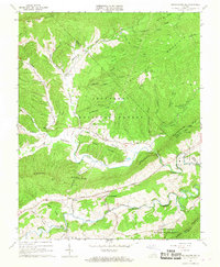 1965 Mechanicsburg1967 Print · USGSBland County, Virginia, is shown in the mid-1960s as a landscape of valley farming and high forest ridges. Researchers can trace rural life through landmarks like Byrns Chapel, the Appalachian Trail corridor, and the State Correctional Farm.2 unique versions available
Showing maps 1-25 of 86
Top cities of Pulaski County
- Pulaski historical maps
- Dublin historical maps
- Fairlawn historical maps
- Parrott historical maps
- Draper historical maps
- New River historical maps
See more
Frequently asked questions
- What are the different types of historical maps available for Pulaski County?
- What is the oldest map of Pulaski County?
- Where can I purchase historical maps of Pulaski County for my home or office?
- Where can I download high-res historical maps of Pulaski County?
- Are there historical topographic maps available for Pulaski County?
- Is there historical aerial imagery available for Pulaski County?
- Where are historical maps of Pulaski County sourced from?