Old Maps of Glen Forest, Roanoke County for Genealogy
Trace your family roots with 14 historic maps of Glen Forest. These high-res maps reveal old neighborhoods, homesites, landmarks, and streets — helping you uncover where your ancestors lived and how the area evolved over time.
- Explore historic neighborhoods: Identify where your relatives may have lived in the 1800s or 1900s.
- Compare maps over time: Trace the changes in streets, buildings, and landmarks for multi-generational research.
- Perfect for genealogy & ancestry research: Used by family historians and researchers to map out lineage and migration.
These maps are an incredible resource for exploring your personal connection to Glen Forest's past.
Glen Forest, Roanoke County maps
(14)- 1890 Map of Christiansburg
 1890 Christiansburg1890 Print · USGSSouthwestern Virginia in the late nineteenth century centers on the emerging rail and resort economy. Trace the Norfolk and Western Railroad through Christiansburg and find historic resorts like Alleghany Springs.10 unique versions available
 - 1929 Map of Salem
 1929 Salem1929 Print · USGSThe Roanoke River valley and surrounding mountain ridges are captured here in the late 1920s as the railroad and highway networks expanded. Genealogists and researchers can trace local landmarks like Catawba Sanatorium, Webb Mill, and old schoolhouses including Rubles Sch.2 unique versions available
 - 1932 Map of Salem
 1932 Salem1932 Print · USGSThe Roanoke Valley and the high ridges of the Blue Ridge meet in this early 1930s survey of the Salem area. Genealogists can locate family landmarks like Webbs Mill, the Catawba Sanatorium, and numerous rural churches including New Hope Church.3 unique versions available
 - 1955 Map of Bluefield
 1955 Bluefield1955 Print · USGSThe Central Appalachian borderlands come alive in the mid-fifties, showing the coal and rail networks connecting Bluefield to Beckley. Researchers can trace the industrial landscape of the New River Ordnance Plant and the terrain of Burkes Garden.
 - 1957 Map of Bluefield, 1967 Print
 1957 Bluefield1967 Print · USGSThe heart of Central Appalachia in the mid-fifties is defined by the winding rail lines and river valleys of the coalfields. Researchers can trace the industrial footprints of towns like Welch and Princeton or locate landmarks such as the Bluestone Reservoir and Claytor Lake.2 unique versions available
 - 1961 Map of Bluefield
 1961 Bluefield1961 Print · USGSThe coalfields and mountain ridges of southern West Virginia and southwest Virginia are captured in the early sixties. Genealogists can trace family ties through rail-linked towns like Princeton and Richlands or along the shores of Bluestone Reservoir.
 - 1963 Map of Glenvar, 1965 Print
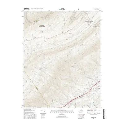
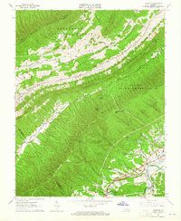 1963 Glenvar1965 Print · USGSRoanoke County in the mid-1960s shows a landscape of steep ridges and river-valley transport. Genealogists and hikers can trace the original Appalachian Trail path and locate family sites like Beard Cem, Shiloh Ch, and the settlement of Bradshaw.4 unique versions available
 - 1977 Map of Glenvar, 1983 Print
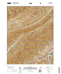
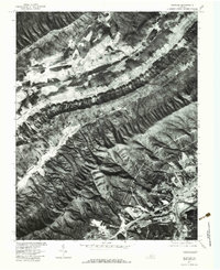 1977 Glenvar1983 Print · USGSRoanoke County in the late seventies is shown here through high-altitude aerial photography, capturing the valley's development and natural borders. Local historians can trace family lands near Glenvar or follow the paths of Catawba Creek and Bradshaw Creek.
 - 1982 Map of Radford, 1983 Print
 1982 Radford1983 Print · USGSThe New River Valley and surrounding highlands are shown during a period of significant regional growth in the early eighties. Genealogists and historians can trace the development of VPI, locate historic sites like Yellow Sulphur Springs, and follow the Norfolk and Western rail lines through the gaps.2 unique versions available
 - 2011 Map of Glenvar, 2011 Print
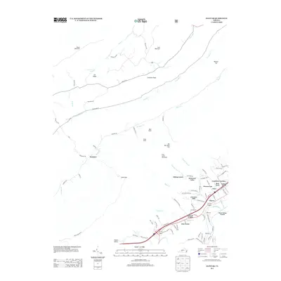
 2011 Glenvar2011 Print · USGSCovers Glen Forest, including Jones, Bear Rock, and other nearby areas
 - 2013 Map of Glenvar, 2013 Print
 2013 Glenvar2013 Print · USGSCovers Glen Forest, including Jones, Bear Rock, and other nearby areas
 - 2016 Map of Glenvar, 2016 Print
 2016 Glenvar2016 Print · USGSCovers Glen Forest, including Jones, Bear Rock, and other nearby areas
 - 2019 Map of Glenvar, 2019 Print
 2019 Glenvar2019 Print · USGSCovers Glen Forest, including Jones, Bear Rock, and other nearby areas
 - 2022 Map of Glenvar, 2022 Print
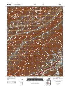
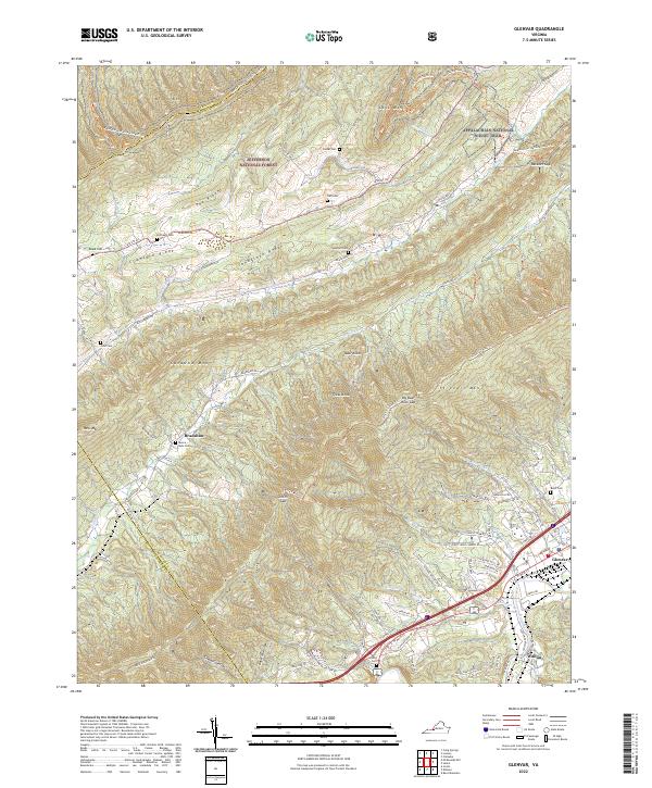 2022 Glenvar2022 Print · USGSThe Roanoke River valley and Jefferson National Forest meet in this 2020s survey of the Virginia highlands. Genealogists and hikers can trace numerous family burial sites like Custer Cem and Moore - Bain Cem or follow the Appalachian National Scenic Trail.
End of results
Showing maps 1-14 of 14
Frequently asked questions
- What are the different types of historical maps available for Glen Forest?
- What is the oldest map of Glen Forest?
- Where can I purchase historical maps of Glen Forest for my home or office?
- Where can I download high-res historical maps of Glen Forest?
- Are there historical topographic maps available for Glen Forest?
- Is there historical aerial imagery available for Glen Forest?
- Where are historical maps of Glen Forest sourced from?