Old Maps of Peales Crossroads, Virginia for Genealogy
Trace your family roots with 14 historic maps of Peales Crossroads. These high-res maps reveal old neighborhoods, homesites, landmarks, and streets — helping you uncover where your ancestors lived and how the area evolved over time.
- Explore historic neighborhoods: Identify where your relatives may have lived in the 1800s or 1900s.
- Compare maps over time: Trace the changes in streets, buildings, and landmarks for multi-generational research.
- Perfect for genealogy & ancestry research: Used by family historians and researchers to map out lineage and migration.
These maps are an incredible resource for exploring your personal connection to Peales Crossroads's past.
Peales Crossroads, VA maps
(14)- 1892 Map of Harrisonburg, 1901 Print
 1892 Harrisonburg1901 Print · USGSThe Shenandoah Valley during the 1890s reveals a landscape of thriving springs, mills, and emerging industry across Rockingham and Albemarle counties. Genealogists can trace family locations through sites like Meyerhoffer's Store, the Crimora Mine, and the University of Virginia Observatory.6 unique versions available
 - 1941 Map of Harrisonburg, 1965 Print
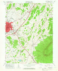
 1941 Harrisonburg1965 Print · USGSHarrisonburg and the surrounding Rockingham County countryside are shown here in the early 1940s, a landscape shaped by rail, river, and regional history. Genealogists can trace family roots through landmarks like Weyers Cave, St Michaels Ch, and the Civilian Public Service Camp No 8.
 - 1943 Map of Harrisonburg
 1943 Harrisonburg1943 Print · USGSMid-century Rockingham County centers on the growing college town of Harrisonburg as the surrounding valley thrives on a mix of agriculture and rail commerce. Genealogists can trace family names through dozens of rural landmarks like Weyers Cave, Bridgewater College, and Melanchthon Chapel.
 - 1949 Map of Charlottesville
 1949 Charlottesville1949 Print · USGSThe Shenandoah Valley and Blue Ridge appear in the late 1940s as a thriving corridor of rail and river commerce. Researchers can trace the mid-century footprints of Harrisonburg, Staunton, and Culpeper alongside the historic routes of the Southern Railway.2 unique versions available
 - 1956 Map of Charlottesville, 1966 Print
 1956 Charlottesville1966 Print · USGSThe Shenandoah Valley and Blue Ridge are captured in detail during the mid-1960s as the modern interstate system began to emerge. Genealogists and historians can trace rail-connected hubs like Waynesboro or follow the river paths of the Rapidan River and Rivanna River.4 unique versions available
 - 1964 Map of Harrisonburg, 1966 Print
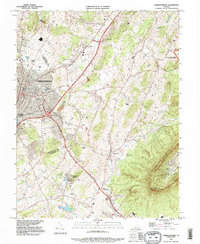
 1964 Harrisonburg1966 Print · USGSThe Harrisonburg area at the height of the mid-sixties shows a growing city and college town meeting the Shenandoah Valley floor. Genealogists and researchers can trace local roots through the Lucy F Simms Sch, Hebrew Cem, and rural crossroads like Penn Laird.5 unique versions available
 - 1986 Map of Charlottesville
 1986 Charlottesville1986 Print · USGSCentral Virginia in the mid-eighties shows a landscape balanced between the growing city centers of the Piedmont and the protected ridges of the Blue Ridge. Trace the historic rail lines of the Chesapeake and Ohio Railway or locate local landmarks like Monticello Mountain and Bridgewater College.3 unique versions available
 - 1989 Map of Harrisonburg, 1995 Print
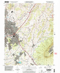
 1989 Harrisonburg1995 Print · USGSHarrisonburg and the central Shenandoah Valley appear here in the late twentieth century, showing the urban expansion of the city alongside its agricultural roots. Researchers can trace historic sites like the Ashby Monument, Massanutten Caverns, and rural settlements including Keezletown.
 - 2002 Map of Harrisonburg, 2004 Print
 2002 Harrisonburg2004 Print · USGSHarrisonburg and the Shenandoah Valley are shown in detail at the turn of the millennium as the city expanded toward the mountains. Researchers can trace local heritage through sites like Massanetta Springs, the Ashby Monument, and Keezletown.
 - 2011 Map of Harrisonburg, 2011 Print
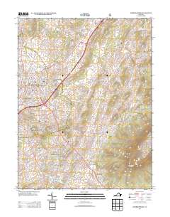
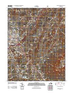 2011 Harrisonburg2011 Print · USGSCovers Peales Crossroads, including Harrisonburg, Massanetta Springs, and other nearby areas
 - 2013 Map of Harrisonburg, 2013 Print
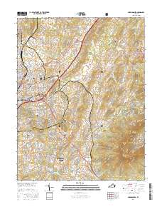
 2013 Harrisonburg2013 Print · USGSCovers Peales Crossroads, including Harrisonburg, Massanetta Springs, and other nearby areas
 - 2016 Map of Harrisonburg, 2016 Print
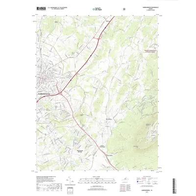
 2016 Harrisonburg2016 Print · USGSCovers Peales Crossroads, including Harrisonburg, Massanetta Springs, and other nearby areas
 - 2019 Map of Harrisonburg, 2019 Print
 2019 Harrisonburg2019 Print · USGSCovers Peales Crossroads, including Harrisonburg, Massanetta Springs, and other nearby areas
 - 2022 Map of Harrisonburg, 2022 Print
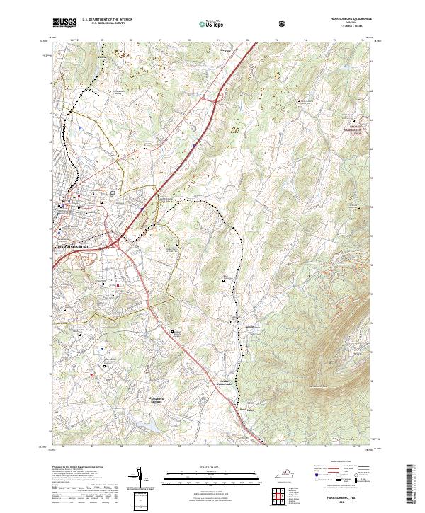 2022 Harrisonburg2022 Print · USGSHarrisonburg and the central Shenandoah Valley appear here in a contemporary 2022 survey. Genealogists can trace local roots through numerous family sites like Brock Family Cem and the historic community of Keezletown.
End of results
Showing maps 1-14 of 14
Top cities near Peales Crossroads
- Harrisonburg historical maps
- Massanetta Springs historical maps
- Bridgewater historical maps
- Verona historical maps
- Broadway historical maps
- Weyers Cave historical maps
See more
Frequently asked questions
- What are the different types of historical maps available for Peales Crossroads?
- What is the oldest map of Peales Crossroads?
- Where can I purchase historical maps of Peales Crossroads for my home or office?
- Where can I download high-res historical maps of Peales Crossroads?
- Are there historical topographic maps available for Peales Crossroads?
- Is there historical aerial imagery available for Peales Crossroads?
- Where are historical maps of Peales Crossroads sourced from?