Old Maps of England Run, Stafford County for Hiking & Exploration
Hike through history with 16 historic maps of England Run. Explore old trails, ghost towns, and forgotten backroads — perfect for outdoor adventurers and local explorers.
- Rediscover forgotten places: Map out old mining camps, roads, and footpaths that no longer exist on modern maps.
- Layer with modern tools: Combine with LiDAR or satellite views to plan hikes through historical terrain.
- Made for exploration: Popular among hikers, overlanders, and local history lovers.
Use these maps to find adventure and explore the hidden past of England Run.
England Run, Stafford County maps
(16)- 1887 Map of Spottsylvania
 1887 Spottsylvania1887 Print · USGSCentral Virginia in the late 1880s remains a landscape of river fords and crossroads shops before modern development. Genealogists and historians can trace the locations of the Vaucluse Gold Mine, Wilderness Tavern, and the path of the Narrow Gauge Railroad.
 - 1892 Map of Spottsylvania
 1892 Spottsylvania1892 Print · USGSCentral Virginia’s post-war landscape is captured here in the late nineteenth century, showing a rural economy defined by gold mining and river crossings. Genealogists can trace family footprints at Todds Tavern, the Vaucluse Gold Mine, and along the Narrow Gauge Railroad.6 unique versions available
 - 1943 Map of Salem Church, 1961 Print
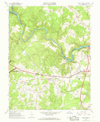
 1943 Salem Church1961 Print · USGSCentral Virginia during the mid-forties reveals a rural landscape of family-named runs and hilltop parishes. Genealogists and historians can trace local life through markers like Chancellor Sch, Zoan Ch, and the crossroads at Holly Corner.
 - 1944 Map of Salem Church
 1944 Salem Church1944 Print · USGSSpotsylvania and Stafford Counties were still primarily rural landscapes of crossroads and small farms during the mid-1940s. Genealogists can trace family roots through specific landmarks like Spring Knoll Farm or local institutions such as Diggs School and Zoan Church.
 - 1948 Map of Washington
 1948 Washington1948 Print · USGSThe Potomac and Chesapeake regions in the late 1940s reveal a landscape of expanding military reach and deep-rooted Tidewater settlements. Trace old rail corridors like the Richmond Fredericksburg & Potomac RR or locate landmarks like the Wakefield Washington Monument and St. Marys College.2 unique versions available
 - 1957 Map of Washington, 1966 Print
 1957 Washington1966 Print · USGSThe mid-Atlantic region during the mid-fifties and early sixties reveals a landscape of growing suburbs and vital military outposts. Researchers can trace historic river towns and shorelines from Alexandria to the Hooper Islands and St Clements Island.5 unique versions available
 - 1961 Map of Washington
 1961 Washington1961 Print · USGSThe mid-Atlantic region in the late fifties is presented in remarkable detail, from the Blue Ridge foothills to the Chesapeake Eastern Shore. Researchers can trace historic river landings and military sites like Mount Vernon, Fort Belvoir, and Point Lookout.2 unique versions available
 - 1966 Map of Salem Church, 1968 Print
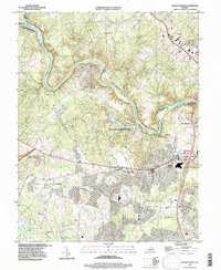
 1966 Salem Church1968 Print · USGSSpotsylvania County is captured in the mid-1960s as suburban growth began to meet its deep Civil War history. Researchers can trace rural church locations like Zoan Ch, find the Spotswood Furnace Ruins, and map the extent of Fivemile Fork.5 unique versions available
 - 1983 Map of Fredericksburg, 1984 Print
 1983 Fredericksburg1984 Print · USGSThe Virginia and Maryland tidewater region comes into sharp focus during the early 1980s, centered on the historic Rappahannock and Potomac river valleys. Researchers can trace the boundaries of the Fredericksburg-Spotsylvania National Military Park alongside growing residential areas and military sites like Fort A.P. Hill Military Reservation.2 unique versions available
 - 1989 Map of Washington
 1989 Washington1989 Print · USGSThe Potomac River valley and Chesapeake Bay are shown in comprehensive detail during the late 1980s. Genealogists and historians can trace the transition from urban Alexandria to the rural Northern Neck, locating landmarks like Mount Vernon and Stratford Hall.
 - 1994 Map of Salem Church, 1997 Print
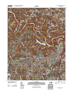
 1994 Salem Church1997 Print · USGSSpotsylvania County in the mid-1990s reveals a unique intersection of Civil War preservation and modern suburban growth. Genealogists and historians can trace old road networks like Plank Road through crossroads at Chancellor and Fivemile Fork.
 - 2011 Map of Salem Church, 2011 Print
 2011 Salem Church2011 Print · USGSCovers England Run, including Spotsylvania County, Culpeper County, and other nearby areas
 - 2013 Map of Salem Church, 2013 Print
 2013 Salem Church2013 Print · USGSCovers England Run, including Spotsylvania County, Culpeper County, and other nearby areas
 - 2016 Map of Salem Church, 2016 Print
 2016 Salem Church2016 Print · USGSCovers England Run, including Spotsylvania County, Culpeper County, and other nearby areas
 - 2019 Map of Salem Church, 2019 Print
 2019 Salem Church2019 Print · USGSCovers England Run, including Spotsylvania County, Culpeper County, and other nearby areas
 - 2022 Map of Salem Church, 2022 Print
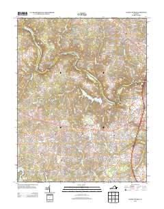
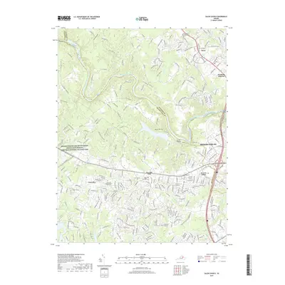
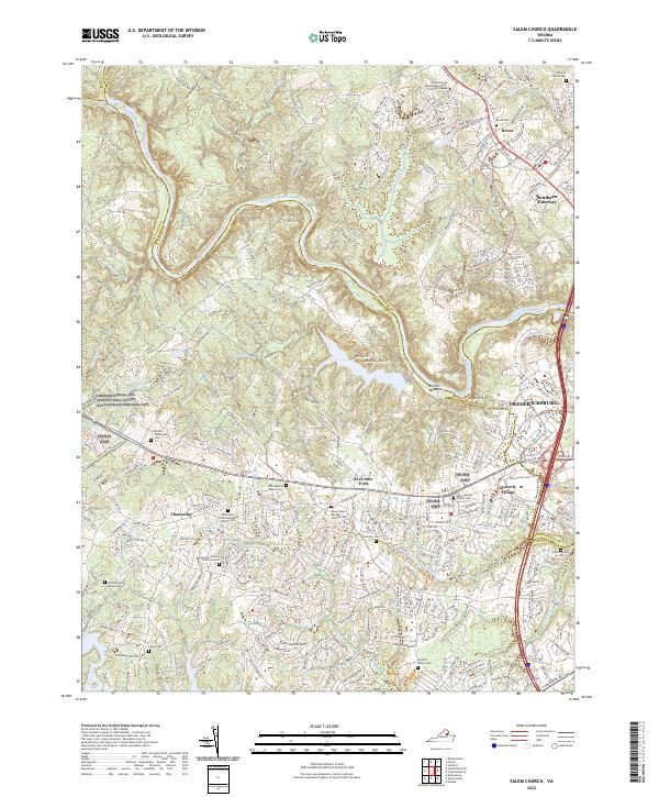 2022 Salem Church2022 Print · USGSThe Rappahannock River corridor west of Fredericksburg is captured here in its contemporary state, where battlefield preservation meets suburban growth. Researchers can locate numerous family burial grounds and historic churchyards like Zoan Baptist Church Cem and the Hildrup Family Burial Ground.
End of results
Showing maps 1-16 of 16
Frequently asked questions
- What are the different types of historical maps available for England Run?
- What is the oldest map of England Run?
- Where can I purchase historical maps of England Run for my home or office?
- Where can I download high-res historical maps of England Run?
- Are there historical topographic maps available for England Run?
- Is there historical aerial imagery available for England Run?
- Where are historical maps of England Run sourced from?