Old Maps of Pound, Virginia
Explore 28 old maps of Pound, spanning from 1890 to today. These high-resolution historic maps reveal how streets, neighborhoods, landmarks, and natural features evolved over time — perfect for genealogy, metal detecting, research, and local history exploration.
What you can do with these maps:
- See how Pound changed over time: Compare historical maps to modern-day views to trace roads, homesites, rail lines & more.
- View detailed metadata: Each map includes creators, publishers, year, scale, and archive source.
- Overlay maps with satellite & LiDAR: Visualize the past alongside modern tools to explore terrain & human change.
- Trusted historical sources: Maps sourced from the USGS, Library of Congress, and other archives.
- Access maps your way: View online, download high-res files, or order prints for personal or research use.
Start exploring old maps of Pound to uncover forgotten places, hidden landmarks, and the deep history beneath your feet.
Pound, VA maps
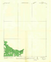
(28)- 1890 Map of Whitesburg
 1890 Whitesburg1890 Print · USGSThe Cumberland Plateau in the 1880s is a world of deep hollows and isolated mountain settlements. Genealogists can trace family roots in early communities like Whitesburgh and Pikeville or locate crossings at Pound Gap and Shelby Gap.
 - 1892 Map of Whitesburg
 1892 Whitesburg1892 Print · USGSEastern Kentucky and the Virginia borderlands appear here in the late nineteenth century as a landscape of isolated mountain hollows. Genealogists and historians can trace early family settlements along Kingdom Come Creek, Beef Hide, and the strategic passage at Pound Gap.4 unique versions available
 - 1912 Map of Pound
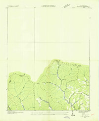
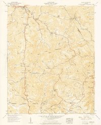
 1912 Pound1912 Print · USGSThe borderlands of Wise County and Kentucky are captured in the early twentieth century before the coal industry fully reshaped the mountain hollows. Researchers can trace ancestral locations of schools and gaps, such as Upper Millstone School, Pound Gap, and the settlement of Jenkins.2 unique versions available
 - 1914 Map of Pound
 1914 Pound1914 Print · USGSThe Central Appalachian coal country comes alive in this survey of the Kentucky and Virginia borderlands during a period of rapid industrial growth. Genealogists can trace family roots through dozens of rural schools like Phipps School and Donald School, or follow the early path of the Lexington and Eastern RR.4 unique versions available
 - 1935 Map of Indian Gap
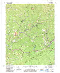
 1935 Indian Gap1935 Print · USGSWise County is shown during a period of coal-driven growth in the mid-1930s. Researchers can trace the industrial landscape of Clinchfield Coal No 14 and the local community around Glamorgan, Vickers, and the Gilliam Sch.
 - 1935 Map of Flat Gap
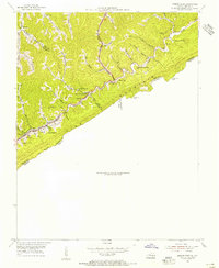
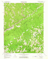
 1935 Flat Gap1935 Print · USGSThe high ridges of the Appalachians meet at the Virginia and Kentucky border during the mid-1930s. Genealogists and local historians can trace family land via Steve Horn Branch, locate the Hunsucker Sch, or follow the old Powell Mc Corkle Lumber Company Tramway.
 - 1954 Map of Jenkins East, 1955 Print
 1954 Jenkins East1955 Print · USGSThe Kentucky and Virginia coalfields hummed with industry in the 1950s as the rail lines reached deep into the mountain hollows. Researchers can trace the layout of mining towns like Burdine and East Jenkins or locate rural landmarks like Marshall Branch Ch.
 - 1954 Map of Jenkins West, 1956 Print
 1954 Jenkins West1956 Print · USGSThe coal-country branch lines and mountain hollows of Letcher County are shown here in the mid-1950s. Researchers can trace family sites from Tolliver Town to Cromona, alongside early industrial landmarks like the Drive-in Theater and Fishpond Lake.3 unique versions available
 - 1955 Map of Flat Gap, 1956 Print
 1955 Flat Gap1956 Print · USGSThe Kentucky and Virginia borderlands are captured here in the mid-fifties, showing the high ridge of Pine Mountain and the headwaters of the Cumberland River. Genealogists can trace local roots through numerous landmarks like Bolling Cem, Cane Patch Church, and Hunsucker Sch.5 unique versions available
 - 1957 Map of Pound, 1959 Print
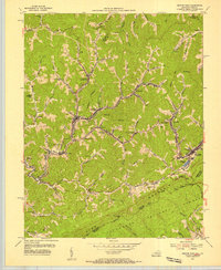
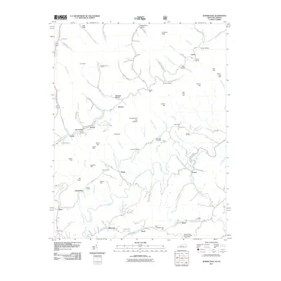
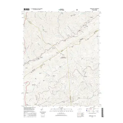
 1957 Pound1959 Print · USGSWise and Dickenson counties are shown here during the late fifties as coal mining and rail transport shaped the mountain landscape. Genealogists can locate family burial grounds and small community centers like Pyles Memorial Ch, Gilliam Sch, and Addington Cem.5 unique versions available
 - 1957 Map of Jenkins, 1974 Print
 1957 Jenkins1974 Print · USGSThe Cumberland Plateau in the mid-twentieth century reveals a complex landscape of winding river valleys and deep-seated industry. Genealogists and historians can trace the development of Hazard, Jenkins, and Pikeville alongside extensive Numerous Oil and Gas Fields and the routes of the Chesapeake & Ohio Railway.
 - 1960 Map of Jenkins
 1960 Jenkins1960 Print · USGSEastern Kentucky and the West Virginia borderlands are captured at a mid-century peak of the coal and rail era. Trace the industrial corridors of the Chesapeake and Ohio RR through mountain hubs like Hazard and Jenkins.
 - 1963 Map of Jenkins East, 1965 Print
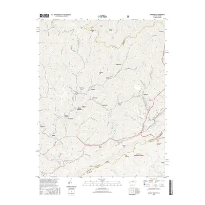
 1963 Jenkins East1965 Print · USGSThe coalfields of the Kentucky-Virginia border are captured here in the early sixties, showing a landscape defined by Pine Mountain and the Chesapeake and Ohio rail line. Trace family roots at Bethel Ch, Shelby Gap, and the Austin Cem.3 unique versions available
 - 1977 Map of Pikeville, 1983 Print
 1977 Pikeville1983 Print · USGSThe Central Appalachian coalfields and the rugged borders of Kentucky and Virginia come into focus during the late seventies. Researchers can trace the rail networks of the C & O and L & N through towns like Jenkins, Whitesburg, and Pikeville.
 - 1992 Map of Jenkins East
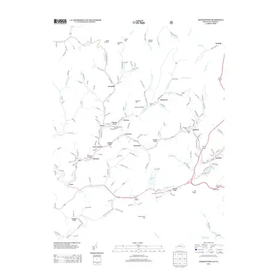
 1992 Jenkins East1992 Print · USGSThe Kentucky-Virginia borderlands in the early nineties show a landscape defined by mountain gaps and the extractive industry of the Cumberland Plateau. Genealogists can locate family landmarks like Haddon Cemetery and Mill Creek School alongside the numerous gas wells and strip mines that shaped the local economy.
 - 1992 Map of Jenkins West
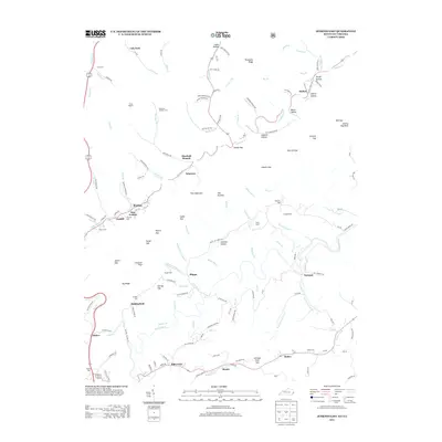
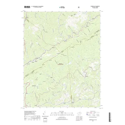
 1992 Jenkins West1992 Print · USGSLetcher County coal country in the early nineties reveals a dense network of mountain settlements and headwaters. Trace family roots and local history through McRoberts, Hemphill, and churches like Moores Chapel or St George Ch.
 - 2011 Map of Jenkins West, 2011 Print
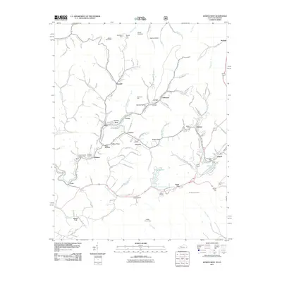 2011 Jenkins West2011 Print · USGSCovers Pound, including Jenkins, Fleming-Neon, and other nearby areas
 - 2011 Map of Jenkins East, 2011 Print
 2011 Jenkins East2011 Print · USGSCovers Pound, including Jenkins, Hylton, and other nearby areas
 - 2013 Map of Jenkins West, 2013 Print
 2013 Jenkins West2013 Print · USGSCovers Pound, including Jenkins, Fleming-Neon, and other nearby areas
 - 2013 Map of Jenkins East, 2013 Print
 2013 Jenkins East2013 Print · USGSCovers Pound, including Jenkins, Hylton, and other nearby areas
 - 2016 Map of Jenkins West, 2016 Print
 2016 Jenkins West2016 Print · USGSCovers Pound, including Jenkins, Fleming-Neon, and other nearby areas
 - 2016 Map of Jenkins East, 2016 Print
 2016 Jenkins East2016 Print · USGSCovers Pound, including Jenkins, Hylton, and other nearby areas
 - 2019 Map of Jenkins East, 2019 Print
 2019 Jenkins East2019 Print · USGSCovers Pound, including Jenkins, Hylton, and other nearby areas
 - 2019 Map of Jenkins West, 2019 Print
 2019 Jenkins West2019 Print · USGSCovers Pound, including Jenkins, Fleming-Neon, and other nearby areas
 - 2022 Map of Pound, 2022 Print
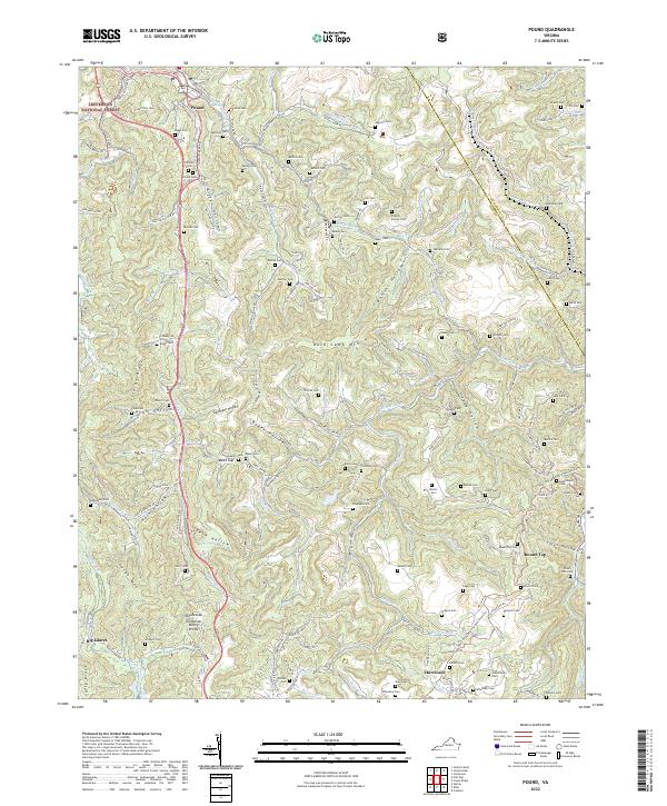 2022 Pound2022 Print · USGSThe mountains of Wise County are shown here in the contemporary era, illustrating the enduring footprint of family settlements. Genealogists can trace family burial sites like Stallard Cem and Addington Cem near landmarks like Bold Camp Mtn.
Showing maps 1-25 of 28
Top cities near Pound
- Norton historical maps
- Wise historical maps
- Jenkins historical maps
- Whitesburg historical maps
- Coeburn historical maps
- Appalachia historical maps
See more
Top neighborhoods of Pound
Frequently asked questions
- What are the different types of historical maps available for Pound?
- What is the oldest map of Pound?
- Where can I purchase historical maps of Pound for my home or office?
- Where can I download high-res historical maps of Pound?
- Are there historical topographic maps available for Pound?
- Is there historical aerial imagery available for Pound?
- Where are historical maps of Pound sourced from?