Old Maps of Wytheville, Virginia for Genealogy
Trace your family roots with 21 historic maps of Wytheville. These high-res maps reveal old neighborhoods, homesites, landmarks, and streets — helping you uncover where your ancestors lived and how the area evolved over time.
- Explore historic neighborhoods: Identify where your relatives may have lived in the 1800s or 1900s.
- Compare maps over time: Trace the changes in streets, buildings, and landmarks for multi-generational research.
- Perfect for genealogy & ancestry research: Used by family historians and researchers to map out lineage and migration.
These maps are an incredible resource for exploring your personal connection to Wytheville's past.
Wytheville, VA maps
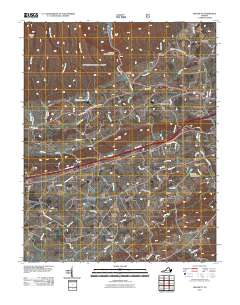
(21)- 1889 Map of Wytheville
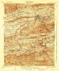
 1889 Wytheville1889 Print · USGSSouthwestern Virginia and northwestern North Carolina are mapped here during the late nineteenth-century rise of the mountain iron industry. Genealogists and historians can locate early post offices and industrial sites such as Bridle Creek P.O., Eagle Furnace, and Rural Retreat.2 unique versions available
 - 1892 Map of Wytheville, 1897 Print
 1892 Wytheville1897 Print · USGSThe high ridges and river valleys of Southwest Virginia and Northwest North Carolina are captured here in the late nineteenth century. Genealogists can trace family footprints across the Iron Mountains to old industrial sites like White Rock Furnace and remote post offices such as Hampton P.O.6 unique versions available
 - 1930 Map of Speedwell
 1930 Speedwell1930 Print · USGSWythe County is captured here in the late twenties, showing the intersection of vital transit corridors and mountain wilderness. Researchers can trace the early Appalachian Trail or locate family roots at St Paul Ch and Slate Spring Sch.
 - 1939 Map of Speedwell
 1939 Speedwell1939 Print · USGSThe mountain valleys of Wythe County are captured here in the late 1930s, showing a landscape of scattered rural schools and early industrial sites. Genealogists can locate family landmarks like Rowe Crossroads or trace the early path of the APPALACHIAN TRAILS past Little Wythe Furnace.3 unique versions available
 - 1953 Map of Winston-Salem, 1974 Print
 1953 Winston-Salem1974 Print · USGSThe North Carolina Piedmont and Virginia highlands meet in the mid-1950s, a landscape defined by the tobacco and textile hubs of the Blue Ridge foothills. Researchers can trace the rail-and-river geography connecting Winston-Salem to mountain towns like Mount Airy and Galax.2 unique versions available
 - 1955 Map of Winston-Salem
 1955 Winston-Salem1955 Print · USGSThe Central Blue Ridge and Piedmont transition are captured here in the mid-fifties, from the industrial hub of Winston-Salem to the high peaks of Southwest Virginia. Genealogists can trace family landmarks like Richmond Hill Ch, Siloam Ch, and the old rail stops along the Southern Railway.
 - 1962 Map of Winston-Salem
 1962 Winston-Salem1962 Print · USGSThe North Carolina Piedmont meets the Virginia highlands in the early sixties, showing the rail corridors and mountain gaps of the southern Appalachians. Researchers can trace the Blue Ridge Parkway or locate family sites near Winston-Salem, Mount Airy, and Hanging Rock Mountain.
 - 1968 Map of Wytheville, 1970 Print
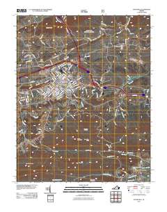
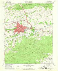 1968 Wytheville1970 Print · USGSWytheville and the surrounding Wythe County highlands are captured here during a period of significant transit growth in the late sixties. Researchers can trace local genealogy and industry through landmarks like Stones Mill, the Wytheville Sanitarium and Hospital, and several rural sanctuaries including Fellowship Ch.4 unique versions available
 - 1968 Map of Crockett, 1971 Print
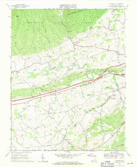 1968 Crockett1971 Print · USGSWythe County, Virginia, is captured here in the late sixties as modern highway infrastructure begins to bisect traditional valley settlements. Researchers can trace family roots at St Pauls Ch and Kings Grove Ch or explore the rail-side operations at Groseclose and Government Siding.3 unique versions available
 - 1976 Map of Wytheville, 1983 Print
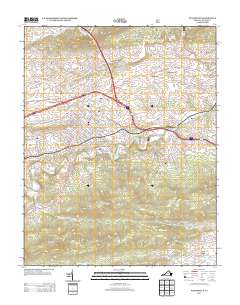
 1976 Wytheville1983 Print · USGSWytheville and the surrounding Blue Ridge foothills are captured in this mid-seventies aerial survey. Researchers can trace the development of Wytheville and its relationship to Reed Creek, or locate rural hamlets like Haven and Stringtown.
 - 1982 Map of Wytheville, 1983 Print
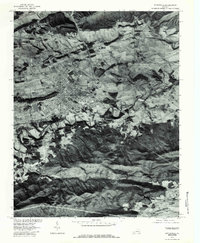
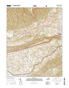
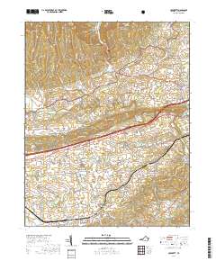
 1982 Wytheville1983 Print · USGSSouthwest Virginia's ridge-and-valley landscape is shown here in the early 1980s as the Interstate era fully connected the region. Genealogists and historians can trace family locations near Emory and Henry College, the historic Austinville Mine, and settlements like Saltville or Lansing.3 unique versions available
 - 2011 Map of Crockett, 2011 Print
 2011 Crockett2011 Print · USGSCovers Wytheville, including Fairview, Favonia, and other nearby areas
 - 2011 Map of Wytheville, 2011 Print
 2011 Wytheville2011 Print · USGSCovers Wytheville, including Stringtown, Kent, and other nearby areas
 - 2013 Map of Wytheville, 2013 Print
 2013 Wytheville2013 Print · USGSCovers Wytheville, including Stringtown, Kent, and other nearby areas
 - 2013 Map of Crockett, 2013 Print
 2013 Crockett2013 Print · USGSCovers Wytheville, including Fairview, Favonia, and other nearby areas
 - 2016 Map of Crockett, 2016 Print
 2016 Crockett2016 Print · USGSCovers Wytheville, including Fairview, Favonia, and other nearby areas
 - 2016 Map of Wytheville, 2016 Print
 2016 Wytheville2016 Print · USGSCovers Wytheville, including Stringtown, Kent, and other nearby areas
 - 2019 Map of Wytheville, 2019 Print
 2019 Wytheville2019 Print · USGSCovers Wytheville, including Stringtown, Kent, and other nearby areas
 - 2019 Map of Crockett, 2019 Print
 2019 Crockett2019 Print · USGSCovers Wytheville, including Fairview, Favonia, and other nearby areas
 - 2022 Map of Wytheville, 2022 Print
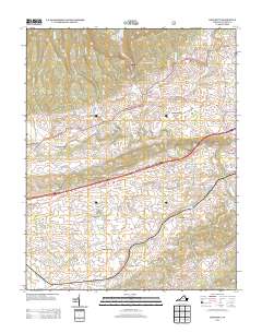
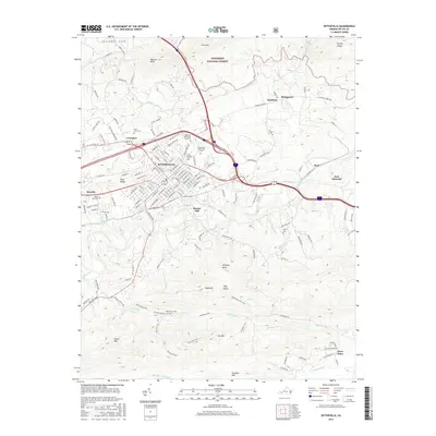
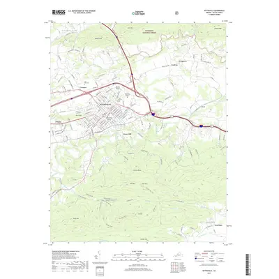
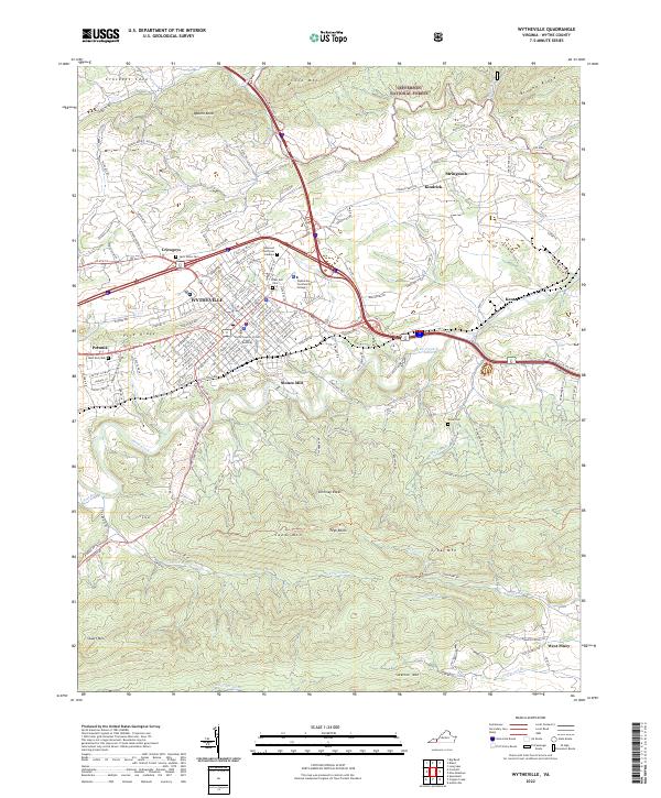 2022 Wytheville2022 Print · USGSWytheville and its surrounding ridges appear in this recent survey, capturing the modern layout of this historic Virginia crossroads. Genealogists and researchers can trace local landmarks like East End Cem, the Stones Mill settlement, and the Norfolk Southern rail line.
 - 2022 Map of Crockett, 2022 Print
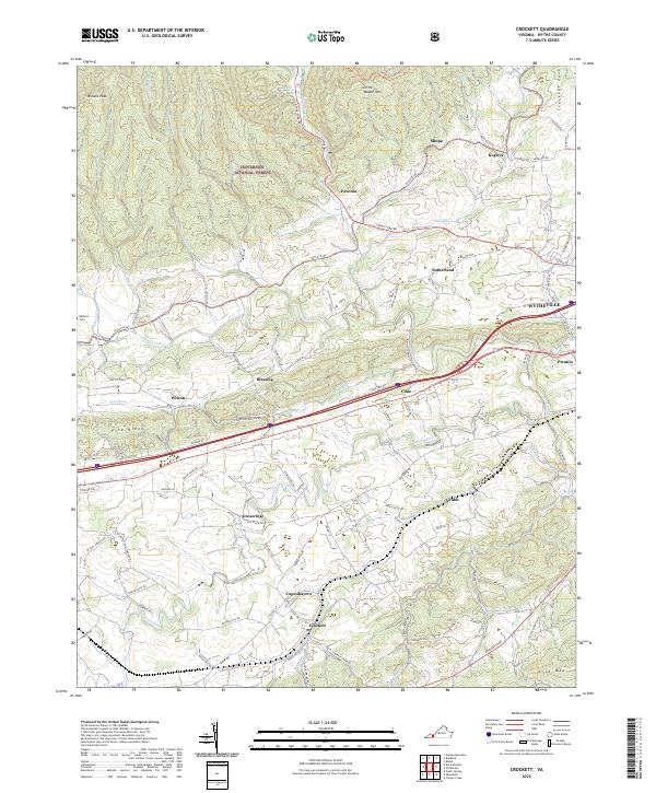 2022 Crockett2022 Print · USGSThe rural valleys and mountain ridges of Wythe County are captured here in a modern era of forest conservation and interstate transit. Researchers can trace family-named roads and old crossroads settlements such as Groseclose, Blessing, and the Earhart Cem.
End of results
Showing maps 1-21 of 21
Top cities near Wytheville
- Rural Retreat historical maps
- Fort Chiswell historical maps
- Max Meadows historical maps
- Ivanhoe historical maps
- Bland historical maps
- Bastian historical maps
See more
Top neighborhoods of Wytheville
Frequently asked questions
- What are the different types of historical maps available for Wytheville?
- What is the oldest map of Wytheville?
- Where can I purchase historical maps of Wytheville for my home or office?
- Where can I download high-res historical maps of Wytheville?
- Are there historical topographic maps available for Wytheville?
- Is there historical aerial imagery available for Wytheville?
- Where are historical maps of Wytheville sourced from?