2000s (21st Century) Maps of Chiwawa Pines, Chelan County
Explore 6 historic maps of Chiwawa Pines from the 2000s (21st Century). These maps offer a rare glimpse into what life looked like during the 2000s — showing old roads, neighborhoods, homes, and landmarks that have changed or disappeared over time.
Whether you're researching your family's past, planning a metal detecting trip, or studying how Chiwawa Pines's landscape evolved across the 2000s, these high-resolution maps are a powerful tool for exploring the history of this region.
- Focus on a specific era: All maps on this page are from the 2000s, giving you a focused view of this time period.
- See what’s changed: Compare century-old streets, trails, and buildings to today's modern landscape using overlays and satellite layers.
- Research with precision: Use these maps for genealogy, historical research, land use analysis, or educational projects.
- View, download, or print: Maps are fully viewable online in high resolution, and can be downloaded or printed for your own records.
Start exploring Chiwawa Pines's history through authentic maps from the 2000s. This is your window into the past.
Chiwawa Pines, Chelan County maps
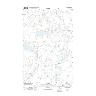
(6)- 2004 Map of Plain, 2008 Print
 2004 Plain2008 Print · USGSThe Wenatchee and Chiwawa rivers meet in the early 2000s, carving a path through the national forest toward the settlement of Plain. Researchers can trace the development of this recreation hub via the Lake Wenatchee State Park, YMCA Camp, and the emergency airstrip.
 - 2011 Map of Plain, 2011 Print
 2011 Plain2011 Print · USGSCovers Chiwawa Pines, including Plain, Coles Corner, and other nearby areas
 - 2014 Map of Plain, 2014 Print
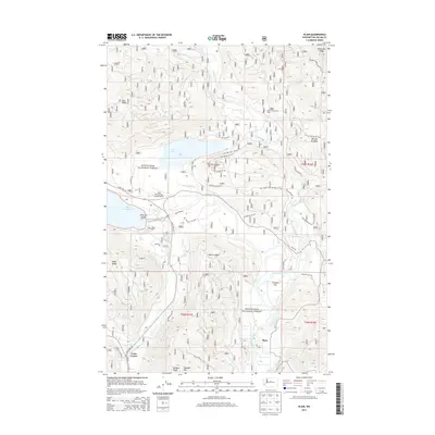 2014 Plain2014 Print · USGSCovers Chiwawa Pines, including Plain, Coles Corner, and other nearby areas
 - 2017 Map of Plain, 2017 Print
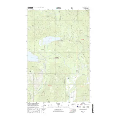 2017 Plain2017 Print · USGSCovers Chiwawa Pines, including Plain, Coles Corner, and other nearby areas
 - 2020 Map of Plain, 2020 Print
 2020 Plain2020 Print · USGSCovers Chiwawa Pines, including Plain, Coles Corner, and other nearby areas
 - 2023 Map of Plain, 2023 Print
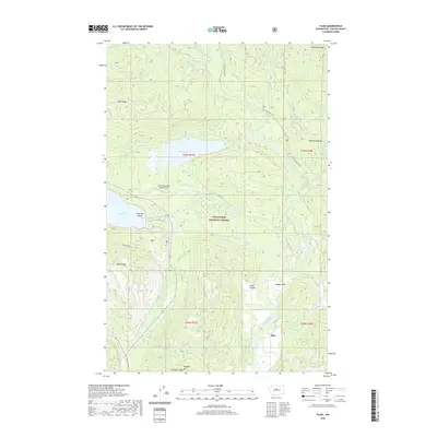
 2023 Plain2023 Print · USGSThe unincorporated community of Plain is shown at a contemporary moment, situated near the confluence of the Wenatchee River and Chiwawa River. Genealogists and historians can trace the local landscape from Schugart Flat to the Lake Wenatchee State Airport and Fish Lake.
End of results
Showing maps 1-6 of 6
Frequently asked questions
- What are the different types of historical maps available for Chiwawa Pines?
- What is the oldest map of Chiwawa Pines?
- Where can I purchase historical maps of Chiwawa Pines for my home or office?
- Where can I download high-res historical maps of Chiwawa Pines?
- Are there historical topographic maps available for Chiwawa Pines?
- Is there historical aerial imagery available for Chiwawa Pines?
- Where are historical maps of Chiwawa Pines sourced from?