Old Maps of Bennington, Vancouver for Academic Research
Study the evolution of Bennington with 24 high-resolution historic maps. Whether you're teaching, researching, or modeling changes in land use, these maps provide essential visual documentation of urban, environmental, and geographic change.
- Analyze long-term change: Track patterns in development, transportation, and natural features.
- Ideal for environmental or urban studies: Support academic projects with primary historical map data.
- Use in the classroom or lab: Educators and researchers rely on these maps to bring historical context to life.
These maps are a powerful tool for teaching, research, and visualizing how Bennington has changed over the decades.
Bennington, Vancouver maps
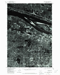
(24)- 1897 Map of Portland
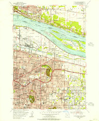
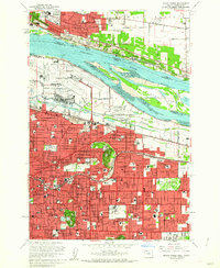
 1897 Portland1897 Print · USGSCovers Bennington, including Portland, Vancouver, and other nearby areas2 unique versions available
 - 1905 Map of Portland
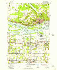
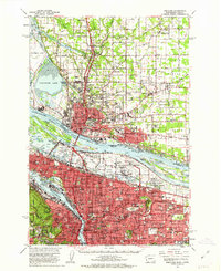
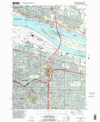
 1905 Portland1905 Print · USGSCovers Bennington, including Portland, Vancouver, and other nearby areas9 unique versions available
 - 1918 Map of Troutdale
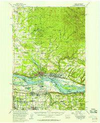
 1918 Troutdale1918 Print · USGSCovers Bennington, including Portland, Vancouver, and other nearby areas2 unique versions available
 - 1934 Map of Troutdale
 1934 Troutdale1934 Print · USGSCovers Bennington, including Portland, Vancouver, and other nearby areas
 - 1940 Map of Portland
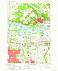
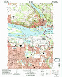
 1940 Portland1940 Print · USGSCovers Bennington, including Portland, Vancouver, and other nearby areas4 unique versions available
 - 1941 Map of Camas
 1941 Camas1941 Print · USGSCovers Bennington, including Portland, Vancouver, and other nearby areas
 - 1942 Map of Camas
 1942 Camas1942 Print · USGSCovers Bennington, including Portland, Vancouver, and other nearby areas2 unique versions available
 - 1948 Map of Vancouver, 1957 Print
 1948 Vancouver1957 Print · USGSCovers Bennington, including Portland, Vancouver, and other nearby areas
 - 1950 Map of Vancouver
 1950 Vancouver1950 Print · USGSCovers Bennington, including Portland, Vancouver, and other nearby areas
 - 1950 Map of Vancouver, 1951 Print
 1950 Vancouver1951 Print · USGSCovers Bennington, including Portland, Vancouver, and other nearby areas
 - 1954 Map of Mount Tabor, 1956 Print
 1954 Mount Tabor1956 Print · USGSCovers Bennington, including Portland, Vancouver, and other nearby areas
 - 1954 Map of Camas, 1957 Print
 1954 Camas1957 Print · USGSCovers Bennington, including Portland, Vancouver, and other nearby areas
 - 1954 Map of Camas, 1958 Print
 1954 Camas1958 Print · USGSCovers Bennington, including Portland, Vancouver, and other nearby areas3 unique versions available
 - 1958 Map of Vancouver, 1968 Print
 1958 Vancouver1968 Print · USGSCovers Bennington, including Portland, Vancouver, and other nearby areas3 unique versions available
 - 1961 Map of Camas, 1962 Print
 1961 Camas1962 Print · USGSCovers Bennington, including Portland, Vancouver, and other nearby areas3 unique versions available
 - 1961 Map of Mount Tabor, 1962 Print
 1961 Mount Tabor1962 Print · USGSCovers Bennington, including Portland, Vancouver, and other nearby areas3 unique versions available
 - 1961 Map of Portland, 1963 Print
 1961 Portland1963 Print · USGSCovers Bennington, including Portland, Vancouver, and other nearby areas3 unique versions available
 - 1964 Map of Vancouver
 1964 Vancouver1964 Print · USGSCovers Bennington, including Portland, Vancouver, and other nearby areas
 - 1975 Map of Camas, 1977 Print
 1975 Camas1977 Print · USGSCovers Bennington, including Portland, Vancouver, and other nearby areas
 - 1975 Map of Mount Tabor, 1977 Print
 1975 Mount Tabor1977 Print · USGSCovers Bennington, including Portland, Vancouver, and other nearby areas
 - 1976 Map of Mount Tabor, 1981 Print
 1976 Mount Tabor1981 Print · USGSCovers Bennington, including Portland, Vancouver, and other nearby areas
 - 1979 Map of Vancouver, 1980 Print
 1979 Vancouver1980 Print · USGSCovers Bennington, including Portland, Vancouver, and other nearby areas2 unique versions available
 - 1990 Map of Mount Tabor, 1995 Print
 1990 Mount Tabor1995 Print · USGSCovers Bennington, including Portland, Vancouver, and other nearby areas
 - 1993 Map of Camas, 1996 Print
 1993 Camas1996 Print · USGSCovers Bennington, including Portland, Vancouver, and other nearby areas
End of results
Showing maps 1-24 of 24
Frequently asked questions
- What are the different types of historical maps available for Bennington?
- What is the oldest map of Bennington?
- Where can I purchase historical maps of Bennington for my home or office?
- Where can I download high-res historical maps of Bennington?
- Are there historical topographic maps available for Bennington?
- Is there historical aerial imagery available for Bennington?
- Where are historical maps of Bennington sourced from?