Old Maps of Renton, Washington
Explore 18 old maps of Renton, spanning from 1895 to today. These high-resolution historic maps reveal how streets, neighborhoods, landmarks, and natural features evolved over time — perfect for genealogy, metal detecting, research, and local history exploration.
What you can do with these maps:
- See how Renton changed over time: Compare historical maps to modern-day views to trace roads, homesites, rail lines & more.
- View detailed metadata: Each map includes creators, publishers, year, scale, and archive source.
- Overlay maps with satellite & LiDAR: Visualize the past alongside modern tools to explore terrain & human change.
- Trusted historical sources: Maps sourced from the USGS, Library of Congress, and other archives.
- Access maps your way: View online, download high-res files, or order prints for personal or research use.
Start exploring old maps of Renton to uncover forgotten places, hidden landmarks, and the deep history beneath your feet.
Renton, WA maps
(18)- 1895 Map of Snohomish, 1954 Print
 1895 Snohomish1954 Print · USGSCovers Renton, including Seattle, Bellevue, and other nearby areas
 - 1897 Map of Tacoma
 1897 Tacoma1897 Print · USGSCovers Renton, including Seattle, Tacoma, and other nearby areas2 unique versions available
 - 1897 Map of Seattle
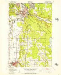
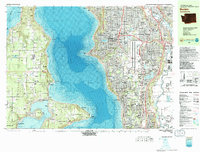
 1897 Seattle1897 Print · USGSCovers Renton, including Seattle, Bellevue, and other nearby areas10 unique versions available
 - 1900 Map of Tacoma
 1900 Tacoma1900 Print · USGSCovers Renton, including Seattle, Tacoma, and other nearby areas9 unique versions available
 - 1949 Map of Maple Valley, 1956 Print
 1949 Maple Valley1956 Print · USGSCovers Renton, including Maple Valley, Covington, and other nearby areas3 unique versions available
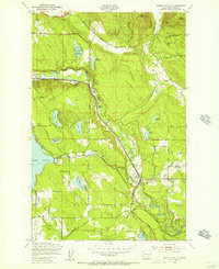
 - 1949 Map of Renton, 1956 Print
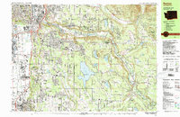
 1949 Renton1956 Print · USGSCovers Renton, including Seattle, Kent, and other nearby areas5 unique versions available
 - 1949 Map of Des Moines, 1956 Print
 1949 Des Moines1956 Print · USGSCovers Renton, including Seattle, Kent, and other nearby areas6 unique versions available
 - 1950 Map of Mercer Island, 1956 Print
 1950 Mercer Island1956 Print · USGSCovers Renton, including Seattle, Bellevue, and other nearby areas4 unique versions available
 - 1958 Map of Seattle, 1966 Print
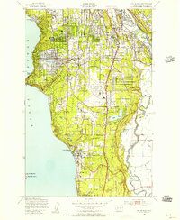
 1958 Seattle1966 Print · USGSCovers Renton, including Seattle, Tacoma, and other nearby areas3 unique versions available
 - 1962 Map of Seattle
 1962 Seattle1962 Print · USGSCovers Renton, including Seattle, Tacoma, and other nearby areas
 - 1975 Map of Tacoma, 1977 Print
 1975 Tacoma1977 Print · USGSCovers Renton, including Seattle, Tacoma, and other nearby areas
 - 1975 Map of Seattle, 1977 Print
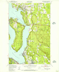
 1975 Seattle1977 Print · USGSCovers Renton, including Seattle, Bellevue, and other nearby areas
 - 1983 Map of Bellevue South
 1983 Bellevue South1983 Print · USGSCovers Renton, including Seattle, Bellevue, and other nearby areas
 - 1983 Map of Renton
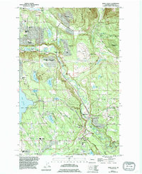
 1983 Renton1983 Print · USGSCovers Renton, including Seattle, Kent, and other nearby areas
 - 1983 Map of Burien
 1983 Burien1983 Print · USGSCovers Renton, including Seattle, Kent, and other nearby areas
 - 1991 Map of Tacoma
 1991 Tacoma1991 Print · USGSCovers Renton, including Seattle, Tacoma, and other nearby areas
 - 1992 Map of Seattle, 1993 Print
 1992 Seattle1993 Print · USGSCovers Renton, including Seattle, Bellevue, and other nearby areas2 unique versions available
 - 1995 Map of Maple Valley
 1995 Maple Valley1995 Print · USGSCovers Renton, including Maple Valley, Covington, and other nearby areas
End of results
Showing maps 1-18 of 18
Top cities near Renton
- Seattle historical maps
- Tacoma historical maps
- Bellevue historical maps
- Kent historical maps
- Federal Way historical maps
- Kirkland historical maps
See more
Top neighborhoods of Renton
- Maplewood historical maps
- Benson Hill historical maps
- Black River Junction historical maps
- Kennydale historical maps
- May Creek historical maps
- Brookfield historical maps
See more
Frequently asked questions
- What are the different types of historical maps available for Renton?
- What is the oldest map of Renton?
- Where can I purchase historical maps of Renton for my home or office?
- Where can I download high-res historical maps of Renton?
- Are there historical topographic maps available for Renton?
- Is there historical aerial imagery available for Renton?
- Where are historical maps of Renton sourced from?