Old Maps of Bainbridge Island, Washington
Explore 18 old maps of Bainbridge Island, spanning from 1894 to today. These high-resolution historic maps reveal how streets, neighborhoods, landmarks, and natural features evolved over time — perfect for genealogy, metal detecting, research, and local history exploration.
What you can do with these maps:
- See how Bainbridge Island changed over time: Compare historical maps to modern-day views to trace roads, homesites, rail lines & more.
- View detailed metadata: Each map includes creators, publishers, year, scale, and archive source.
- Overlay maps with satellite & LiDAR: Visualize the past alongside modern tools to explore terrain & human change.
- Trusted historical sources: Maps sourced from the USGS, Library of Congress, and other archives.
- Access maps your way: View online, download high-res files, or order prints for personal or research use.
Start exploring old maps of Bainbridge Island to uncover forgotten places, hidden landmarks, and the deep history beneath your feet.
Bainbridge Island, WA maps
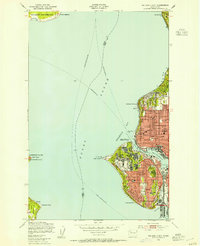
(18)- 1894 Map of Seattle, 1903 Print
 1894 Seattle1903 Print · USGSCovers Bainbridge Island, including Seattle, Kirkland, and other nearby areas2 unique versions available
 - 1895 Map of Snohomish, 1954 Print
 1895 Snohomish1954 Print · USGSCovers Bainbridge Island, including Seattle, Bellevue, and other nearby areas
 - 1897 Map of Seattle
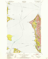
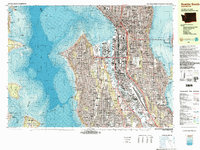
 1897 Seattle1897 Print · USGSCovers Bainbridge Island, including Seattle, Bellevue, and other nearby areas10 unique versions available
 - 1908 Map of Seattle, 1955 Print
 1908 Seattle1955 Print · USGSCovers Bainbridge Island, including Seattle, Kirkland, and other nearby areas2 unique versions available
 - 1909 Map of Seattle Special
 1909 Seattle Special1909 Print · USGSCovers Bainbridge Island, including Seattle, Kirkland, and other nearby areas4 unique versions available
 - 1937 Map of Port Orchard, 1960 Print
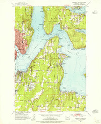
 1937 Port Orchard1960 Print · USGSCovers Bainbridge Island, including Bremerton, Silverdale, and other nearby areas2 unique versions available
 - 1949 Map of Shilshole Bay, 1954 Print
 1949 Shilshole Bay1954 Print · USGSCovers Bainbridge Island, including Seattle, Shoreline, and other nearby areas4 unique versions available
 - 1949 Map of Duwamish Head, 1956 Print
 1949 Duwamish Head1956 Print · USGSCovers Bainbridge Island, including Seattle, Cowley, and other nearby areas3 unique versions available
 - 1953 Map of Bremerton East, 1955 Print
 1953 Bremerton East1955 Print · USGSCovers Bainbridge Island, including Bremerton, Port Orchard, and other nearby areas4 unique versions available
 - 1953 Map of Suquamish, 1955 Print
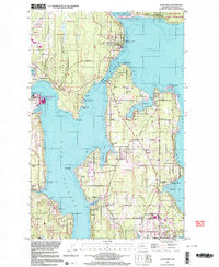
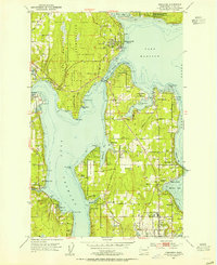 1953 Suquamish1955 Print · USGSCovers Bainbridge Island, including Poulsbo, Suquamish, and other nearby areas5 unique versions available
 - 1958 Map of Seattle, 1966 Print
 1958 Seattle1966 Print · USGSCovers Bainbridge Island, including Seattle, Tacoma, and other nearby areas3 unique versions available
 - 1962 Map of Seattle
 1962 Seattle1962 Print · USGSCovers Bainbridge Island, including Seattle, Tacoma, and other nearby areas
 - 1968 Map of Duwamish Head, 1969 Print
 1968 Duwamish Head1969 Print · USGSCovers Bainbridge Island, including Seattle, Cowley, and other nearby areas
 - 1975 Map of Seattle, 1977 Print
 1975 Seattle1977 Print · USGSCovers Bainbridge Island, including Seattle, Bellevue, and other nearby areas
 - 1983 Map of Seattle South
 1983 Seattle South1983 Print · USGSCovers Bainbridge Island, including Seattle, Burien, and other nearby areas3 unique versions available
 - 1983 Map of Seattle North
 1983 Seattle North1983 Print · USGSCovers Bainbridge Island, including Seattle, Kirkland, and other nearby areas2 unique versions available
 - 1992 Map of Seattle, 1993 Print
 1992 Seattle1993 Print · USGSCovers Bainbridge Island, including Seattle, Bellevue, and other nearby areas2 unique versions available
 - 1997 Map of Suquamish, 2003 Print
 1997 Suquamish2003 Print · USGSCovers Bainbridge Island, including Poulsbo, Suquamish, and other nearby areas
End of results
Showing maps 1-18 of 18
Top cities near Bainbridge Island
- Seattle historical maps
- Kent historical maps
- Shoreline historical maps
- Burien historical maps
- Edmonds historical maps
- Bremerton historical maps
See more
Top neighborhoods of Bainbridge Island
- Manzanita historical maps
- Town Square at City Hall historical maps
- West Blakely historical maps
- Battle Point historical maps
- Winslow historical maps
- Point White historical maps
See more
Frequently asked questions
- What are the different types of historical maps available for Bainbridge Island?
- What is the oldest map of Bainbridge Island?
- Where can I purchase historical maps of Bainbridge Island for my home or office?
- Where can I download high-res historical maps of Bainbridge Island?
- Are there historical topographic maps available for Bainbridge Island?
- Is there historical aerial imagery available for Bainbridge Island?
- Where are historical maps of Bainbridge Island sourced from?