Old Maps of Port Orchard, Washington
Explore 28 old maps of Port Orchard, spanning from 1937 to today. These high-resolution historic maps reveal how streets, neighborhoods, landmarks, and natural features evolved over time — perfect for genealogy, metal detecting, research, and local history exploration.
What you can do with these maps:
- See how Port Orchard changed over time: Compare historical maps to modern-day views to trace roads, homesites, rail lines & more.
- View detailed metadata: Each map includes creators, publishers, year, scale, and archive source.
- Overlay maps with satellite & LiDAR: Visualize the past alongside modern tools to explore terrain & human change.
- Trusted historical sources: Maps sourced from the USGS, Library of Congress, and other archives.
- Access maps your way: View online, download high-res files, or order prints for personal or research use.
Start exploring old maps of Port Orchard to uncover forgotten places, hidden landmarks, and the deep history beneath your feet.
Port Orchard, WA maps
(28)- 1937 Map of Port Orchard, 1960 Print
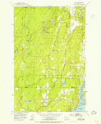
 1937 Port Orchard1960 Print · USGSBremerton and the Kitsap Peninsula were defined by their deep-water naval facilities and ferry networks in the years preceding World War II. Local historians can trace the early footprints of the Puget Sound Navy Yard, the Port Madison Indian Reservation, and the Fort Ward coastal defenses.2 unique versions available
 - 1942 Map of Gig Harbor, 1954 Print
 1942 Gig Harbor1954 Print · USGSThe Kitsap Peninsula and surrounding islands are mapped here during the early 1940s, highlighting a maritime world of inlets and ferries. Trace old family sites and rural landmarks like Elgin Sch, Lisabeula, and the many landings along Henderson Bay.
 - 1943 Map of Gig Harbor
 1943 Gig Harbor1943 Print · USGSThe Puget Sound shoreline and its peninsulas are captured here in the 1940s as a maritime network of small landings and inland schools. Genealogists can trace family footprints at Sunny Slope Sch, Lisabeula, and the many homesteads near Artondale.
 - 1953 Map of Burley, 1954 Print
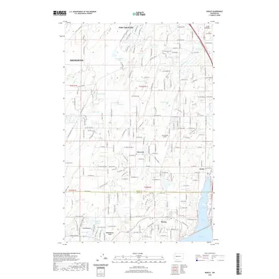
 1953 Burley1954 Print · USGSThe Kitsap Peninsula is captured here in the early fifties, showing a rural landscape of timber and tide. Researchers can trace the development of early communities like Burley, Glenwood, and Bethel, or locate landmarks such as Bethel Ch and South Port Orchard Airport.6 unique versions available
 - 1953 Map of Bremerton West, 1955 Print
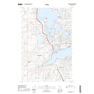
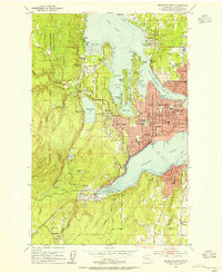 1953 Bremerton West1955 Print · USGSKitsap County during the early fifties reveals a landscape defined by the Puget Sound Naval Shipyard and its surrounding coastal communities. Genealogists can trace family homes near Kitsap Lake or locate ancestral plots at Ivy Green Cem and Forest Lawn Cem.5 unique versions available
 - 1953 Map of Bremerton East, 1955 Print
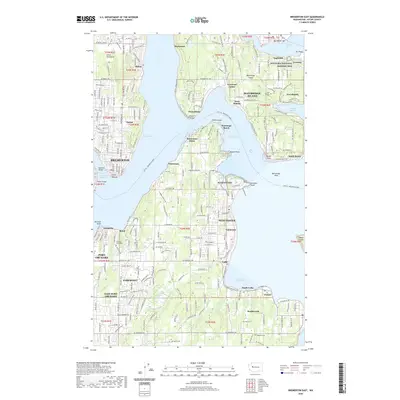
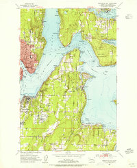 1953 Bremerton East1955 Print · USGSThe Kitsap Peninsula and Bainbridge Island shorelines appear in the early fifties, caught between their naval legacy and post-war growth. Researchers can trace family sites from Winslow to Harper or locate ancestors at the Port Blakely Cemetery and Veterans Home Cem.4 unique versions available
 - 1958 Map of Seattle, 1966 Print
 1958 Seattle1966 Print · USGSThe Puget Sound region in the mid-fifties showcases a balance of urban growth and Olympic wilderness. Trace the industrial waterfronts of Tacoma, old naval facilities like Keyport Naval Res, and mountain peaks like Mount Constance.3 unique versions available
 - 1962 Map of Seattle
 1962 Seattle1962 Print · USGSThe Puget Sound region and Olympic Peninsula are shown at a peak of mid-century growth. Genealogists and historians can trace rail lines like the Pacific Coast RR or locate landmarks such as Fort Lawton and the Bothell Power Station.
 - 1975 Map of Tacoma, 1977 Print
 1975 Tacoma1977 Print · USGSThe Puget Sound region in the mid-seventies reveals a landscape of growing urban centers and massive federal installations. Genealogists and historians can trace the development of Tacoma and Olympia, or locate landmarks like the McNeil Island Penitentiary and Fort Lewis Military Reservation.
 - 1975 Map of Seattle, 1977 Print
 1975 Seattle1977 Print · USGSThe Puget Sound region in the mid-seventies shows a landscape of rapid suburban growth and vital maritime industry. Researchers can trace the development of Eastside hubs like Bellevue or examine the rail and naval infrastructure of Bremerton and Paine Field.
 - 1991 Map of Tacoma
 1991 Tacoma1991 Print · USGSThe South Sound and Tacoma waterfront appear here in the early nineties, showing a landscape defined by deep-water inlets and massive federal installations. Researchers can trace the development of Lakewood Center or locate the historic rail lines of the Burlington Northern Railroad and Union Pacific Railroad.
 - 1992 Map of Seattle, 1993 Print
 1992 Seattle1993 Print · USGSThe Seattle metropolitan area and Puget Sound are shown here in the early nineties during a period of rapid suburban and technological growth. Researchers can trace the development of Mercer Island, locate the Bangor Naval Submarine Base, and study the industrial layout of Boeing Field.2 unique versions available
 - 1999 Map of Burley, 2003 Print
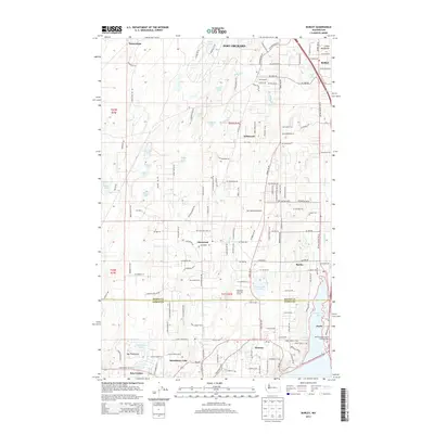
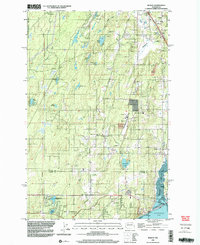 1999 Burley2003 Print · USGSThe Key Peninsula and the Kitsap-Pierce county line are shown here in the late nineties, centered on the communities of Burley and Purdy. Local historians can trace family-named landmarks and rural infrastructure from Bethel Ch to the Port Orchard Airport.
 - 2011 Map of Bremerton West, 2011 Print
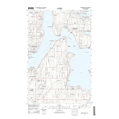
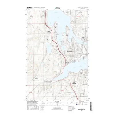
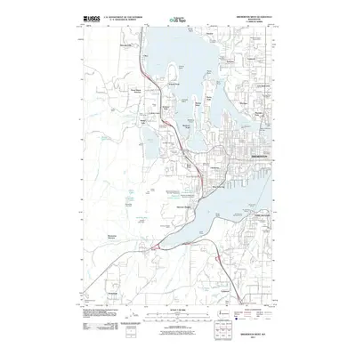 2011 Bremerton West2011 Print · USGSCovers Port Orchard, including Bremerton, Tracyton, and other nearby areas
 - 2011 Map of Burley, 2011 Print
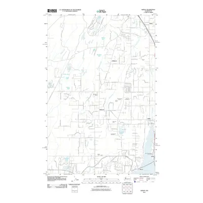 2011 Burley2011 Print · USGSCovers Port Orchard, including Bremerton, Wildwood, and other nearby areas
 - 2011 Map of Bremerton East, 2011 Print
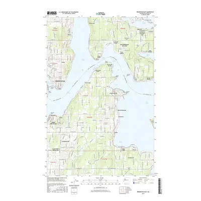
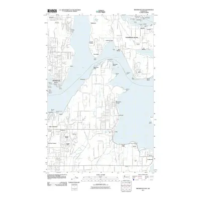 2011 Bremerton East2011 Print · USGSCovers Port Orchard, including Bremerton, Bainbridge Island, and other nearby areas
 - 2014 Map of Burley, 2014 Print
 2014 Burley2014 Print · USGSCovers Port Orchard, including Bremerton, Wildwood, and other nearby areas
 - 2014 Map of Bremerton East, 2014 Print
 2014 Bremerton East2014 Print · USGSCovers Port Orchard, including Bremerton, Bainbridge Island, and other nearby areas
 - 2014 Map of Bremerton West, 2014 Print
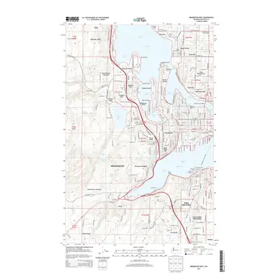 2014 Bremerton West2014 Print · USGSCovers Port Orchard, including Bremerton, Tracyton, and other nearby areas
 - 2017 Map of Burley, 2017 Print
 2017 Burley2017 Print · USGSCovers Port Orchard, including Bremerton, Wildwood, and other nearby areas
 - 2017 Map of Bremerton East, 2017 Print
 2017 Bremerton East2017 Print · USGSCovers Port Orchard, including Bremerton, Bainbridge Island, and other nearby areas
 - 2017 Map of Bremerton West, 2017 Print
 2017 Bremerton West2017 Print · USGSCovers Port Orchard, including Bremerton, Tracyton, and other nearby areas
 - 2020 Map of Burley, 2020 Print
 2020 Burley2020 Print · USGSCovers Port Orchard, including Bremerton, Wildwood, and other nearby areas
 - 2020 Map of Bremerton West, 2020 Print
 2020 Bremerton West2020 Print · USGSCovers Port Orchard, including Bremerton, Tracyton, and other nearby areas
 - 2020 Map of Bremerton East, 2020 Print
 2020 Bremerton East2020 Print · USGSCovers Port Orchard, including Bremerton, Bainbridge Island, and other nearby areas
Showing maps 1-25 of 28
Top cities near Port Orchard
- Seattle historical maps
- Tacoma historical maps
- Bremerton historical maps
- Bainbridge Island historical maps
- Silverdale historical maps
- Artondale historical maps
See more
Top neighborhoods of Port Orchard
Frequently asked questions
- What are the different types of historical maps available for Port Orchard?
- What is the oldest map of Port Orchard?
- Where can I purchase historical maps of Port Orchard for my home or office?
- Where can I download high-res historical maps of Port Orchard?
- Are there historical topographic maps available for Port Orchard?
- Is there historical aerial imagery available for Port Orchard?
- Where are historical maps of Port Orchard sourced from?