Old Maps of Artondale, Washington
Explore 21 old maps of Artondale, spanning from 1942 to today. These high-resolution historic maps reveal how streets, neighborhoods, landmarks, and natural features evolved over time — perfect for genealogy, metal detecting, research, and local history exploration.
What you can do with these maps:
- See how Artondale changed over time: Compare historical maps to modern-day views to trace roads, homesites, rail lines & more.
- View detailed metadata: Each map includes creators, publishers, year, scale, and archive source.
- Overlay maps with satellite & LiDAR: Visualize the past alongside modern tools to explore terrain & human change.
- Trusted historical sources: Maps sourced from the USGS, Library of Congress, and other archives.
- Access maps your way: View online, download high-res files, or order prints for personal or research use.
Start exploring old maps of Artondale to uncover forgotten places, hidden landmarks, and the deep history beneath your feet.
Artondale, WA maps
(21)- 1942 Map of Gig Harbor, 1954 Print
 1942 Gig Harbor1954 Print · USGSThe Kitsap Peninsula and surrounding islands are mapped here during the early 1940s, highlighting a maritime world of inlets and ferries. Trace old family sites and rural landmarks like Elgin Sch, Lisabeula, and the many landings along Henderson Bay.
 - 1943 Map of Gig Harbor
 1943 Gig Harbor1943 Print · USGSThe Puget Sound shoreline and its peninsulas are captured here in the 1940s as a maritime network of small landings and inland schools. Genealogists can trace family footprints at Sunny Slope Sch, Lisabeula, and the many homesteads near Artondale.
 - 1953 Map of Sylvan, 1954 Print
 1953 Sylvan1954 Print · USGSThe Key Peninsula and Fox Island areas are shown here in the early fifties during a period of transition and coastal growth. Researchers can find coastal settlements like Glencove and Sylvan, the State Biological Sta and Fish Hatchery, and the Fox Island Bridge Under Construction.5 unique versions available
 - 1953 Map of Gig Harbor, 1955 Print
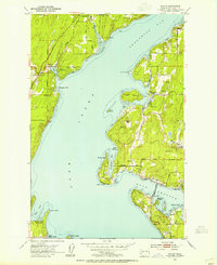
 1953 Gig Harbor1955 Print · USGSThe maritime reaches of the Puget Sound come to life in the early fifties, showing the developing shores of the Kitsap Peninsula and Tacoma. Trace family roots at the Artondale Cem or explore historic sites like Ft Nisqually (Restoration) and the Tacoma Smelter.
 - 1958 Map of Seattle, 1966 Print
 1958 Seattle1966 Print · USGSThe Puget Sound region in the mid-fifties showcases a balance of urban growth and Olympic wilderness. Trace the industrial waterfronts of Tacoma, old naval facilities like Keyport Naval Res, and mountain peaks like Mount Constance.3 unique versions available
 - 1959 Map of Gig Harbor, 1960 Print
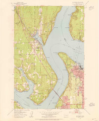
 1959 Gig Harbor1960 Print · USGSThe maritime communities surrounding Gig Harbor and West Tacoma come to life in the late fifties as suburban growth meets heavy industry. Genealogists and historians can trace Gig Harbor Cemetery, the Tacoma Smelter works, and the Camp Sealth grounds.5 unique versions available
 - 1962 Map of Seattle
 1962 Seattle1962 Print · USGSThe Puget Sound region and Olympic Peninsula are shown at a peak of mid-century growth. Genealogists and historians can trace rail lines like the Pacific Coast RR or locate landmarks such as Fort Lawton and the Bothell Power Station.
 - 1975 Map of Tacoma, 1977 Print
 1975 Tacoma1977 Print · USGSThe Puget Sound region in the mid-seventies reveals a landscape of growing urban centers and massive federal installations. Genealogists and historians can trace the development of Tacoma and Olympia, or locate landmarks like the McNeil Island Penitentiary and Fort Lewis Military Reservation.
 - 1991 Map of Tacoma
 1991 Tacoma1991 Print · USGSThe South Sound and Tacoma waterfront appear here in the early nineties, showing a landscape defined by deep-water inlets and massive federal installations. Researchers can trace the development of Lakewood Center or locate the historic rail lines of the Burlington Northern Railroad and Union Pacific Railroad.
 - 1997 Map of Fox Island, 2003 Print
 1997 Fox Island2003 Print · USGSThe intricate shoreline of Pierce County's inlets and islands comes into focus in the 1990s, showing a landscape defined by maritime research and waterfront communities. Researchers can trace local development through sites like the Fox Island Acoustic Laboratory, Fox Island Cemetery, and the Minter Creek Fish Hatchery.
 - 1997 Map of Gig Harbor, 2003 Print
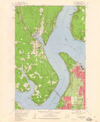
 1997 Gig Harbor2003 Print · USGSThe Gig Harbor peninsula and the Tacoma waterfront are shown here in the late nineties, connected by the iconic Tacoma Narrows Bridge. Genealogists and local historians can trace family-named sites and landmarks from Camp Sealth to Fort Nisqually.
 - 2011 Map of Gig Harbor, 2011 Print
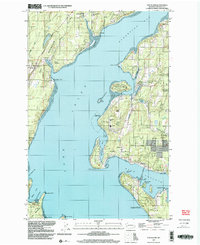
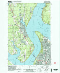
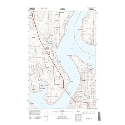
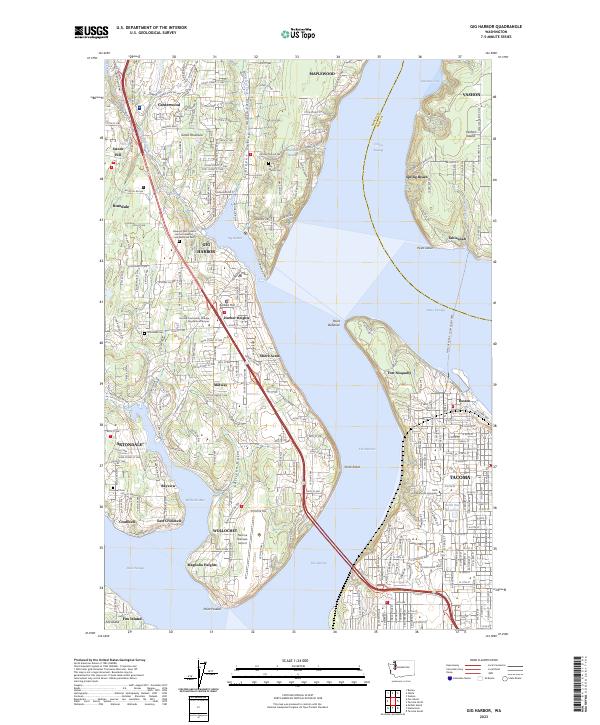
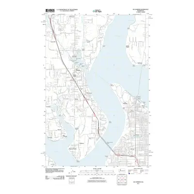 2011 Gig Harbor2011 Print · USGSCovers Artondale, including Tacoma, Gig Harbor, and other nearby areas
 - 2011 Map of Fox Island, 2011 Print
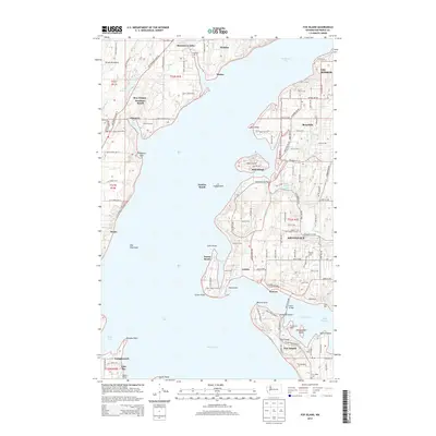
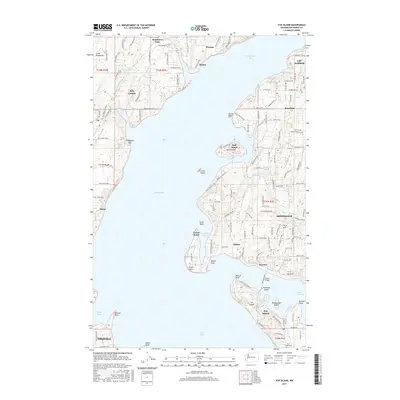
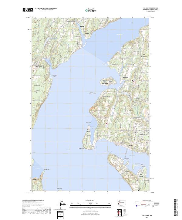
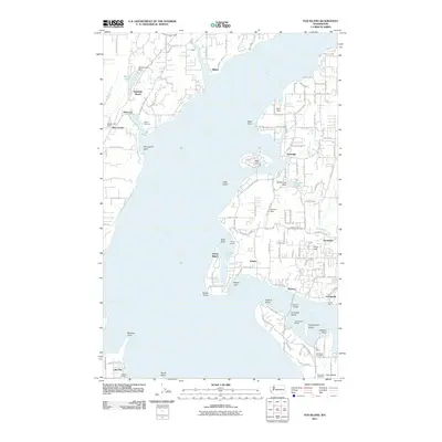 2011 Fox Island2011 Print · USGSCovers Artondale, including Fox Island, Sunshine Beach, and other nearby areas
 - 2014 Map of Fox Island, 2014 Print
 2014 Fox Island2014 Print · USGSCovers Artondale, including Fox Island, Sunshine Beach, and other nearby areas
 - 2014 Map of Gig Harbor, 2014 Print
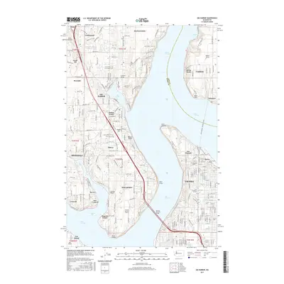
 2014 Gig Harbor2014 Print · USGSCovers Artondale, including Tacoma, Gig Harbor, and other nearby areas
 - 2017 Map of Fox Island, 2017 Print
 2017 Fox Island2017 Print · USGSCovers Artondale, including Fox Island, Sunshine Beach, and other nearby areas
 - 2017 Map of Gig Harbor, 2017 Print
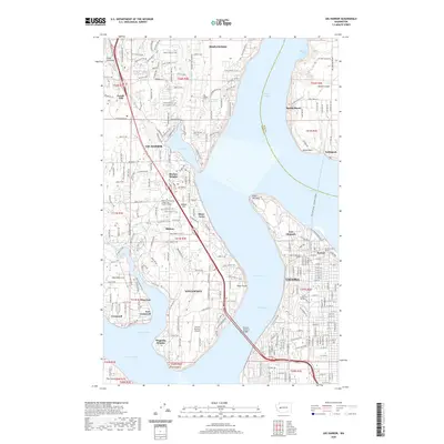
 2017 Gig Harbor2017 Print · USGSCovers Artondale, including Tacoma, Gig Harbor, and other nearby areas
 - 2020 Map of Gig Harbor, 2020 Print
 2020 Gig Harbor2020 Print · USGSCovers Artondale, including Tacoma, Gig Harbor, and other nearby areas
 - 2020 Map of Fox Island, 2020 Print
 2020 Fox Island2020 Print · USGSCovers Artondale, including Fox Island, Sunshine Beach, and other nearby areas
 - 2023 Map of Fox Island, 2023 Print
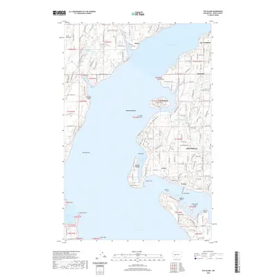
 2023 Fox Island2023 Print · USGSThe waters surrounding the Great Peninsula and Fox Island define this modern coastal survey. Researchers can trace local lineage and land use through sites like Fox Island Cem, the community at Sunrise Beach, and the residential layout of Gig Harbor.
 - 2023 Map of Gig Harbor, 2023 Print
 2023 Gig Harbor2023 Print · USGSPierce County coastal communities and Vashon Island shores are seen here in the early twenty-first century. Genealogists can trace family sites at Artondale Cem or explore the grounds of Fort Nisqually and the Tacoma Narrows Airport.
End of results
Showing maps 1-21 of 21
Top cities near Artondale
- Seattle historical maps
- Tacoma historical maps
- Federal Way historical maps
- Lakewood historical maps
- Lacey historical maps
- Bremerton historical maps
See more
Top neighborhoods of Artondale
- Arletta historical maps
- Warren historical maps
- Bayview historical maps
- Rosedale Estates historical maps
Frequently asked questions
- What are the different types of historical maps available for Artondale?
- What is the oldest map of Artondale?
- Where can I purchase historical maps of Artondale for my home or office?
- Where can I download high-res historical maps of Artondale?
- Are there historical topographic maps available for Artondale?
- Is there historical aerial imagery available for Artondale?
- Where are historical maps of Artondale sourced from?