2000s (21st Century) Maps of Artondale, Washington
Explore 2 historic maps of Artondale from the 2000s (21st Century). These maps offer a rare glimpse into what life looked like during the 2000s — showing old roads, neighborhoods, homes, and landmarks that have changed or disappeared over time.
Whether you're researching your family's past, planning a metal detecting trip, or studying how Artondale's landscape evolved across the 2000s, these high-resolution maps are a powerful tool for exploring the history of this region.
- Focus on a specific era: All maps on this page are from the 2000s, giving you a focused view of this time period.
- See what’s changed: Compare century-old streets, trails, and buildings to today's modern landscape using overlays and satellite layers.
- Research with precision: Use these maps for genealogy, historical research, land use analysis, or educational projects.
- View, download, or print: Maps are fully viewable online in high resolution, and can be downloaded or printed for your own records.
Start exploring Artondale's history through authentic maps from the 2000s. This is your window into the past.
Artondale, WA maps
(2)- 2023 Map of Fox Island, 2023 Print
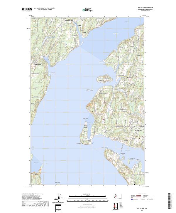 2023 Fox Island2023 Print · USGSThe waters surrounding the Great Peninsula and Fox Island define this modern coastal survey. Researchers can trace local lineage and land use through sites like Fox Island Cem, the community at Sunrise Beach, and the residential layout of Gig Harbor.
 - 2023 Map of Gig Harbor, 2023 Print
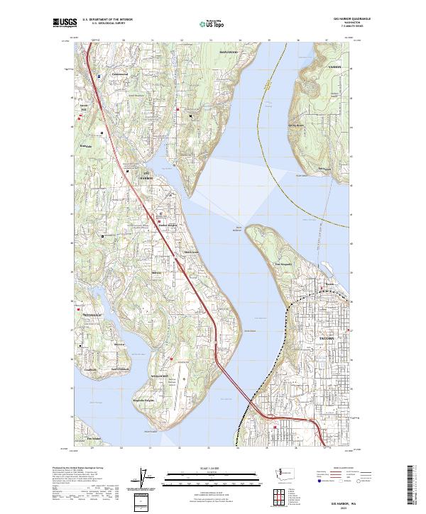 2023 Gig Harbor2023 Print · USGSPierce County coastal communities and Vashon Island shores are seen here in the early twenty-first century. Genealogists can trace family sites at Artondale Cem or explore the grounds of Fort Nisqually and the Tacoma Narrows Airport.
End of results
Showing maps 1-2 of 2
Top cities near Artondale
- Seattle historical maps
- Tacoma historical maps
- Federal Way historical maps
- Lakewood historical maps
- Lacey historical maps
- Bremerton historical maps
See more
Top neighborhoods of Artondale
- Warren historical maps
- Arletta historical maps
- Bayview historical maps
- Rosedale Estates historical maps
Frequently asked questions
- What are the different types of historical maps available for Artondale?
- What is the oldest map of Artondale?
- Where can I purchase historical maps of Artondale for my home or office?
- Where can I download high-res historical maps of Artondale?
- Are there historical topographic maps available for Artondale?
- Is there historical aerial imagery available for Artondale?
- Where are historical maps of Artondale sourced from?