Old Maps of Dot, Washington for Hiking & Exploration
Hike through history with 7 historic maps of Dot. Explore old trails, ghost towns, and forgotten backroads — perfect for outdoor adventurers and local explorers.
- Rediscover forgotten places: Map out old mining camps, roads, and footpaths that no longer exist on modern maps.
- Layer with modern tools: Combine with LiDAR or satellite views to plan hikes through historical terrain.
- Made for exploration: Popular among hikers, overlanders, and local history lovers.
Use these maps to find adventure and explore the hidden past of Dot.
Dot, WA maps
(7)- 1916 Map of Arlington
 1916 Arlington1916 Print · USGSThe Columbia River frontier of the mid-1910s reveals a world where the Oregon Trail and early railroads met the water. Genealogists can trace family roots through rural landmarks like Stegeman Ranch, Shutler, and the Locust Grove School.4 unique versions available
 - 1953 Map of The Dalles, 1965 Print
 1953 The Dalles1965 Print · USGSThe Columbia River Gorge at mid-century shows a region being transformed by massive hydroelectric dams and a growing highway network. Researchers can trace the development of The Dalles Dam, locate the Maryhill Museum, and find old rail stops in Rufus, Wishram, and Arlington.3 unique versions available
 - 1956 Map of The Dalles
 1956 The Dalles1956 Print · USGSThe Columbia River Gorge and the high Cascades are captured in the mid-1950s, showing a vital corridor of rail and road. Researchers can trace the original path of The Old Oregon Trail or locate historical landmarks like the Maryhill Museum and Mount Hood.
 - 1957 Map of The Dalles
 1957 The Dalles1957 Print · USGSThe Columbia River Gorge and the high plateaus of the mid-1950s come alive on this detailed survey of northern Oregon and southern Washington. Researchers can trace the path of the Oregon Trail and The Old Barlow Road alongside river towns like The Dalles and Wishram.
 - 1965 Map of Dot, 1967 Print
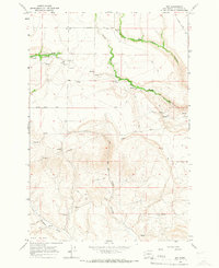 1965 Dot1967 Print · USGSThe community of Dot in Klickitat County is captured here in the mid-1960s, showing a landscape defined by ranching and high-plateau drainages. Local historians can locate the Dot Sch, the Grange Hall, and land features like Old Lady Canyon and Wood Gulch.2 unique versions available
 - 1980 Map of Goldendale, 1981 Print
 1980 Goldendale1981 Print · USGSThe Columbia River corridor in the 1980s was a critical junction of rail, water, and highway commerce between Washington and Oregon. Genealogists and historians can trace riverside settlements like Wishram, high-country towns like Bickleton, and the grounds of the Maryhill Museum.
 - 2023 Map of Dot, 2023 Print
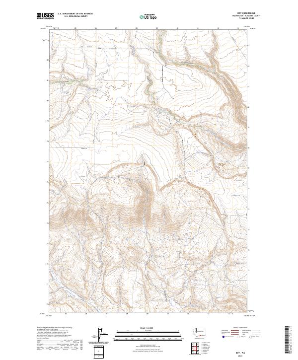 2023 Dot2023 Print · USGSThis high-plateau area of Klickitat County is shown in 2023, where the small settlement of Dot sits amid a network of deep canyons and seasonal creeks. Local researchers can trace family land and historical routes like Old Hwy 8, Old Spring, and the terrain of Glass Canyon.
End of results
Showing maps 1-7 of 7
Top cities near Dot
Frequently asked questions
- What are the different types of historical maps available for Dot?
- What is the oldest map of Dot?
- Where can I purchase historical maps of Dot for my home or office?
- Where can I download high-res historical maps of Dot?
- Are there historical topographic maps available for Dot?
- Is there historical aerial imagery available for Dot?
- Where are historical maps of Dot sourced from?