Old Maps of Deckerville, Washington for Genealogy
Trace your family roots with 11 historic maps of Deckerville. These high-res maps reveal old neighborhoods, homesites, landmarks, and streets — helping you uncover where your ancestors lived and how the area evolved over time.
- Explore historic neighborhoods: Identify where your relatives may have lived in the 1800s or 1900s.
- Compare maps over time: Trace the changes in streets, buildings, and landmarks for multi-generational research.
- Perfect for genealogy & ancestry research: Used by family historians and researchers to map out lineage and migration.
These maps are an incredible resource for exploring your personal connection to Deckerville's past.
Deckerville, WA maps
(11)- 1943 Map of Nahwatzel Lake
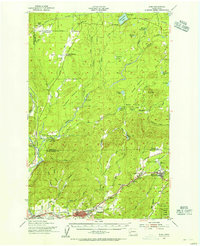
 1943 Nahwatzel Lake1943 Print · USGSThe timber country of Mason and Grays Harbor counties comes to life in this mid-century survey of the Satsop river system. Genealogists and historians can trace the Simpson Logging Co RR and locate landmarks like Oakhurst Sanitorium and Masonio Cem.
 - 1953 Map of Elma, 1956 Print
 1953 Elma1956 Print · USGSGrays Harbor and Mason Counties come alive in the early fifties, showing a region defined by its timber economy and river valleys. Genealogists and historians can trace rail-side settlements like Deckerville, Rayville, and Elma, or locate family sites near Turnow Cem and the Mary M Knight School.2 unique versions available
 - 1958 Map of Seattle, 1966 Print
 1958 Seattle1966 Print · USGSThe Puget Sound region in the mid-fifties showcases a balance of urban growth and Olympic wilderness. Trace the industrial waterfronts of Tacoma, old naval facilities like Keyport Naval Res, and mountain peaks like Mount Constance.3 unique versions available
 - 1962 Map of Seattle
 1962 Seattle1962 Print · USGSThe Puget Sound region and Olympic Peninsula are shown at a peak of mid-century growth. Genealogists and historians can trace rail lines like the Pacific Coast RR or locate landmarks such as Fort Lawton and the Bothell Power Station.
 - 1981 Map of Matlock, 1982 Print
 1981 Matlock1982 Print · USGSMason County’s logging and river landscape comes to life in the early 1980s, centered on the Matlock area. Researchers can trace the timber rail network from Frisken Wye to the Matlock Siding or locate sites like the Tornow Cemetery.
 - 1988 Map of Shelton
 1988 Shelton1988 Print · USGSThe Olympic Peninsula's transition from high mountain wilderness to Puget Sound tideflats is captured here in the late eighties. Researchers can trace the path of the Logging Railroad or locate historical sites like Sanderson Field and the Skokomish Indian Reservation.
 - 2011 Map of Matlock, 2011 Print
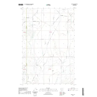
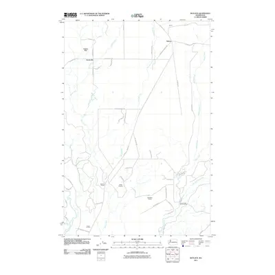 2011 Matlock2011 Print · USGSCovers Deckerville, including Matlock, Grays Harbor County, and other nearby areas
 - 2014 Map of Matlock, 2014 Print
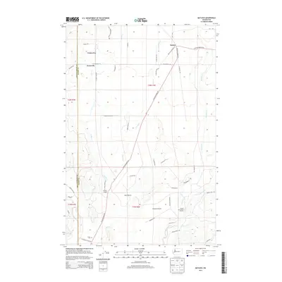 2014 Matlock2014 Print · USGSCovers Deckerville, including Matlock, Grays Harbor County, and other nearby areas
 - 2017 Map of Matlock, 2017 Print
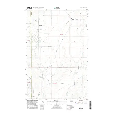 2017 Matlock2017 Print · USGSCovers Deckerville, including Matlock, Grays Harbor County, and other nearby areas
 - 2020 Map of Matlock, 2020 Print
 2020 Matlock2020 Print · USGSCovers Deckerville, including Matlock, Grays Harbor County, and other nearby areas
 - 2023 Map of Matlock, 2023 Print
 2023 Matlock2023 Print · USGSMason County’s rural timber and prairie lands are detailed here in the early twenty-first century. Genealogists and local historians can locate Grove Cem and trace the roads connecting Matlock to Deckerville and Frisken Wye.
End of results
Showing maps 1-11 of 11
Top cities near Deckerville
Frequently asked questions
- What are the different types of historical maps available for Deckerville?
- What is the oldest map of Deckerville?
- Where can I purchase historical maps of Deckerville for my home or office?
- Where can I download high-res historical maps of Deckerville?
- Are there historical topographic maps available for Deckerville?
- Is there historical aerial imagery available for Deckerville?
- Where are historical maps of Deckerville sourced from?