Old Maps of Marblemount, Washington
Explore 11 old maps of Marblemount, spanning from 1953 to today. These high-resolution historic maps reveal how streets, neighborhoods, landmarks, and natural features evolved over time — perfect for genealogy, metal detecting, research, and local history exploration.
What you can do with these maps:
- See how Marblemount changed over time: Compare historical maps to modern-day views to trace roads, homesites, rail lines & more.
- View detailed metadata: Each map includes creators, publishers, year, scale, and archive source.
- Overlay maps with satellite & LiDAR: Visualize the past alongside modern tools to explore terrain & human change.
- Trusted historical sources: Maps sourced from the USGS, Library of Congress, and other archives.
- Access maps your way: View online, download high-res files, or order prints for personal or research use.
Start exploring old maps of Marblemount to uncover forgotten places, hidden landmarks, and the deep history beneath your feet.
Marblemount, WA maps
(11)- 1953 Map of Marblemount, 1955 Print
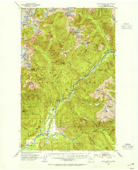 1953 Marblemount1955 Print · USGSThe Skagit River valley in the mid-fifties shows a landscape defined by hydropower logistics and the North Cascades wilderness. You can trace the City of Seattle Railway past Newhalem or locate the Skagit Talc Mine near Marblemount.3 unique versions available
 - 1955 Map of Concrete, 1967 Print
 1955 Concrete1967 Print · USGSThe North Cascades in the mid-fifties reveal a landscape of deep glacier-fed lakes and riverside timber towns. You can trace the Great Northern rail lines through Granite Falls or locate remote outposts like Stehekin and Marblemount along the Skagit and Chelan waters.
 - 1958 Map of Concrete
 1958 Concrete1958 Print · USGSThe North Cascades and Skagit Valley are captured here in the late fifties, showing a landscape defined by glacier-carved peaks and river-bottom settlements. Genealogists and historians can locate remote mining sites like Holden Mine and mountain outposts such as Stehekin, Marblemount, and Mazama.2 unique versions available
 - 1962 Map of Concrete
 1962 Concrete1962 Print · USGSThe Northern Cascades in the early sixties reveal a landscape of high alpine peaks and deep river valleys before the modern park era. Genealogists and historians can trace rail-and-river towns like Concrete, Darrington, and Stehekin, alongside industry at the Holden Mine.
 - 1979 Map of Mt. Baker, 1980 Print
 1979 Mt. Baker1980 Print · USGSThe North Cascades in the late 1970s are defined here by high-altitude glaciers and the industrial river valleys of the Skagit. Researchers can trace the rail corridors of the Burlington Northern Railroad and locate mining history at Red Mountain Mine and Silver Lake Mine.
 - 1989 Map of Marblemount
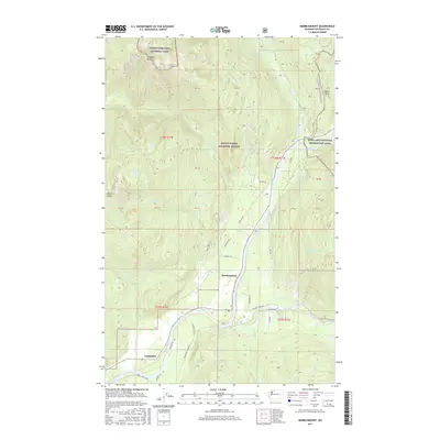
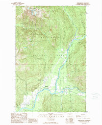 1989 Marblemount1989 Print · USGSMarblemount and the Skagit valley are captured here in the late eighties as the region balanced conservation and mountain access. Genealogists and researchers can trace local landmarks like Corkindale, the Gaging Station, and the convergence of the Skagit River and Cascade River.
 - 2011 Map of Marblemount, 2011 Print
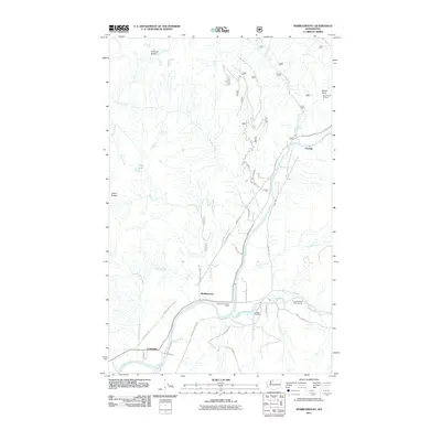 2011 Marblemount2011 Print · USGSCovers Marblemount, including Portage, Corkindale, and other nearby areas
 - 2014 Map of Marblemount, 2014 Print
 2014 Marblemount2014 Print · USGSCovers Marblemount, including Portage, Corkindale, and other nearby areas
 - 2017 Map of Marblemount, 2017 Print
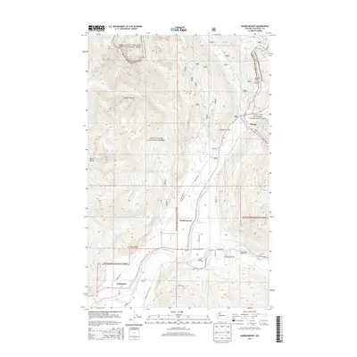
 2017 Marblemount2017 Print · USGSCovers Marblemount, including Portage, Corkindale, and other nearby areas
 - 2020 Map of Marblemount, 2020 Print
 2020 Marblemount2020 Print · USGSCovers Marblemount, including Portage, Corkindale, and other nearby areas
 - 2023 Map of Marblemount, 2023 Print
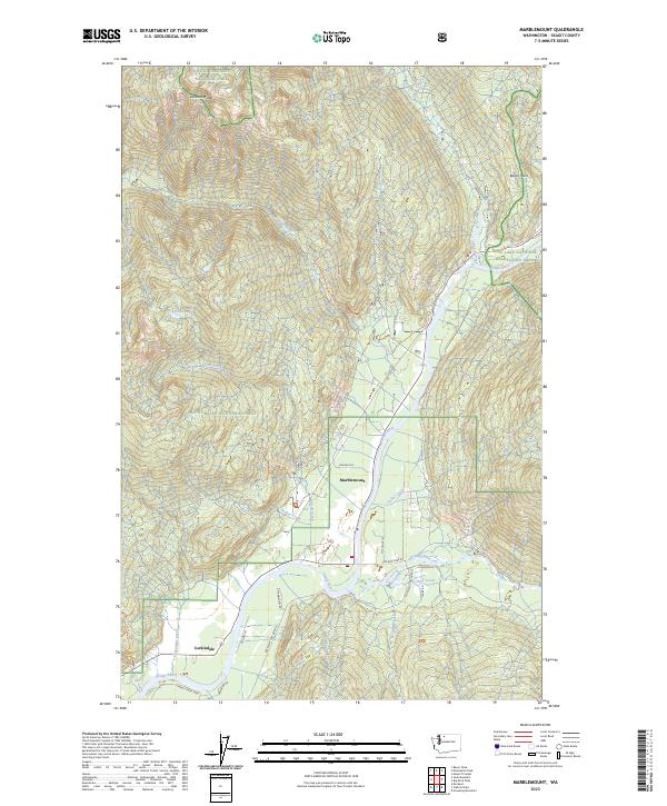 2023 Marblemount2023 Print · USGSMarblemount and the Skagit River valley are documented here in 2023 at the gateway to the North Cascades. Researchers can trace the riverfront at Corkindale, follow the Cascade River Rd, and locate family landmarks like Cow Heaven or Bacon Point.
End of results
Showing maps 1-11 of 11
Frequently asked questions
- What are the different types of historical maps available for Marblemount?
- What is the oldest map of Marblemount?
- Where can I purchase historical maps of Marblemount for my home or office?
- Where can I download high-res historical maps of Marblemount?
- Are there historical topographic maps available for Marblemount?
- Is there historical aerial imagery available for Marblemount?
- Where are historical maps of Marblemount sourced from?