Old Maps of Hazel, Washington
Explore 12 old maps of Hazel, spanning from 1899 to today. These high-resolution historic maps reveal how streets, neighborhoods, landmarks, and natural features evolved over time — perfect for genealogy, metal detecting, research, and local history exploration.
What you can do with these maps:
- See how Hazel changed over time: Compare historical maps to modern-day views to trace roads, homesites, rail lines & more.
- View detailed metadata: Each map includes creators, publishers, year, scale, and archive source.
- Overlay maps with satellite & LiDAR: Visualize the past alongside modern tools to explore terrain & human change.
- Trusted historical sources: Maps sourced from the USGS, Library of Congress, and other archives.
- Access maps your way: View online, download high-res files, or order prints for personal or research use.
Start exploring old maps of Hazel to uncover forgotten places, hidden landmarks, and the deep history beneath your feet.
Hazel, WA maps
(12)- 1899 Map of Stillaguamish, 1955 Print
 1899 Stillaguamish1955 Print · USGSThe North Cascades foothills at the turn of the century are defined by the rapid expansion of rail lines and mining camps. Trace the early routes of the Everett & Monte Cristo Ry and locate early settlements like Silverton, Darrington, and Granite Falls.
 - 1901 Map of Stilaguamish
 1901 Stilaguamish1901 Print · USGSThe North Cascades at the close of the nineteenth century reveal a landscape of mining camps and pioneer river settlements. Genealogists and historians can trace early families in Silverton, Darrington, and the remote Mansford Prairie.6 unique versions available
 - 1955 Map of Concrete, 1967 Print
 1955 Concrete1967 Print · USGSThe North Cascades in the mid-fifties reveal a landscape of deep glacier-fed lakes and riverside timber towns. You can trace the Great Northern rail lines through Granite Falls or locate remote outposts like Stehekin and Marblemount along the Skagit and Chelan waters.
 - 1956 Map of Oso, 1958 Print
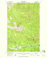 1956 Oso1958 Print · USGSThe Stillaguamish River valley and the surrounding peaks of the North Cascades come into focus during the mid-fifties. Researchers can trace the path of the Northern Pacific railroad through Oso and Hazel or locate early recreation spots like the Stillaguamish Country Club.3 unique versions available
 - 1958 Map of Concrete
 1958 Concrete1958 Print · USGSThe North Cascades and Skagit Valley are captured here in the late fifties, showing a landscape defined by glacier-carved peaks and river-bottom settlements. Genealogists and historians can locate remote mining sites like Holden Mine and mountain outposts such as Stehekin, Marblemount, and Mazama.2 unique versions available
 - 1962 Map of Concrete
 1962 Concrete1962 Print · USGSThe Northern Cascades in the early sixties reveal a landscape of high alpine peaks and deep river valleys before the modern park era. Genealogists and historians can trace rail-and-river towns like Concrete, Darrington, and Stehekin, alongside industry at the Holden Mine.
 - 1989 Map of Mt Higgins
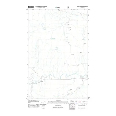
 1989 Mt Higgins1989 Print · USGSThe North Fork Stillaguamish River valley in the late 1980s shows a landscape defined by timber, small settlements, and high-altitude wilderness. Trace the river road through Hazel and Rowan or explore the high peaks of Mt Higgins and Skadulgwas Peak.
 - 2011 Map of Mount Higgins, 2011 Print
 2011 Mount Higgins2011 Print · USGSCovers Hazel, including Rowan, Tulker, and other nearby areas
 - 2014 Map of Mount Higgins, 2014 Print
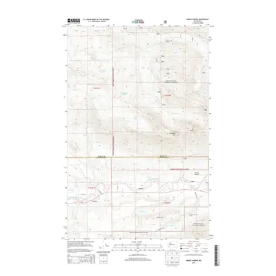 2014 Mount Higgins2014 Print · USGSCovers Hazel, including Rowan, Tulker, and other nearby areas
 - 2017 Map of Mount Higgins, 2017 Print
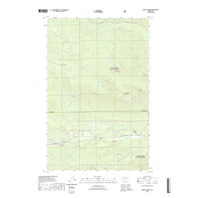
 2017 Mount Higgins2017 Print · USGSCovers Hazel, including Rowan, Tulker, and other nearby areas
 - 2020 Map of Mount Higgins, 2020 Print
 2020 Mount Higgins2020 Print · USGSCovers Hazel, including Rowan, Tulker, and other nearby areas
 - 2023 Map of Mount Higgins, 2023 Print
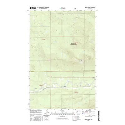
 2023 Mount Higgins2023 Print · USGSThe Stillaguamish River valley in the early 2020s remains a vital corridor for small mountain communities and timberland access. Researchers can locate long-standing settlements like Hazel and Rowan or trace the winding course of the Boulder River through the Mount Baker National Forest.
End of results
Showing maps 1-12 of 12
Top cities near Hazel
Frequently asked questions
- What are the different types of historical maps available for Hazel?
- What is the oldest map of Hazel?
- Where can I purchase historical maps of Hazel for my home or office?
- Where can I download high-res historical maps of Hazel?
- Are there historical topographic maps available for Hazel?
- Is there historical aerial imagery available for Hazel?
- Where are historical maps of Hazel sourced from?