Old Maps of Peone, Washington
Explore 12 old maps of Peone, spanning from 1901 to today. These high-resolution historic maps reveal how streets, neighborhoods, landmarks, and natural features evolved over time — perfect for genealogy, metal detecting, research, and local history exploration.
What you can do with these maps:
- See how Peone changed over time: Compare historical maps to modern-day views to trace roads, homesites, rail lines & more.
- View detailed metadata: Each map includes creators, publishers, year, scale, and archive source.
- Overlay maps with satellite & LiDAR: Visualize the past alongside modern tools to explore terrain & human change.
- Trusted historical sources: Maps sourced from the USGS, Library of Congress, and other archives.
- Access maps your way: View online, download high-res files, or order prints for personal or research use.
Start exploring old maps of Peone to uncover forgotten places, hidden landmarks, and the deep history beneath your feet.
Peone, WA maps
(12)- 1901 Map of Spokane
 1901 Spokane1901 Print · USGSThe Inland Empire was entering a period of massive rail-driven growth at the turn of the century, with Spokane as its industrial heart. Genealogists and historians can trace the early foundations of Ft. Wright, the railroad works at Hillyard, and rural outposts like Chattaroy and Spokane Bridge.6 unique versions available
 - 1943 Map of Mt Spokane
 1943 Mt Spokane1943 Print · USGSThe Washington and Idaho borderlands are shown here during the early years of the state park's development. Genealogists and local historians can trace rural school districts like Blanchard Valley Sch and old supply points like the Peone Store.2 unique versions available
 - 1950 Map of Mt Spokane, 1952 Print
 1950 Mt Spokane1952 Print · USGSThe Washington-Idaho borderlands in the early fifties reveal a landscape of high summits and quiet lake basins. Genealogists and local historians can trace rural school districts like Kit Carson School and small community hubs such as Inland Grange and Peone.3 unique versions available
 - 1955 Map of Spokane, 1965 Print
 1955 Spokane1965 Print · USGSInland Empire life in the fifties and sixties centers on the growth of Spokane and the heavy mining industry of northern Idaho. Trace mid-century landmarks like Fairchild Air Force Base, the Bunker Hill Mine, and early campuses such as Gonzaga University.2 unique versions available
 - 1958 Map of Spokane
 1958 Spokane1958 Print · USGSThe Inland Empire is shown at a mid-century peak of industrial and military activity, from the rail hubs of Spokane to the deep silver mines of northern Idaho. Researchers can trace the sprawling rail lines of the Union Pacific RR or locate landmarks like Fairchild Air Force Base and the Bunker Hill Smelter & Mine.
 - 1973 Map of Foothills, 1977 Print
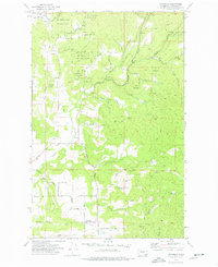 1973 Foothills1977 Print · USGSSpokane County's rural northern frontier is captured here in the early seventies as small farming communities began to interface with public parklands. Genealogists and historians can trace the property lines and early roads connecting Peone, Foothills, and Deadman Creek.4 unique versions available
 - 1987 Map of Spokane
 1987 Spokane1987 Print · USGSGreater Spokane and its surrounding prairies are captured in the late 1980s as the region solidified its role as a regional hub. Researchers can trace family sites near Medical Lake, military life at Fairchild Air Force Base, and rural settlements like Peone and Chattaroy.
 - 2011 Map of Foothills, 2011 Print
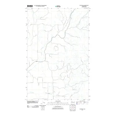 2011 Foothills2011 Print · USGSCovers Peone, including Spokane County, United States, and other nearby areas
 - 2014 Map of Foothills, 2014 Print
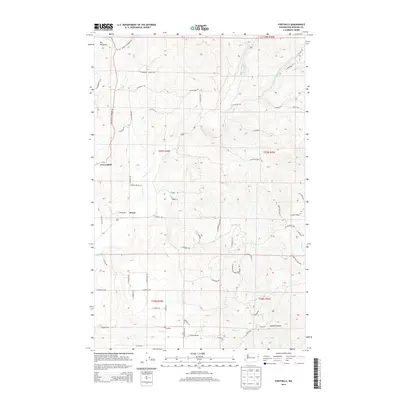 2014 Foothills2014 Print · USGSCovers Peone, including Spokane County, United States, and other nearby areas
 - 2017 Map of Foothills, 2017 Print
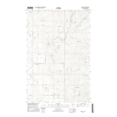 2017 Foothills2017 Print · USGSCovers Peone, including Spokane County, United States, and other nearby areas
 - 2020 Map of Foothills, 2020 Print
 2020 Foothills2020 Print · USGSCovers Peone, including Spokane County, United States, and other nearby areas
 - 2023 Map of Foothills, 2023 Print
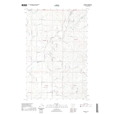
 2023 Foothills2023 Print · USGSThe fruit-growing plateau of Green Bluff and the rural valley of Peone are documented here in the early twenty-first century. Researchers can trace the drainages of Deadman Creek and Peone Creek alongside family-named routes like N Day Mt Spokane Rd.
End of results
Showing maps 1-12 of 12
Top cities near Peone
- Spokane historical maps
- Spokane Valley historical maps
- Post Falls historical maps
- Liberty Lake historical maps
- Colbert historical maps
- Fairwood historical maps
See more
Frequently asked questions
- What are the different types of historical maps available for Peone?
- What is the oldest map of Peone?
- Where can I purchase historical maps of Peone for my home or office?
- Where can I download high-res historical maps of Peone?
- Are there historical topographic maps available for Peone?
- Is there historical aerial imagery available for Peone?
- Where are historical maps of Peone sourced from?