Old Maps of Post Falls, Idaho
Explore 39 old maps of Post Falls, spanning from 1901 to today. These high-resolution historic maps reveal how streets, neighborhoods, landmarks, and natural features evolved over time — perfect for genealogy, metal detecting, research, and local history exploration.
What you can do with these maps:
- See how Post Falls changed over time: Compare historical maps to modern-day views to trace roads, homesites, rail lines & more.
- View detailed metadata: Each map includes creators, publishers, year, scale, and archive source.
- Overlay maps with satellite & LiDAR: Visualize the past alongside modern tools to explore terrain & human change.
- Trusted historical sources: Maps sourced from the USGS, Library of Congress, and other archives.
- Access maps your way: View online, download high-res files, or order prints for personal or research use.
Start exploring old maps of Post Falls to uncover forgotten places, hidden landmarks, and the deep history beneath your feet.
Post Falls, ID maps
(39)- 1901 Map of Spokane
 1901 Spokane1901 Print · USGSThe Inland Empire was entering a period of massive rail-driven growth at the turn of the century, with Spokane as its industrial heart. Genealogists and historians can trace the early foundations of Ft. Wright, the railroad works at Hillyard, and rural outposts like Chattaroy and Spokane Bridge.6 unique versions available
 - 1903 Map of Rathdrum
 1903 Rathdrum1903 Print · USGSNorthern Idaho's transition from frontier outposts to a rail-and-timber economy is visible here just after the turn of the century. Researchers can trace the early layout of Rathdrum, locate Fort Sherman, and follow the Leiberg Trail through the mountains.4 unique versions available
 - 1949 Map of Greenacres, 1961 Print
 1949 Greenacres1961 Print · USGSThe Spokane Valley-Rathdrum Prairie border is captured here at a peak of post-war industrial activity. Local historians can trace the massive Naval Supply Depot, the Aluminum Rolling Mill, and various country landmarks like the Saltese Cemetery and Tri-Community Grange.3 unique versions available
 - 1951 Map of Greenacres
 1951 Greenacres1951 Print · USGSThe Spokane Valley at the mid-century shows a busy corridor of rail lines and new post-war industry. Researchers can trace family roots at Saltese Cem, explore the early footprint of the Naval Supply Depot, or locate vanished stations along the Spokane International railroad.2 unique versions available
 - 1955 Map of Spokane, 1965 Print
 1955 Spokane1965 Print · USGSInland Empire life in the fifties and sixties centers on the growth of Spokane and the heavy mining industry of northern Idaho. Trace mid-century landmarks like Fairchild Air Force Base, the Bunker Hill Mine, and early campuses such as Gonzaga University.2 unique versions available
 - 1957 Map of Coeur D'Alene, 1959 Print
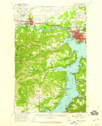 1957 Coeur D'Alene1959 Print · USGSCoeur d'Alene and the Spokane River are captured here in the late fifties, showing a bustling landscape of timber mills and rail junctions. Researchers can trace the lines of the Great Northern railroad through Grand Junction or locate family sites near Evergreen Cemetery and Cloverleaf Grange.2 unique versions available
 - 1958 Map of Spokane
 1958 Spokane1958 Print · USGSThe Inland Empire is shown at a mid-century peak of industrial and military activity, from the rail hubs of Spokane to the deep silver mines of northern Idaho. Researchers can trace the sprawling rail lines of the Union Pacific RR or locate landmarks like Fairchild Air Force Base and the Bunker Hill Smelter & Mine.
 - 1961 Map of Rathdrum, 1962 Print
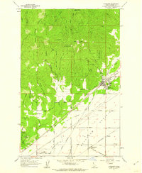 1961 Rathdrum1962 Print · USGSRathdrum served as a critical Idaho rail hub in the early sixties, where three major lines crossed at the edge of the mountains. Genealogists and historians can trace the town's original footprint, including the Grange Hall, and locate outlying settlements like Howelltown and East Greenacres.3 unique versions available
 - 1961 Map of Spirit Lake, 1963 Print
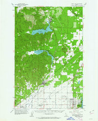 1961 Spirit Lake1963 Print · USGSThe transition from the forested Idaho panhandle to the agricultural Rathdrum Prairie is captured here in the early sixties. Genealogists and rail historians can trace the paths of the Milwaukee Road and locate sites like the Hayden Lake School and Greenwood Cemetery.2 unique versions available
 - 1973 Map of Liberty Lake, 1977 Print
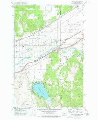 1973 Liberty Lake1977 Print · USGSSpokane Valley and the Idaho borderlands are captured here in the early seventies during a period of suburban and industrial growth. Researchers can trace the rail-and-river economy through landmarks like Moab, the Hauser siding, and the Saltese Flats.2 unique versions available
 - 1975 Map of Coeur D'Alene NW, 1980 Print
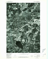
 1975 Coeur D'Alene NW1980 Print · USGSPost Falls and the Kootenai area are captured in the mid-seventies just as suburban development began to reshape the landscape. Local researchers can trace the growth of Post Falls and the wooded terrain surrounding the Spokane River and Cougar Creek.
 - 1975 Map of Greenacres NE, 1981 Print
 1975 Greenacres NE1981 Print · USGSThe Washington-Idaho borderlands come into sharp focus in the mid-seventies, showing the agricultural and residential patterns of the Spokane Valley. Trace the development of State Line Village and the rural surroundings of Newman Lake and Liberty Lake.
 - 1978 Map of Liberty Lake, 1981 Print
 1978 Liberty Lake1981 Print · USGSLiberty Lake and the Spokane River corridor are captured in detail during the late seventies as residential growth began to reshape the valley. Researchers can trace land development around Liberty Lake or locate the settlement of Moab near the water.
 - 1981 Map of Coeur D'Alene, 1982 Print
 1981 Coeur D'Alene1982 Print · USGSThe northern shores of Coeur d'Alene Lake are captured here in the early eighties, showcasing a period of significant regional development. Researchers can trace historic cemeteries such as Forest Cem and St Thomas Cem or locate old industrial sites near Huetter.2 unique versions available
 - 1981 Map of Post Falls, 1982 Print
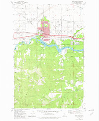 1981 Post Falls1982 Print · USGSPost Falls and the Spokane River are captured here in the early eighties as industrial growth and suburban expansion began to reshape the Idaho landscape. Genealogists and local historians can trace the foundations of the community through landmarks like Evergreen Cemetery, Seltice Sch, and the rail junction at McGuire.2 unique versions available
 - 1987 Map of Spokane
 1987 Spokane1987 Print · USGSGreater Spokane and its surrounding prairies are captured in the late 1980s as the region solidified its role as a regional hub. Researchers can trace family sites near Medical Lake, military life at Fairchild Air Force Base, and rural settlements like Peone and Chattaroy.
 - 1987 Map of Coeur D'Alene
 1987 Coeur D'Alene1987 Print · USGSNorthern Idaho in the late eighties shows a landscape of deep-water lakes and heavy industry where the timber and mining economies meet growing valley settlements. Genealogists and historians can trace the footprints of the Sunshine Mine, the rail sidings at Corbin Junction, and the historic Old Mission State Park.3 unique versions available
 - 1996 Map of Rathdrum, 1999 Print
 1996 Rathdrum1999 Print · USGSNorthern Idaho's mountain-to-prairie transition is captured here in the mid-1990s as the community of Rathdrum grew. Genealogists and local historians can trace legacy sites like the Grange Hall and the early layout of Howelltown and East Greenacres.
 - 1996 Map of Coeur D'Alene, 1999 Print
 1996 Coeur D'Alene1999 Print · USGSThe Kootenai County shoreline in the mid-nineties shows the regional hub of Coeur d'Alene during a period of steady growth. Researchers can trace local heritage through detailed locations of Forest Cemetery, North Idaho College, and the residential layout of Dalton Gardens.
 - 2010 Map of Post Falls, 2010 Print
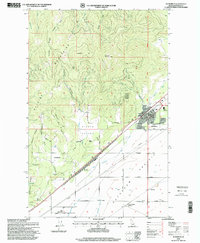
 2010 Post Falls2010 Print · USGSCovers Post Falls, including Kootenai County, United States, and other nearby areas
 - 2011 Map of Coeur D'Alene, 2011 Print
 2011 Coeur D'Alene2011 Print · USGSCovers Post Falls, including Coeur d'Alene, Hayden, and other nearby areas
 - 2011 Map of Rathdrum, 2011 Print
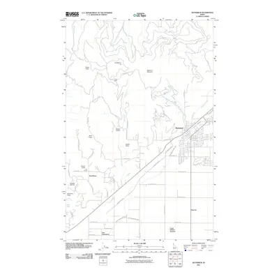 2011 Rathdrum2011 Print · USGSCovers Post Falls, including Rathdrum, Hauser, and other nearby areas
 - 2011 Map of Liberty Lake, 2011 Print
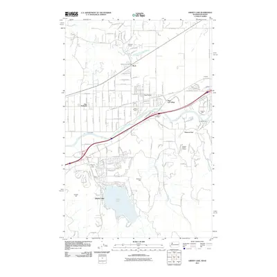 2011 Liberty Lake2011 Print · USGSCovers Post Falls, including Liberty Lake, Hauser, and other nearby areas
 - 2013 Map of Coeur D'Alene, 2013 Print
 2013 Coeur D'Alene2013 Print · USGSCovers Post Falls, including Coeur d'Alene, Hayden, and other nearby areas
 - 2013 Map of Post Falls, 2013 Print
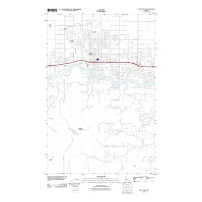
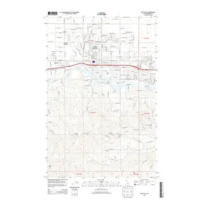 2013 Post Falls2013 Print · USGSCovers Post Falls, including Kootenai County, United States, and other nearby areas
Showing maps 1-25 of 39
Top cities near Post Falls
- Spokane Valley historical maps
- Coeur d'Alene historical maps
- Hayden historical maps
- Liberty Lake historical maps
- Rathdrum historical maps
- Dalton Gardens historical maps
See more
Top neighborhoods of Post Falls
Frequently asked questions
- What are the different types of historical maps available for Post Falls?
- What is the oldest map of Post Falls?
- Where can I purchase historical maps of Post Falls for my home or office?
- Where can I download high-res historical maps of Post Falls?
- Are there historical topographic maps available for Post Falls?
- Is there historical aerial imagery available for Post Falls?
- Where are historical maps of Post Falls sourced from?