Old Maps of Roosevelt Way Estates, Whatcom County for Genealogy
Trace your family roots with 13 historic maps of Roosevelt Way Estates. These high-res maps reveal old neighborhoods, homesites, landmarks, and streets — helping you uncover where your ancestors lived and how the area evolved over time.
- Explore historic neighborhoods: Identify where your relatives may have lived in the 1800s or 1900s.
- Compare maps over time: Trace the changes in streets, buildings, and landmarks for multi-generational research.
- Perfect for genealogy & ancestry research: Used by family historians and researchers to map out lineage and migration.
These maps are an incredible resource for exploring your personal connection to Roosevelt Way Estates's past.
Roosevelt Way Estates, Whatcom County maps
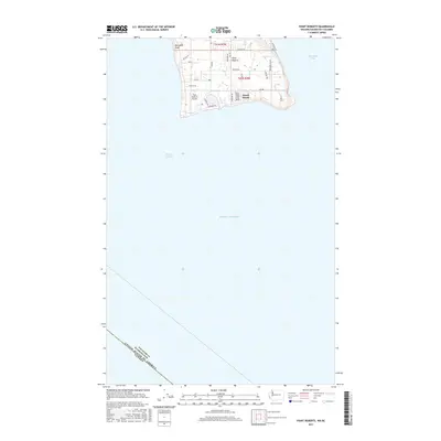
(13)- 1952 Map of Point Roberts, 1954 Print
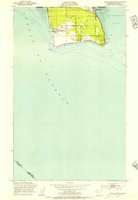 1952 Point Roberts1954 Print · USGSPoint Roberts is captured here as a mid-century coastal exclave defined by its international border and maritime surroundings. Researchers can locate the Pt Roberts Lighthouse, the Northwest Grange, and seasonal settlements at Maple Beach and South Beach.5 unique versions available
 - 1957 Map of Victoria, 1960 Print
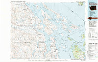
 1957 Victoria1960 Print · USGSThe San Juan Islands and the North Cascades coastline are shown in detail during the late fifties, a period of significant military and industrial presence. Researchers can trace historic rail lines like the Great Northern or locate sites such as the Whidbey Island Naval Air Sta and Friday Harbor.4 unique versions available
 - 1981 Map of Roche Harbor
 1981 Roche Harbor1981 Print · USGSThe maritime boundary between the Gulf Islands and San Juans was well-established by the early eighties. Researchers can trace transportation routes like the Canadian Pacific Railway and find coastal settlements from Sidney to Ganges.2 unique versions available
 - 1997 Map of Point Roberts, 2003 Print
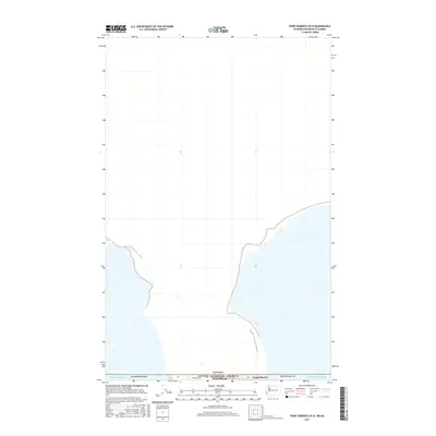
 1997 Point Roberts2003 Print · USGSPoint Roberts is shown here as a distinct American exclave in the late nineties, separated from the mainland by the international boundary. Researchers can trace the layout of Maple Beach, the U S Customs station, and waterfront landmarks like Lighthouse Park.
 - 2011 Map of Point Roberts, 2011 Print
 2011 Point Roberts2011 Print · USGSCovers Roosevelt Way Estates, including Point Roberts, Southern Gulf Islands Electoral Area, and other nearby areas
 - 2014 Map of Point Roberts, 2014 Print
 2014 Point Roberts2014 Print · USGSCovers Roosevelt Way Estates, including Point Roberts, Southern Gulf Islands Electoral Area, and other nearby areas
 - 2014 Map of Point Roberts OE N, 2014 Print
 2014 Point Roberts OE N2014 Print · USGSCovers Roosevelt Way Estates, including Richmond, Delta, and other nearby areas
 - 2017 Map of Point Roberts, 2017 Print
 2017 Point Roberts2017 Print · USGSCovers Roosevelt Way Estates, including Point Roberts, Southern Gulf Islands Electoral Area, and other nearby areas
 - 2017 Map of Point Roberts OE N, 2017 Print
 2017 Point Roberts OE N2017 Print · USGSCovers Roosevelt Way Estates, including Richmond, Delta, and other nearby areas
 - 2020 Map of Point Roberts, 2020 Print
 2020 Point Roberts2020 Print · USGSCovers Roosevelt Way Estates, including Point Roberts, Southern Gulf Islands Electoral Area, and other nearby areas
 - 2020 Map of Point Roberts OE N, 2020 Print
 2020 Point Roberts OE N2020 Print · USGSCovers Roosevelt Way Estates, including Richmond, Delta, and other nearby areas
 - 2023 Map of Point Roberts OE N, 2023 Print
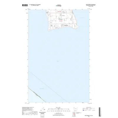
 2023 Point Roberts OE N2023 Print · USGSModern settlement patterns at the edge of the 49th parallel are clearly visible in this recent study of the Point Roberts exclave. Researchers can trace the shoreline between the Strait of Georgia and Boundary Bay or follow roads like Roosevelt Way to the international border.
 - 2023 Map of Point Roberts, 2023 Print
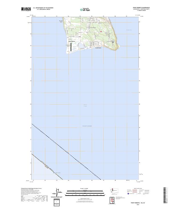 2023 Point Roberts2023 Print · USGSPoint Roberts is captured in the early 2020s as a distinct American exclave defined by its international border and coastal reaches. Genealogists and historians can trace the local landscape from Point Roberts Cem to Boundary Bluff and the Point Roberts Airpark.
End of results
Showing maps 1-13 of 13
Frequently asked questions
- What are the different types of historical maps available for Roosevelt Way Estates?
- What is the oldest map of Roosevelt Way Estates?
- Where can I purchase historical maps of Roosevelt Way Estates for my home or office?
- Where can I download high-res historical maps of Roosevelt Way Estates?
- Are there historical topographic maps available for Roosevelt Way Estates?
- Is there historical aerial imagery available for Roosevelt Way Estates?
- Where are historical maps of Roosevelt Way Estates sourced from?