Old Maps of American River, Washington
Explore 14 old maps of American River, spanning from 1902 to today. These high-resolution historic maps reveal how streets, neighborhoods, landmarks, and natural features evolved over time — perfect for genealogy, metal detecting, research, and local history exploration.
What you can do with these maps:
- See how American River changed over time: Compare historical maps to modern-day views to trace roads, homesites, rail lines & more.
- View detailed metadata: Each map includes creators, publishers, year, scale, and archive source.
- Overlay maps with satellite & LiDAR: Visualize the past alongside modern tools to explore terrain & human change.
- Trusted historical sources: Maps sourced from the USGS, Library of Congress, and other archives.
- Access maps your way: View online, download high-res files, or order prints for personal or research use.
Start exploring old maps of American River to uncover forgotten places, hidden landmarks, and the deep history beneath your feet.
American River, WA maps
(14)- 1902 Map of Mount Aix
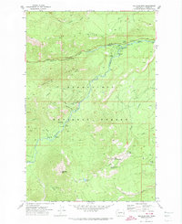
 1902 Mount Aix1902 Print · USGSThe eastern Cascades around Yakima are captured here at the start of the twentieth century, showing a high-country landscape of early mining and pack trails. Genealogists and historians can locate the site of Fife's Mine, the settlement at Goose Prairie, and early landmarks like Lake House.
 - 1904 Map of Mt Aix
 1904 Mt Aix1904 Print · USGSThe high mountain passes and forest reserves of the Central Cascades are captured here at the start of the century. Genealogists and researchers can trace early outposts like Russell Ranch and the Lake House, or locate the Fires Mine and remote Mc Allister Meadows.6 unique versions available
 - 1950 Map of Yakima, 1951 Print
 1950 Yakima1951 Print · USGSThe Yakima Valley and the towering Cascades meet in this mid-century survey of South Central Washington. Genealogists and local historians can trace the irrigation-era growth of Yakima, the historic Fort Simcoe outpost, and the White Swan Mission on the Yakima Indian Reservation.
 - 1958 Map of Yakima, 1964 Print
 1958 Yakima1964 Print · USGSThe Yakima Valley in the late fifties shows a landscape of mountain peaks and irrigated plains at the height of its rail-era development. Researchers can trace the lineage of early settlements through sites like Fort Simcoe, the Wenas Cemetery, and the Yakima Indian Agency School.3 unique versions available
 - 1961 Map of Yakima
 1961 Yakima1961 Print · USGSCentral Washington thrived in the mid-century as an agricultural powerhouse defined by the Yakima River. Trace local roots through Medicine Valley School, Fort Simcoe, and the rail lines of the Northern Pacific RR.
 - 1971 Map of Old Scab Mtn., 1974 Print
 1971 Old Scab Mtn.1974 Print · USGSThe Snoqualmie National Forest was a hub for high-country recreation and fire surveillance in the early 1970s. Trace the network of forest trails and camping spots like Indian Flat Campground, the Lookout Tower on Little Bald Mountain, and Soda Springs.2 unique versions available
 - 1978 Map of Mount Rainier
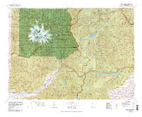 1978 Mount Rainier1978 Print · USGSThe high Cascades and the Yakima backcountry are shown in detail during the late seventies, centered on the glacial peaks and river valleys. Researchers can trace the development of Packwood and Goose Prairie or locate landmarks like the Packwood Landing Strip and Rimrock Lake.2 unique versions available
 - 1992 Map of Old Scab Mtn, 1996 Print
 1992 Old Scab Mtn1996 Print · USGSThe high Cascades of Yakima County are documented here in the early nineties, centered on the protected reaches of the William O Douglas Wilderness. Hikers and historians can trace old routes near American Forks, Saddle Camp, and the Soda Springs Footbridge.
 - 2000 Map of Old Scab Mountain, 2001 Print
 2000 Old Scab Mountain2001 Print · USGSThe Cascades of Yakima County are documented here as they appeared at the turn of the century, showing a wilderness crisscrossed by fire trails and forest roads. Trace routes up Fifes Ridge or locate backcountry sites like Flat Iron Lake and Indian Flat Campground.
 - 2011 Map of Old Scab Mountain, 2011 Print
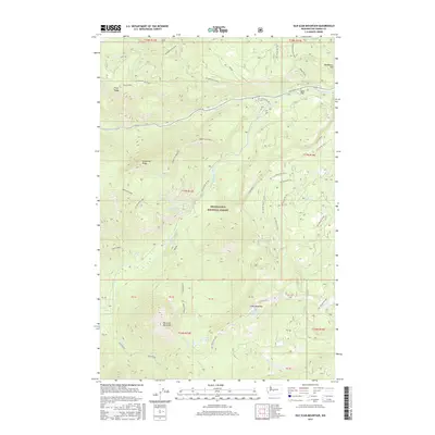
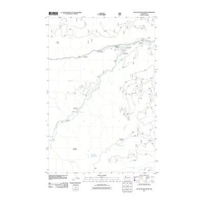 2011 Old Scab Mountain2011 Print · USGSCovers American River, including Yakima County, United States, and other nearby areas
 - 2014 Map of Old Scab Mountain, 2014 Print
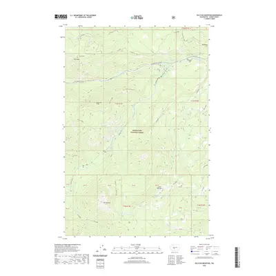
 2014 Old Scab Mountain2014 Print · USGSCovers American River, including Yakima County, United States, and other nearby areas
 - 2017 Map of Old Scab Mountain, 2017 Print
 2017 Old Scab Mountain2017 Print · USGSCovers American River, including Yakima County, United States, and other nearby areas
 - 2020 Map of Old Scab Mountain, 2020 Print
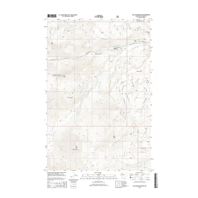
 2020 Old Scab Mountain2020 Print · USGSCovers American River, including Yakima County, United States, and other nearby areas
 - 2023 Map of Old Scab Mountain, 2023 Print
 2023 Old Scab Mountain2023 Print · USGSThe high ridges of Yakima County are preserved in this recent record of the Snoqualmie National Forest and surrounding wilderness. Hikers and historians can trace high-altitude landmarks like Old Scab Mtn and the historic Chinook Pass Highway.
End of results
Showing maps 1-14 of 14
Top cities near American River
Frequently asked questions
- What are the different types of historical maps available for American River?
- What is the oldest map of American River?
- Where can I purchase historical maps of American River for my home or office?
- Where can I download high-res historical maps of American River?
- Are there historical topographic maps available for American River?
- Is there historical aerial imagery available for American River?
- Where are historical maps of American River sourced from?