Old Maps of Eagle's Ridge, Yakima County
Explore 9 old maps of Eagle's Ridge, spanning from 1899 to today. These high-resolution historic maps reveal how streets, neighborhoods, landmarks, and natural features evolved over time — perfect for genealogy, metal detecting, research, and local history exploration.
What you can do with these maps:
- See how Eagle's Ridge changed over time: Compare historical maps to modern-day views to trace roads, homesites, rail lines & more.
- View detailed metadata: Each map includes creators, publishers, year, scale, and archive source.
- Overlay maps with satellite & LiDAR: Visualize the past alongside modern tools to explore terrain & human change.
- Trusted historical sources: Maps sourced from the USGS, Library of Congress, and other archives.
- Access maps your way: View online, download high-res files, or order prints for personal or research use.
Start exploring old maps of Eagle's Ridge to uncover forgotten places, hidden landmarks, and the deep history beneath your feet.
Eagle's Ridge, Yakima County maps
(9)- 1899 Map of Ellensburg, 1957 Print
 1899 Ellensburg1957 Print · USGSCentral Washington at the turn of the century shows a landscape of growing river towns and high ridges. Researchers can trace early railroad expansion along the Northern Pacific RR or locate rural outposts like Tampico, Ahtanum, and Nile.
 - 1901 Map of Ellensburg
 1901 Ellensburg1901 Print · USGSCentral Washington at the turn of the century shows a landscape shaped by river valleys and high ridges. Trace the early Northern Pacific Railway line through Ellensburg and the remote outposts of Nile and Tampico.6 unique versions available
 - 1950 Map of Yakima, 1951 Print
 1950 Yakima1951 Print · USGSThe Yakima Valley and the towering Cascades meet in this mid-century survey of South Central Washington. Genealogists and local historians can trace the irrigation-era growth of Yakima, the historic Fort Simcoe outpost, and the White Swan Mission on the Yakima Indian Reservation.
 - 1958 Map of Yakima, 1964 Print
 1958 Yakima1964 Print · USGSThe Yakima Valley in the late fifties shows a landscape of mountain peaks and irrigated plains at the height of its rail-era development. Researchers can trace the lineage of early settlements through sites like Fort Simcoe, the Wenas Cemetery, and the Yakima Indian Agency School.3 unique versions available
 - 1961 Map of Yakima
 1961 Yakima1961 Print · USGSCentral Washington thrived in the mid-century as an agricultural powerhouse defined by the Yakima River. Trace local roots through Medicine Valley School, Fort Simcoe, and the rail lines of the Northern Pacific RR.
 - 1971 Map of Manastash Lake, 1974 Print
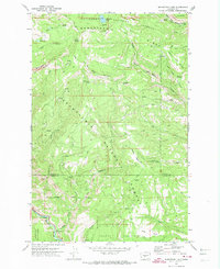 1971 Manastash Lake1974 Print · USGSThe border of Yakima and Kittitas counties is captured here in the early seventies, showcasing a transition from timbered peaks to deep river valleys. You can trace early backcountry access via Barber Springs Road and locate remote landmarks like Manastash Lake and Milk Lake.2 unique versions available
 - 1992 Map of Manastash Lake, 1996 Print
 1992 Manastash Lake1996 Print · USGSThe high Cascades at the Kittitas and Yakima county line appear here in the early 1990s, centered on the historic Naches Pass Trail. Researchers can trace old mountain routes through Canteen Flats and locate remote water sources like Manastash Lake and Cattle Camp Spring.
 - 2000 Map of Manastash Lake, 2001 Print
 2000 Manastash Lake2001 Print · USGSKittitas and Yakima counties at the start of the millennium are defined here by the high timber and drainages of the Cascades. Map collectors can trace the remote water sources and ridgelines of the Wenatchee National Forest, including Manastash Lake and Rocky Prairie.
 - 2023 Map of Manastash Lake, 2023 Print
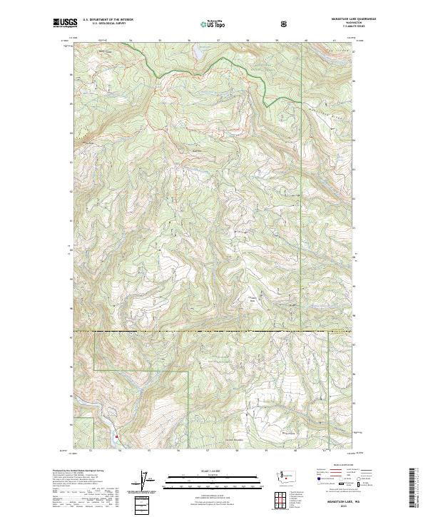 2023 Manastash Lake2023 Print · USGSThe high ridges of the Kittitas and Yakima county border are captured here in the early twenty-first century. Researchers can trace the complex drainage networks and historic forest routes surrounding Manastash Lake, Canteen Flats, and Cleman Mountain.
End of results
Showing maps 1-9 of 9
Frequently asked questions
- What are the different types of historical maps available for Eagle's Ridge?
- What is the oldest map of Eagle's Ridge?
- Where can I purchase historical maps of Eagle's Ridge for my home or office?
- Where can I download high-res historical maps of Eagle's Ridge?
- Are there historical topographic maps available for Eagle's Ridge?
- Is there historical aerial imagery available for Eagle's Ridge?
- Where are historical maps of Eagle's Ridge sourced from?